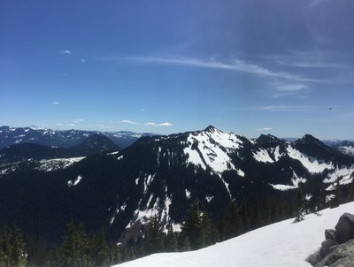
Humpback Mountain
This scramble varies in distance, elevation gain and difficulty according to season and snow conditions. Without snow it has 2,600 feet of elevation gain and is 5.2 miles round trip. The summit block is large talus with views of the I-90 corridor to the east.
Getting there
Take Exit 47 off of I-90 and drive south on Forest Road 55 (Tinkham Road). At the T intersection turn right (west) to continue on Forest Road 55. In 1.5 miles, turn left (south) onto Forest Road 5510. Continue as far as the snow level allows or until you reach 2,900 ft. Note that in winter, Forest Road is usually closed, so you'll need to park near the highway.
approach & ASCENT
The standard route follows the northwest ridge, with access point determined by how far one can drive up Hansen Creek on Forest Road 5510. Highest starting point is at approximately 2,900 ft. Note that this trip summary begins from the lower starting point. Walk the gated road to the ridge line, catching a boot track slanting back to the right. The "trail" follows the ridge, eventually reaching taller trees. The final narrow summit block/large talus often requires ice ax use with snow. True summit is at the south end, reached by passage on the west side of the talus.
notes
- In winter, the roads are normally not plowed much beyond I-90, so the distance and elevation gain are substantially higher than summer. It's 8.0 miles round-trip with 3,200 feet of elevation gain.
Information for LEADERS
Permit information
As of 2017, the Snoqualmie Ranger District considers Mountaineers trips and courses to be "nominal use". Leaders should print and copy this designation letter to show rangers they may see on trail.
- Suitable Activities: Scrambling
- Seasons: April, May, June, July, August, September
- Weather: View weather forecast
- Difficulty: Technical 3, Strenuous 3
- Length: 5.2 mi
- Elevation Gain: 2,600 ft
- 5,174 ft
-
Land Manager:
Mount Baker-Snoqualmie National Forest
Snoqualmie Ranger District (MBSNF)
- Parking Permit Required: Northwest Forest Pass
- Recommended Party Size: 12
- Maximum Party Size: 12
- Maximum Route/Place Capacity: 12
- USGS Snoqualmie Lake
- USGS Lost Lake
There are no resources for this route/place. Log in and send us updates, images, or resources.
