Huckleberry Mountain
A strenuous hike in the Suiattle River Valley and Glacier Peak Wilderness. It climbs 4,900 feet in 7 miles to the site of an old lookout, now removed.
Getting There
Drive SR-530 7.5 miles north from Darrington and turn onto Forest Road 26, Suiattle River Road. The trailhead is at a small signpost (1,000 ft) on the north side of the Suiattle River Road, 14.5 miles past the turnoff from SR-530.
on the trail
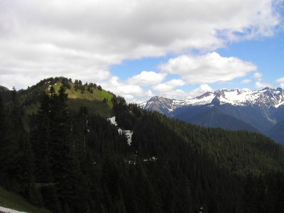
The trail switchbacks through old growth forest and occasional brushy spots to a small campsite signed Fred Bugner at just under 4 miles (4,000 ft). This is the last dependable water source in the summer. Reach the ridge top in another half mile where the grade levels out. At about 5.5 miles the trail reaches timber line and a large meadow with views to the mountains of the Glacier Peak Wilderness. The trail drops from the end of the meadow about 500 feet and then ascends to the site of an old, removed lookout (7 mi, 5,900 ft). A faint scramble route continues from here to Boulder Lake and Tenas Creek.
- Suitable Activities: Day Hiking
- Seasons: June, July, August, September, October
- Weather: View weather forecast
- Difficulty: Strenuous
- Length: 14.0 None
- Elevation Gain: 4,900 ft
- 5,900 ft
-
Land Manager:
Mount Baker-Snoqualmie National Forest
Glacier Peak Wilderness, Darrington Ranger District (MBSNF)
- Parking Permit Required: None
- Recommended Party Size: 12
- Maximum Party Size: 12
- Maximum Route/Place Capacity: 12
- Green Trails Snowking Mtn No. 79
- Trails Illustrated Glacier Peak Wilderness
There are no resources for this route/place. Log in and send us updates, images, or resources.
