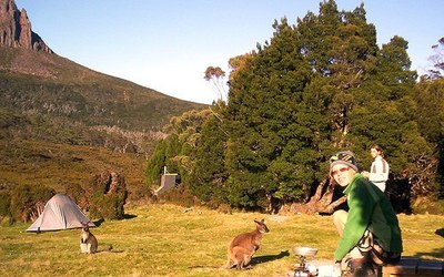
Backpack Wild Tasmania on the Overland Track
The 65-km Overland Track in Tasmania's World Heritage wilderness is one of the world's great long-distance trails, attracting hikers from around the globe. The track features majestic ancient mountains, wild rivers and waterfalls, boardwalk through lovely moors, unique beech and myrtle forests and crystal lakes. Independent walkers generally do the trail six days, though stunning side trips are available.
Tasmania is a place of wild and ancient landscapes, friendly people with a relaxed island lifestyle, wonderful food and wine, and a haunting history evoked by world-famous convict ruins. These features have made it a haven for walkers across the world. Almost half of this small and scenic state is protected within national parks and reserves and 20 per cent is World Heritage-listed.
The Overland Track is an unforgettable 65-km route across the heart of Tasmania's World Heritage wilderness, from Cradle Mountain to Lake St Clair (the deepest lake in Australia), featuring lakes, wild rivers, unique forest vegetation, ancient stony mountain peaks, lovely moorland, and lots of spectacular waterfalls. Walkers usually complete the track in five or six days, normally from north to south (the mandatory direction between 1st October and 31st May), though a range of side trips are possible along the route as well as short and day walks from the Cradle Mountain Visitor Centre and Dove Lake. Side tracks go to the summits of Cradle Mountain and Mount Ossa, the tallest mountain in Tasmania, as well as to a group of tarns called The Labyrinth. Many choose to add the 17-km hike along Lake St Clair as a rewarding extension at the end. While the route has eight basic stove-heated huts, there's no guarantee of space so walkers must bring their own overnight gear, as well as their own food.
The best time to walk the track is between November and April, when the weather is mild and the Austral summer days are long. In April (the autumn), the local deciduous beech turn spectacular colors.
- Suitable Activities: Global Adventures
- Seasons: January, February, March, April, November, December
- Weather: View weather forecast
- Length: 40.0 mi
- Elevation Gain: 4,677 ft
- 4,182 ft
- Land Manager: Land Manager Varies
- Parking Permit Required: see Land Manager
- Recommended Party Size: 8
- Maximum Party Size: 8
- Maximum Route/Place Capacity: 12
There are no resources for this route/place. Log in and send us updates, images, or resources.
