
McClellan Peak
A long approach, gaining over 7,200 feet through the stunning Enchantments to the 84th highest peak in Washington State, capped off by steep snow, a short ridge run, and a final rock scramble.
Getting There
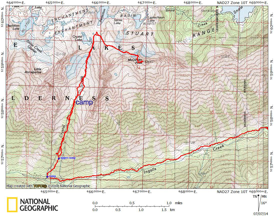
From SR-2 in Leavenworth drive Icicle Creek Road (Forest Road 76) for 4.2 miles to the trailhead and parking lot on the south side of the road (1,350 ft).
Approach & Ascent
Hike the Snow Lakes Trail (No. 1553). It switchbacks immediately and relentlessly. After 10 miles of hiking reach the upper core of the Enchantments basin. There are abundant campsites.
At the flat area at 7,000 ft between Leprechaun and Sprite Lakes, leave the trail and ascend south-southeast toward McClellan Ridge. There is a distinct rock tower called the Prong, keep to the west of it. Ascend steep snow and/or rock to the ridge. This section becomes very icy and dangerous in late season.
Once on McClellan Ridge, scramble east on the south side of the ridge. The southeast side of the summit block is the easiest scrambling.
Notes
- Camping in the Enchantments requires a permit from May 15 until October 31. The permits are given out by lottery drawing in March. You may obtain a walk-up permit the day of your trip, but do not expect that there will be one available.
- Suitable Activities: Scrambling
- Seasons: May, June, July
- Weather: View weather forecast
- Difficulty: Strenuous 5, Technical 4
- Length: 22.0 mi
- Elevation Gain: 7,200 ft
- 8,364 ft
-
Land Manager:
Okanogan-Wenatchee National Forests
The Enchantments, Wenatchee River Ranger District (OWNF)
- Parking Permit Required: Northwest Forest Pass
- Recommended Party Size: 8
- Maximum Party Size: 8
- Maximum Route/Place Capacity: 8
- Green Trails Alpine Lakes East (Stuart Range) No. 208SX
- Green Trails The Enchantments No. 209S
- USGS Enchantment Lakes