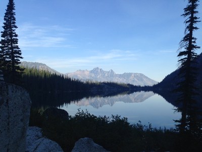
Colchuck Lake
A moderate, 9 mile round trip day hike with 2,100 feet of elevation gain. The hike starts in a lodgepole pine forest along side Mountaineer Creek steadily climbing to an alpine lake set in granite cliffs under the towering crags of the Enchantment peaks. No dogs are allowed on this heavily used trail.
getting there
From US-2 in Leavenworth drive Icicle Creek Road (Forest Road 76) for 8.4 miles. Turn left on Eightmile Road (Forest Road 7601); it's about one mile past Eightmile Campground and signed Lake Stuart/Colchuck Lake. Continue 3.8 miles to the trailhead (3,400 ft).
on the trail
Hike southwest on the Stuart Lake Trail. At first the trail parallels Mountaineer Creek and gains 1,100 feet in 2.5 miles. At the junction take the left fork, the Colchuck Lake Trail. The trail is steep and reaches Colchuck Lake via switchbacks in 1,100 feet of elevation gain and 1.6 miles. At Colchuck Lake, an easy going 1.1 miles travels the east and south shores.
- Suitable Activities: Day Hiking
- Seasons: July, August, September, October
- Weather: View weather forecast
- Difficulty: Moderate
- Length: 9.0 mi
- Elevation Gain: 2,100 ft
- 5,570 ft
-
Land Manager:
Okanogan-Wenatchee National Forests
The Enchantments, Wenatchee River Ranger District (OWNF)
- Parking Permit Required: Northwest Forest Pass
- Recommended Party Size: 8
- Maximum Party Size: 8
- Maximum Route/Place Capacity: 8
- Green Trails Alpine Lakes East (Stuart Range) No. 208SX
- USGS Enchantment Lakes
- Green Trails The Enchantments No. 209S
There are no resources for this route/place. Log in and send us updates, images, or resources.
