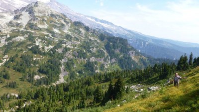
Copper Mountain, Iron Mountain & Pyramid Peak
Scramble any one of these peaks, the Cooper & Iron Mountain pair, or all three, all strenuous scrambles of 12+ miles and 4,500+ feet of elevation gain that are moderately technical. The approach to these peaks in the southwestern part of Mount Rainier National Park leads through old growth forest to the lush Indian Henry's Hunting Ground and an old ranger cabin.
Getting There
From SR-7 in Elbe, turn east onto SR-706, both known as the National Park Highway. Continue through the Nisqually Entrance of Mount Rainier National Park. Be prepared to pay the fee just after entering the park. Continue 3 miles to the Kautz Creek Trailhead on the left (north) side of the road (2,400 ft).
Approach & ASCENT
Pyramid Peak (6,937 ft)
14 miles round trip, 4,500 feet of Elevation Gain
Rock Difficulty: Strenuous 5, Technical 1
Snow Difficulty: Strenuous 5, Technical 3
Hike the Kautz Creek Trail 5.7 miles to Indian Henrys Hunting Ground and junction with Wonderland Trail. Turn right onto the Wonderland Trail, hike 0.3 mile and bear right onto the Mirror Lake Trail. At Mirror Lake look for a boot path heading NNE toward Pyramid Peak that is over the shoulder of Copper Mountain. Follow the boot path to the south ridge of Pyramid Peak and views of Paradise to the east. Follow the south ridge to the summit.
Notes: In early season the trail to Mirror Lake and the boot path is snow covered and more challenging to follow. The south slopes are prone to avalanche early season. The boot path to summit is steep and has loose rock in places.
Copper Mountain (6,280 ft) & Iron Mountain (6,283 ft)
14 miles round trip, 5,000 feet of elevation gain Difficulty: Strenuous 5, Technical 3
Hike the Kautz Creek Trail to Indian Henry's Hunting Ground. From the ranger cabin head north northeast to the saddle between Copper & Iron. Head north to the summit Copper Mountain and south to the summit of Iron Mountain.
Notes: In early season the trail may be snow-covered and difficult following trail. The steep heather slopes are slippery when wet.
Copper Mountain, Iron Mountain & Pyramid Peak Traverse
19 miles round trip, 5,900 feet of elevation gain, difficulty: Strenuous 5, Technical 3
A scramble of three summits in the southwest corner of Mount Rainier National Park. This strenuous traverse keeps things interesting with new terrain for most of the route.
- Suitable Activities: Scrambling
- Seasons: March, April, May, June, July, August, September
- Weather: View weather forecast
- Difficulty: Strenuous 5, Technical 3, Technical 1
- Length: 14.0 mi
- Elevation Gain: 4,500 ft
- 6,937 ft
-
Land Manager:
Mount Rainier National Park
Mount Rainier Wilderness
- Parking Permit Required: National Park Entrance Fee
- Recommended Party Size: 12
- Maximum Party Size: 12
- Maximum Route/Place Capacity: 12
- Green Trails Mount Rainier Wonderland No. 269SX
- Green Trails Mt Rainier West No. 269
- USGS Wahpenayo Peak
This is a list of titles that represent the variations of trips you can take at this route/place. This includes side trips, extensions and peak combinations. Not seeing a title that fits your trip? Log in and send us updates, images, or resources.
- Copper Mountain
- Iron Mountain
- Pyramid Peak
- Copper & Iron Mountains
- Pearl Falls & Pyramid Peak
- Copper Mountain, Iron Mountain & Pyramid Peak Traverse
| Name/Description |
|---|
| Copper Mountain, Iron Mountain & Pyramid Peak Traverse Topo Map A topo map showing the traverse route for Copper Mountain, Iron Mountain, and Pyramid Peak in Mount Rainier Nation Park by Dave Morgan. |
