Commonwealth Basin
An easy 2-5 miles round trip snowshoe trip with 500-900 feet of elevation gain to falls and though a basin near Snoqualmie Pass.
GETTING THERE
Take Exit 52 off of I-90 and park at the Summit at Snoqualmie Summit West parking lot. Carefully cross the summit access road and walk under the highway overpass to reach the trailhead on the north side of I-90. Don't be tempted to park at the cleared area at the top of Forest Road 58, the old Snoqualmie Pass Road. Despite appearances, that is a not parking area.
ON THE TRAIL
Commonwealth Falls
2.0 miles round trip, 500 feet of elevation gain, 3,500 ft high point
After crossing under the highway to the northbound Pacific Crest Trail (PCT) Trailhead, travel along Commonwealth Creek to Commonwealth Falls.
Commonwealth Basin
5.0 miles round trip, 900 feet of elevation gain, 3,900 ft high point
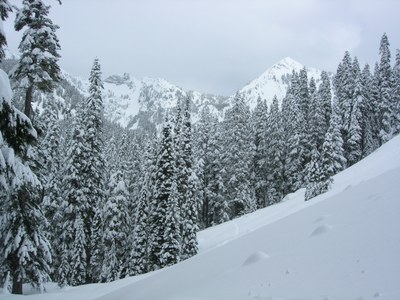
After crossing under the highway to the PCT Trailhead, travel along Commonwealth Creek to Commonwealth Falls and then head up into Commonwealth Basin where it opens up to views of Red Mountain and Lundin Peak.
Information for leaders
scheduling & Permits
- As of 2017, the Snoqualmie Ranger District considers Mountaineers trips and courses to be "nominal use". Leaders should print and copy this designation letter to show rangers they may see on trail or carry a digital copy on their phone.
- If you are scheduling this as a non-course related activity, please limit your group size to the recommended party size. The maximum party size is for use by course field trips only, and includes both students and instructors. Group size maximums do not reflect how course field trips are run (in smaller groups of students and instructors), but allow for course leaders to register the course in our system.
- Please note that this trail enters the Alpine Lakes Wilderness, and trips proceeding into the Wilderness must comply with wilderness regulations. Groups exceeding 12 must divide into physically and logistically separate parties and maintain a minimum distance of one-mile separation.
- If you are scheduling a course field trip, please contact our Member Services Team to confirm the field trip and any permitting regulations.
- Suitable Activities: Snowshoeing
- Snowshoeing Category: Basic
- Seasons: January, February, March
- Weather: View weather forecast
- View avalanche forecast.
- Difficulty: Moderate
- Length: 5.0 mi
- Elevation Gain: 900 ft
- 3,900 ft
-
Land Manager:
Mount Baker-Snoqualmie National Forest
Alpine Lakes Wilderness, Snoqualmie Ranger District (MBSNF)
- Parking Permit Required: None
- Recommended Party Size: 12
- Maximum Party Size: 24
- Maximum Route/Place Capacity: 24
- Green Trails Snoqualmie Pass No. 207
- USGS Snoqualmie Pass
There are no resources for this route/place. Log in and send us updates, images, or resources.
