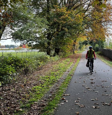
Chehalis Western Trail
Easy paved 45 mile out and back trail with 943 feet of elevation gain. Begins and ends at the northern terminus of Chehalis Western Trail. Turn around point will be the town of Rainier. The trail begins in rural forests, passes through the outskirts of Lacey, follows the Deschutes River, then passes through the Deschutes prairie.
This route begins with parking at the northern terminus of the Chehalis Western Trail, off Woodard Bay Road Northeast.
The trail is paved with low pedestrian and other cyclist traffic. The route crosses automobile traffic at a few highly marked areas. The trail is flat and passes many scenic areas: heavy forests where owls can be seen, a river, a sculpture park that welcomes bicyclists, prairies, and the turn around point is the small town of Rainier, which has a grocery store, espresso stand, a cafe and a pizza restaurant. In the fall elk can be heard bugling in the distance. The return ride is just as scenic as the ride out. Water is available at the store in Rainier, There are 4 rustic toilets along the trail.
- Suitable Activities: Bikepacking, Day Hiking
- Seasons: Year-round
- Weather: View weather forecast
- Difficulty: Easy, Easy
- Length: 45.0 mi
- Elevation Gain: 943 ft
- Land Manager: Thurston County Parks
- Parking Permit Required: None
- Recommended Party Size: 12
- Maximum Party Size: 12
- Maximum Route/Place Capacity: 12
There are no resources for this route/place. Log in and send us updates, images, or resources.
