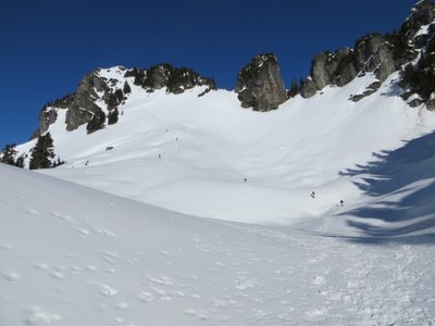
Bettys Jugs
A scramble to a ridge southeast of Illabot Peaks on the border of the Glacier Peak Wilderness. Named because the peak is between Betty's Pass and Jug Lake. It is designated Point 6103 on USGS maps and in Beckey's "Cascade Alpine Guide."
Getting there
From Darrington, drive the Suiattle River Road 6.5 miles. Turn left on Forest Road 2640 (Grade Creek Road) and follow it to its end.
Approach & ascent
The summit ridge has a steep step to gain the ridge. The final summit push is steep and exposed.
notes
- This is most often done as a winter scramble, but SummitPost has recent accounts (circa 2015) of summer routes and bestowed upon it the 2015 Underrated Peak of the Year Award.
- Suitable Activities: Scrambling
- Seasons: Year-round
- Weather: View weather forecast
- View avalanche forecast.
- Difficulty: Strenuous 3, Technical 3, Winter Scramble
- Length: 8.0 mi
- Elevation Gain: 3,800 ft
- 6,103 ft
-
Land Manager:
Mount Baker-Snoqualmie National Forest
Darrington Ranger District (MBSNF)
- Parking Permit Required: None
- Recommended Party Size: 12
- Maximum Party Size: 12
- Maximum Route/Place Capacity: 12
- USGS Illabot Peaks
- Green Trails Snowking Mtn No. 79
This is a list of titles that represent the variations of trips you can take at this route/place. This includes side trips, extensions and peak combinations. Not seeing a title that fits your trip? Log in and send us updates, images, or resources.
- Bettys Jugs (winter)
There are no resources for this route/place. Log in and send us updates, images, or resources.
