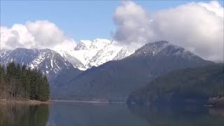
Baker River & East Baker Lake
This easy-moderate 13 mile day hike with 650 feet of elevation gain offers groves of old-growth giants, an imposing glacier-fed river, turquoise pools and views to rugged summits including Mount Baker and Mount Shuksan. Combining two shorter trails that extend in different directions from the same trailhead, wanderers on this route will experience the best that the lowlands of Baker Lake and the Baker River have to offer.
getting there
Take Exit 230 off of I-5, drive east on SR-20 (North Cascades Highway) for 23 miles, and turn left (north) onto Baker Lake Road (between MP 82 and MP 83). Continue on Baker Lake Road for 26 miles—it becomes Forest Road 11 and the pavement ends after 23 miles—reaching the road end and trailhead (750 ft).
on the trail
Baker River
5.2 miles round trip with 300 feet of elevation gain, 900 ft high point
This is a wonderful trail option for families and for getting out when higher country is snowbound. For the first half-mile, the Baker Lake Trail (No. 610) and Baker River Trail (No. 606) share the same path. First explore 2.5 miles north along the Baker River with an easy amble among massive cedars and mossy rock gardens along the broad gravel lined glacier-fed river. Climb a slope above the river to look down on quiet pools and tumbling water. Alternately drop through deep forest to get your feet wet crossing small side channels, then climb again to view-full bluffs. The Baker River trail ends at Sulphide Creek (900 ft).
Baker River to Noisy Creek Camp
8.8 MILES ROUND TRIP WITH 700 FEET OF ELEVATION GAIN
Hike the Baker River Trail 0.6 mile to its junction with the Baker Lake Trail (or retrace your steps 2 miles on the Baker River Trail to this junction). Hike southeast, crossing the river on a 1990s suspension bridge and then on another stationery bridge, and traverse a huge washout from the November 2006 floods. Then follow the river, finally catching peeks at Mount Baker before climbing steeply to cross Hidden Creek on a high bridge, the creek tumbling down a rocky cut. The trail continues through massive old growth, crossing several more creeks, before reaching the thickly forested shores of Baker Lake. Enjoy the lakeshore at Noisy Creek Campground on a small peninsula in the lake at about 4.5 miles, grab some lunch while enjoying the Mount Baker views.
Baker Lake
28 miles round trip or 14 miles one-way with 2,000 feet of elevation gain, 960 ft high point
Hike west and south on the Baker River and then Baker Lake Trail as far as desired. Campsites along the way are Noisy Creek (4.6 miles), Silver Creek (5.9 miles), Maple Grove (10.4 miles), and Anderson Point (12.4 miles). The Baker Lake Trailhead is 14 miles from the Baker River Trailhead.
notes
- For longer backpacking explorations or trips that start at the southern end of Baker Lake, se our Baker Lake route/place.
- Suitable Activities: Backpacking, Day Hiking
- Seasons: Year-round
- Weather: View weather forecast
- Difficulty: Easy/Moderate
- Length: 13.0 mi
- Elevation Gain: 650 ft
- 1,000 ft
-
Land Manager:
Mount Baker-Snoqualmie National Forest
Mount Baker Ranger District (MBSNF)
- Parking Permit Required: Northwest Forest Pass
- Recommended Party Size: 12
- Maximum Party Size: 12
- Maximum Route/Place Capacity: 12
- Green Trails Mt Shuksan No. 14
- Green Trails Mount Baker Wilderness Climbing No. 13SX
This is a list of titles that represent the variations of trips you can take at this route/place. This includes side trips, extensions and peak combinations. Not seeing a title that fits your trip? Log in and send us updates, images, or resources.
- Baker River
- East Baker Lake
- Baker River to Noisy Creek Camp
There are no resources for this route/place. Log in and send us updates, images, or resources.
