Trip
Alpine Scramble - Mary's Peak
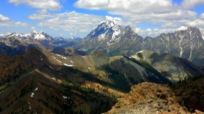
Mary's Peak as approached from the upper left Bean Basin is a pleasant snow or alpine meadow scramble with some rock at the very top and on the adjacent Bean- Mary's or Judi-Mary's ridges. It poses only low technical challenges or exposure and is only moderately strenuous, with much of the approach on trail or established way-trail, with the only significant concern being the crossing of Bean Creek during spring snowmelt. Mary's is virtually always included in the options offered by the branches who use the Basin for their scramble field trips in order to provide a range of opportunities for students of varying skill and condition. It is named in honor of Mary Sutliff, a long-term scramble instructor, former Seattle scramble chair, and author of "Teanaway Country," who helped introduce the Teanaway area to the Mountaineers.
- Tue, May 25, 2021
- Seattle Alpine Scrambling
- Scrambling
- Adults
- Moderate, Technical 2
- Moderate
- Mileage: 5.0 mi
- Elevation Gain: 3,143 ft
- High Point Elevation: 6,680 ft
- FULL (2 capacity)
- FULL (3 capacity)
- Mon, May 24, 2021 at 10:49 AM
- Mon, May 24, 2021 at 11:30 AM
- Cancellation & Refund Policy
- iCal Google
See above.
Please note that this special purpose trip is full as presently constituted.
Meeting Place: Bean-Beverly TH at the end of Forest Road 9737-112. See detailed directions below.
Meeting Time: 9:30 am, Tuesday, May 25, 2021.
Directions: You would be wise to review these in advance with Google Maps or similar open in front of you! From Seattle take I-90 East to Exit 85 (east end of Cle Elum, WA), turning right onto SR-970. (Ignore the signs for a right turn on old Hwy 97 toward Ellensburg which you will see after the first mile or so and continue northerly on SR-970.)
Go about 5 miles on SR-970, then turn left/west onto the paved and county-maintained Teanaway River Road. Follow signs for the North Fork Teanaway about 13 miles (generally west for several miles alongside farms and recreational properties, then turning north; ignore signs inviting you to turn left toward the West Fork Teanaway) to a junction at 29 Pines Campground. This road is Open Range, which means you need to be attentive to possible cow, deer, and elk encounters!
After passing 29 Pines campground on your left, take the right fork where the pavement ends (that is, veer slightly to your right onto Forest Road 9737). This road is currently well-graded in some stretches and drivable but with potholes and washboard in others. You will cross a cattle guard and a small bridge across a side creek (ignore the right/east turn up the Stafford Creek road).
Go approximately 3 more miles to the junction with the Beverly Creek Road, Forest Road 9737-112 (may not be signed, but it is just before the substantial bridge over Beverly Creek: if you fail to make the turn and continue across the bridge, you will come to Beverly Campground in about half a mile -- turn around and retrace your steps, perhaps after making use of the Forest Service toilet).
Follow side road 112 (rougher but still drivable by street-high vehicles, with occasional deep "water bars" that may require some thoughtful maneuvering) 1.5 miles to the road end and trailhead for Beverly Creek Trail. The trailhead elevation is ~3,600 feet.
Driving time from Seattle is about 2 hours and 15 minutes, longer for those unfamiliar with the area or who are less confident driving on dirt Forest Service roads (add 15 minutes to half an hour). Usually somewhat shorter driving back because the options are coming together instead of diverging.
Beverly Campground and its nearby informal sites (open areas alongside the road or down short side roads, often with rock-edged fire rings, legal unless signed Private or No Camping) in this beautiful open rain-shadow forest alongside the spirited North Fork of the river are well worth a stay, particularly for those coming over from the west side of the mountains for scramble field trips. Beverly has a modest fee and individual camp sites with picnic tables and enclosed fire pits and metal grates. It also has a two-unit Forest Service toilet which is used by many who don't stay at the campground or pay the fee (bring your own toilet paper just in case, and maybe one to donate for the general welfare!) Twenty Nine Pines is also a pleasant campground, but because it is reachable entirely by paved road tends to attract RVs and larger groups.
Bean Creek Basin
-
Green Trails Alpine Lakes East (Stuart Range) No. 208SX
Green Trails Mt Stuart No. 209
USGS Teanaway Butte
USGS Mount Stuart
USGS Red Top Mtn
USGS Enchantment Lakes - See full route/place details.
Required Equipment
- The Ten Essentials
- Helmet
- Mountaineering Boots
- Ice Axe
- Protected Downclimb kit (locking 'biner, cord loop, runner tied for hasty harness)
