Trip Report
Alpine Scramble - Boundary Peak
Yet another early season attempt at Boundary peak spoiled by less than ideal weather and route conditions.
- Sat, Jun 18, 2022
- Alpine Scramble - Boundary Peak
- Unicorn, Foss, Boundary & Stevens Peaks
- Scrambling
- Turned Around
-

- Road suitable for all vehicles
-
Trail is completely snow covered from the parking lot on. The avalanche chute to the upper basin was in good condition. The route to gain the ridge line directly from the Unicorn saddle has a moat that is opening up. With the warm weather forecast this week it will probably not be possible to go this route in the near future. The ridge line from Unicorn to Boundary peak still has cornices on it. Approximately 700 feet from Boundary the ridge is impassable due to a large cornice and moat blocking safe travel.
Early last week with a promising weather report(partly sunny for Saturday) I decided it was about time to attempt Boundary peak again. I have attempted this peak and been turned around twice over the last two years by bad weather and route conditions. As the week went by and Saturday approached the weather forecast went to not so promising but still sounding better than what I have walked into on previous attempts.
The drive out to our meeting point at Longmire was uneventful with no major issues or road problems. At Longmire some of the days participants decided to carpool to the Snowlake trailhead to make room for other vehicles. Upon our arrival at the Snowlake trailhead we found only two vehicles parked in the pull out. At this point the Steven's canyon road is closed off to further travel.
Once parked we all quickly geared up and discussed the hazards for the day one of which was the weather. As forecast it was supposed to be a cloudy day with a chance of precipitation later on. As what seems to be the norm lately it was at this point that we felt the first drops of moisture hitting us. Hoping that things would go more as forecast we donned our raingear and decided to head on out.
From the parking area the trail was snow covered. Occasionally we would find a section that was melted out but I bet we only walked on around 100 yards or less of trail for the entire day. Travel and navigation were fairly easy and straight forward to the hill you must go over to get from Bench lake into the gully heading towards Snow Lake. Right before this hill there is a creek flowing that had melted the snow . It was wide in places and fairly deep. It took us a few minutes to find a suitable crossing with a proper vegi-belay to aid us. Once across we proceeded into the gully heading up to Snow lake and finally our approach to the upper basin.
Our first view of the ascent chute to the upper basin. Photo by Kat Netzler
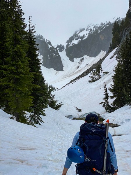
By this point we were hopeful that the weather was getting better. So far on the route we had experienced a misty rain but also got a few bits of clearing and glimpses of blue sky. Not being able to see Unicorn peak as it was shrouded in mists and clouds was not reassuring.
At the base of the ascent chute we geared up for steeper snow travel. Helmets and axes out, trekking poles stowed. We then began our slow deliberate ascent. Thanks to previous visitors to the area and a Mazama group ahead of us we had plenty of steps already kicked up the gully. Ascending the chute went fairly quickly and uneventfully.
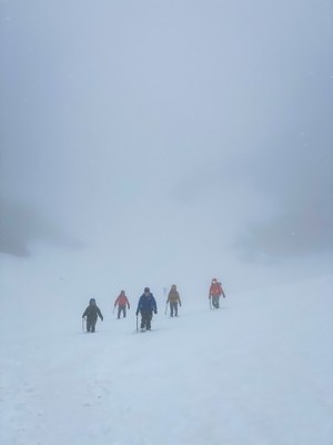
Once we arrived at the upper basin visibility started to be an issue. By this point visibility was down to 100 yards or less. Beyond that everything was shrouded in an impenetrable white cloak that hid where snow ended and sky began. Seeing as how this was better than past trips and so far snow conditions were ideal we pressed on heading to the Unicorn saddle. On our way to the saddle we met the Mazama's group that was in the area to climb Unicorn peak for the day. At the saddle we were happy to find that we could still directly gain the ridge from the shoulder of Unicorn. At this time a moat had formed climbers left. This section is steep and was some participants first time dealing with this. Everyone did fine and easily ascended this section.
Ascending from Unicorn Saddle onto SW flank Unicorn peak. Moat visible on right.
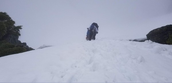
Once we gained the shoulder of Unicorn our group took over lead from the Mazama group and kicked steps up the Southwest flank of Unicorn before breaking off to head down the ridge towards Boundary. Visibility was now very limited but still not as bad as I experienced two years ago on this same ridge line. Once I gained the ridge to Boundary I elected to attempt to stay climbers right and work my way through the trees on the ridge. This was done since I suspected that there would be cornices present along the ridge that may not be visible. This worked out well even though I did find a tree well which some of the participants found rather humorous at this point.
Not supposed to be waist deep in snow. Photo by Kat Netzler
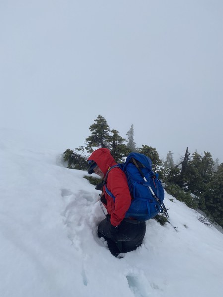
Looking back towards Unicorn from my position waist deep in snow.
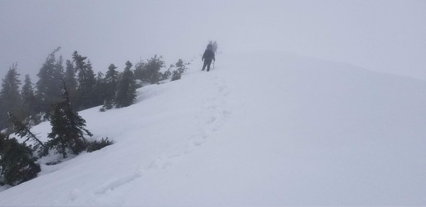
Progress down the ridge was going great until we reached a spot that steeply descended to the Boundary/Unicorn saddle. At this point the ridge line narrowed considerably and had a very steep section. By now we were only around 700 horizontal feet from the top of Boundary peak which was still not visible in the fog. As we awaited for everyone to regroup I studied what we were going to do next. Of concern was that there was a deep moat that had formed between the snow and rock of the ridge line that would force us directly onto the snow section which would get very narrow and steep. Furthermore at this point I suspected that the piled up snow may be a cornice. As we waited the weather cleared just enough for us to get a short glimpse of the snow that we would have to go across which immediately confirmed my suspicions. Yes it was a large cornice. Furthermore upon examining the snow just off the rock on the ridge line we had what appeared to be evidence that the cornice was starting to break off. There was a large crack just below us running directly towards the cornice lining up perfectly with the rock and moat. At this point we had a discussion and decided that Boundary would still be there for next time and now would be a great time to turn around. Furthermore the weather and visibility had continued to deteriorate. It was now snowing on us.
Our turnaround point. Boundary peak shrouded in mist 700 feet away. Deep moat surrounding rock outcropping on all sides. Large cornice running down ridge climbers left. Photo by Yu-Hang Kuo
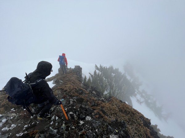
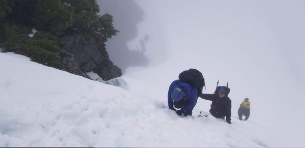
After a quick bite to eat and snacks we returned back to she shoulder of Unicorn peak following the path we made earlier. We then descended back down to the Unicorn saddle. By this point we noticed that the moat we avoided to gain the shoulder of Unicorn appeared much larger and now on our right and left sides. I believe today may have been the final day to use this route to gain the ridge since the moat will most likely completely block access in the next day or so. For safety the assistant leader went down first and then guided the remaining participants down as they self belayed down this very steep section. I stayed at the top with the rope just in case we had need to deploy it to get through this area.
Self-Belay down to Unicorn saddle.
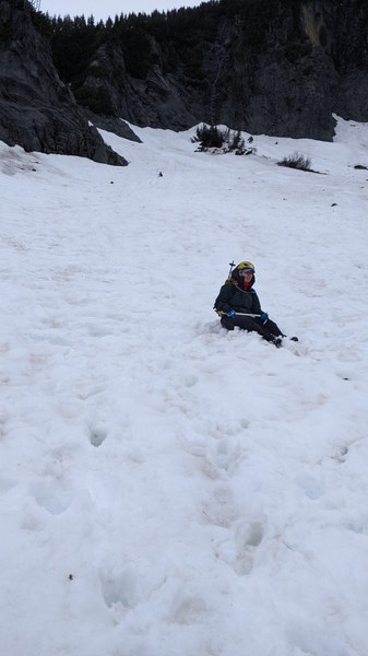
Once we reached the saddle we started glissading back down to Snowlake. The snow was just about perfect for nice slow controllable glissades. All the participants agreed the best part of this trip was the glissade out.
End of final glissade. Photo by Christina Black
Once we got back to Snow lake we stowed our helmets and axes and proceeded back out. The only hiccup we had on the way out was once again crossing the creek. Instead of attempting the vegi-belay route we decided to try a spot where we could jump across the creek. Unfortunately one of our party jumped a little bit short and managed to jump right into the center of the creek which was just under waist deep on them at this point. After helping them out we then returned to our vehicles which were only around a half hour away.
Total trip time was 6 hours 23 minutes.
Distance was 5.15 miles
Elevation gain 3,000 feet.
 Jerrick Linde