Trip Report
Day Hike - Malcolm Mountain Loop
Faint trail at times, so not for the faint of heart hiker.
- Fri, Aug 4, 2023
- Day Hike - Malcolm Mountain Loop
- Malcolm Mountain Loop
- Day Hiking
- Successful
-

- Road suitable for all vehicles
-
Vegetation encroaches on both trail 1383.1 and 1383 in the lower Johnson Creek valley, but mostly not of the leg-scratching variety, and often of the nourishing variety. 1383.1 switches back through burn from the Jolly Mountain fire, but there has been a great deal of trail maintenance this year removing deadfall. Beyond the junction with Koppen Mountain trail 1225, the deadfall has not been cleared, but none poses great difficulty in crossing. The trail becomes fainter beyond Point 4938, and becomes practically nonexistent in places until north of Point 5343, requiring competence in navigation.
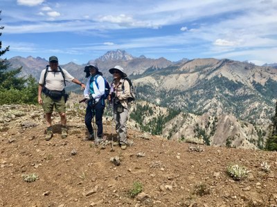
This was a Tacoma CHS hike with no CHS hikers. We followed the clockwise route as recommended in hike 58 of Dan Nelson's Loop Hikes Washington. Anticipating an August inferno in the Teanaway, we got a very early start for the drive, and were on the trail by 8:15. We stopped to use the vault toilet at Beverly Campground, but there is also a porta potty at the parking area for this hike 0.3 miles up the road from Beverly. It was 48 degrees when we arrived, and 82 degrees when we returned to the car after 4 p.m.
There were many ripe huckleberry and thimbleberry bushes below the ridges. Trail is well signed, including some new signs since the Jolly Mountain fire. On the traverse below Johnson Mountain, there was a robust spring on a prior trip I did in the springtime, but it is dry in August, so there is no water once you leave the valley floor. I recommended 3 quarts for this warm-weather hike.
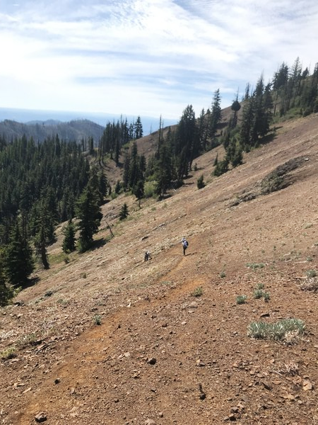
Views of Mount Stuart, the Stuart Range, and the Teanaway peaks abound the higher you go. There were essentially no bugs, likely due to the dry conditions. As noted above, the trail becomes very faint for over a mile north of Point 4938, causing some consternation among hikers not used to such conditions. The sidehilling below the ridge leading to Malcolm Mountain was particularly challenging hiking:

This section of the trail could be avoided by climbing 300' up the fall line to intersect the ENE ridge coming from the Malcolm summit, turning right and descending the ridge to intersect the trail again at the 5000' saddle, but most hikers should be able to manage it with caution. I'm not sure the best route from the 5000' saddle to Point 5343 because we didn't find it, but you want to be at least 40-60' below Point 5343 as you bypass it to the west. There is definitely no discernable trail where the USGS map shows one, and many game trails come and go.
Beyond Point 5343 the route is easier to follow and mainly stays close to the ridge, with wonderful views.
I recommended this hike to lovers of views, berries, solitude, and navigation.
Berries consumed: Innumerable
Humans encountered: 0
 David Judish