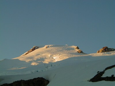
Mount Baker/Easton Glacier
The Easton Glacier is moderately sloped, with one steep section on the Roman Wall just below the summit plateau, and gaining nearly 5,000 feet from camp to summit. Views of Glacier Peak, North Cascades, and north Puget Sound. Approach is popular with snowmobilers in early season. Times: 3-4 hr trailhead to camp, 5-8 hr climb to summit.
getting there
Take I-5 to just north of Mount Vernon and go east on SR-20 (North Cascades Highway) and turn left on Baker Lake Road. Continue 12.5 mi to just past the Rocky Creek Bridge, turn left onto Forest Road 12. Go 3.5 mi to Sulfur Creek Road (Forest Road 13). Turn right and follow it 6 mi to its end at the Park Butte Trailhead (3,360 ft).
Approach
Cross Sulfur Creek, through Schreiber’s Meadows, through timber, across melt water streams, and up forested slope (switch backs) to Morovitz Meadows (2 mi). From Upper Meadow take right fork to Baker Pass. Head up on a trail to the crest of the Railroad Grade. Campsites are in trees behind eastern moraine around 5,500 ft, and on ridge east of Railroad Grade at 5,800 ft. High camps are possible north of Baker Pass at 6,000 ft, and as high as 6,800 ft in low snow conditions.
Ascent Route
From high camp get onto the Easton Glacier and ascend almost due north aiming at or a little west of Sherman Peak. Near the base of Sherman Peak, go west to the eastern base of the Roman Wall. Go up snow slopes or ascend to rocky ridge, keeping right of Roman Wall. Ascend steep snow past the Roman Wall to large summit plateau. The summit (10,778 ft) is at the far east-northeast side.
Descent Route
Descend the climbing route.
Trip Profile
| Segment | TIME (HR) | ELEVATION GAIN (FT) |
|---|---|---|
| TH to Camp | 3-4 | 2,400 |
| Camp to Summit | 5-8 | 5,000 |
| Summit to Camp | 2-3 | |
| Camp to TH | 2-3 |
EQUIPMENT
Standard glacier equipment including wands.
NOTEs
- The route described stays east (right) of the major crevasses.
- In low snow conditions, a route can be found that borders the Deeming Glacier.
- The upper snow slope is steep enough to pose problems, if icy.
- In early to mid season, a direct line up the Easton Glacier may be possible, crossing the bergschrund on snow bridges.
Information for LEADERS
Scheduling
- This route is for CLIMBS ONLY. Field trips to this area should be listed on the Mt. Baker Recreation Area Route/Place.
- This is a very popular climbing route. Please check the PRIORITY CLIMBS LIST before listing trip to be sure your branch has priority for this route for the dates you plan to schedule it.
- Suitable Activities: Backcountry Skiing, Climbing
- Climbing Category: Basic Alpine
- Seasons: June, July, August
- Weather: View weather forecast
- Difficulty: Technical 3, Strenuous 3, Basic Glacier Climb, M3G Expert Glacier Ski, Basic Experience Climb
- Length: 14.0 mi
- Elevation Gain: 7,500 ft
- 10,778 ft
-
Land Manager:
Mount Baker-Snoqualmie National Forest
Mount Baker National Recreation Area, Mount Baker Ranger District (MBSNF)
- Parking Permit Required: Northwest Forest Pass
- Recommended Party Size: 12
- Maximum Party Size: 12
- Maximum Route/Place Capacity: 12
- USGS Mt Baker
- Green Trails Mount Baker Wilderness Climbing No. 13SX
- USGS Baker Pass
There are no resources for this route/place. Log in and send us updates, images, or resources.
