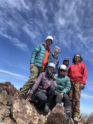
Trip Report
Mount Olympus/Blue Glacier
Beautiful, challenging climb with outstanding people!
- Fri, Jul 14, 2023 — Mon, Jul 17, 2023
- Mount Olympus/Blue Glacier
- Climbing
- Successful
-

- Road suitable for all vehicles
-
- Two mid-calf to knee deep river crossings shortly before the Hoh Ranger station. No obvious logs to cross. Water was not swift (and actually felt pretty good!). Crossings are close enough together that you can just keep your water shoes on until both are done.
- Ladder just before Glacier Meadows was a bottleneck.
- The point where you start down the moraine is marked with an obvious white pole. There's a faint boot path and cairns to guide you down.
- Water was abundant throughout. Last running water at the base of the snow dome (~6,200 ft).
- Snow Dome was the highest objective hazard on the route. In the morning we did a low traverse across very steep and runout snow. Recommend protecting with pickets. In the afternoon we traveled higher but encountered a roughly 200ft long descending traverse on slushy blue ice. Recommend protecting with ice screws. Neither was great. Pick your poison.
- Crystal Pass is melted out and there's an open crevasse splitting the former bootpath. A steep snow wall (approx 60 degrees, 30ft high) is your path up.
- 60m double strand rappel just reached from the summit block to the base of the north face with a few feet to spare.
TL/DR... Just give me the beta!
- Begin descending the moraine at the white pole.
- Rope up to cross the Blue Glacier. Unrope when you reach the rocks at 5,700ft.
- Refill water and rope up again at about 6,200 ft. From here you will probably have to choose between the high route through the bare ice or the low route with the super sketchy runout.
- We felt this was the highest consequence, highest risk part of the day (both in the morning and afternoon).
- If you do the traverse, highly recommend a running belay with pickets.
- If you do the blue ice, highly recommend at least 4 ice screws to provide a running belay. The ice screws would also be necessary if you had to build an anchor for any reason on the Blue Glacier, which is 90%+ bare.
- Unrope at the base of the false summit. It might be helpful to go one at a time due to the choss.
- The snow at the base of the true summit looks super steep but it's a paper tiger. Just go up!
- A standard single rack of cams (0.2 to 3") was sufficient for the 5.4 climb.
- 60m rope was sufficient to rappel the north face as a double strand rappel. If it's no longer the case, there's also a mid-point rappel station.
- Protip: you can empty the contents of your blue bags in the toilets at camp, but still pack out the soiled waste.
Narrative
Day 1
Permit was printed out online ahead of time. Arrived at Hoh Ranger Station at 8am. Abundant parking. Hiked to Lewis Meadows group site camp which was outstanding. Had to cross two slow-moving streams, either barefoot or in water shoes. You could realistically just keep them on until the second crossing since they aren't that far apart. Two bear wires at Lewis Meadows and nice (by backcountry standards) toilets. Water was easy to access by the river.
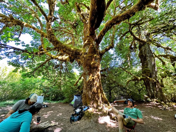
Day 2
Left camp around 8am. Reached the ladder to find it bottlenecked by day-hikers going to look at the glacier. Ladder was in good shape but the sheath in the middle section of rope was stripped, revealing the individual strands which are the guts of a climbing rope. This section, while slow, was uneventful. Arrived at Glacier Meadows group site. Best water source seemed to be the group site camp just to climber's right of the emergency shelter, but we camped at the one that was straight ahead. Since no one else arrived for the second site, we used that water source. There were several toilets here and abundant bear wires.
Day 3
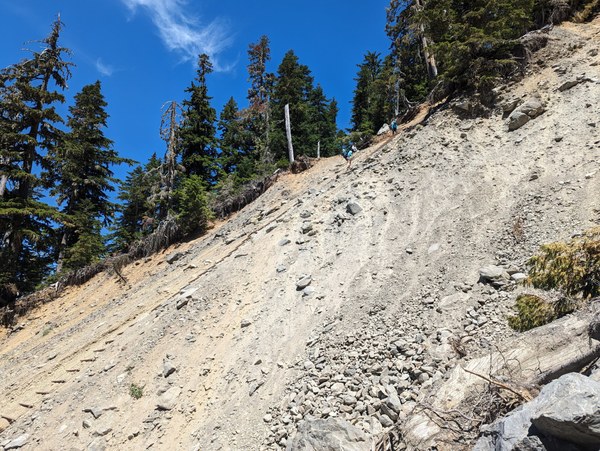
After getting very mixed messages from others (including one group that started at 2am and got back at 10pm!) we decided to play it safe and leave early... 0030.
Keep traveling along the moraine until you reach the very, VERY obvious white pole. This marks the start of the boot path, which is generally visible by headlamp but disappears in places. Eventually we got on nicer, stable rocks and worked our way down to the Blue Glacier.
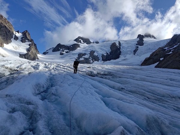
We roped up and basically went straight across the Blue Glacier, which was mostly bare ice. At around 5,700 ft, we reached rock and snow which marks the transition off of the Blue Glacier. A very loud waterfall was running down the rocks. Here we unroped and ascended to 6,200 ft, alternating between snow and rock. Be aware that there is water running underneath a lot of the snow.
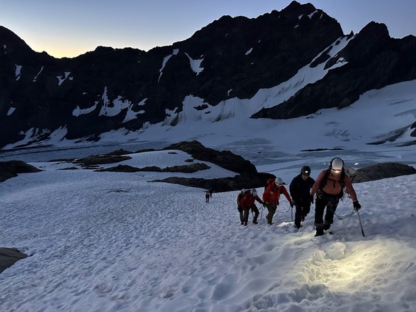
At 6,200 ft is probably your last best place to get running water. Here we roped up again to begin the ascent of Snow Dome. Directly above us was a large patch of blue ice with some small crevasses in it. Not wanting anything to do with that, we opted for a low traverse, which pretty rapidly became a very sketchy, steep, runout traverse. In hindsight, we wish we had protected it with pickets.
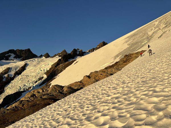 You can see the blue ice up high. The sketchy traverse is down low. The picture makes it look not-so-bad. Don't be fooled!
Once up on Snow Dome there was a very obvious boot path that took us to Crystal Pass without incident. Crystal Pass was melted out, so there's a little dirt climb up and over the notch. On the backside of the notch, the old boot path was split by a decent-sized crevasse, blocking the path. Instead, we went up a steep (~60 degree) snow wall for about 30 ft, which allowed us to get back onto the boot path toward the false summit.
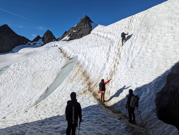
Thinking we might need ropes to ascend the snow slope to the true summit, we stayed roped up on the false summit, which was a chossy mess. This was a mistake as the rope only slowed us down, and we didn't use it for the snow up to the true summit.
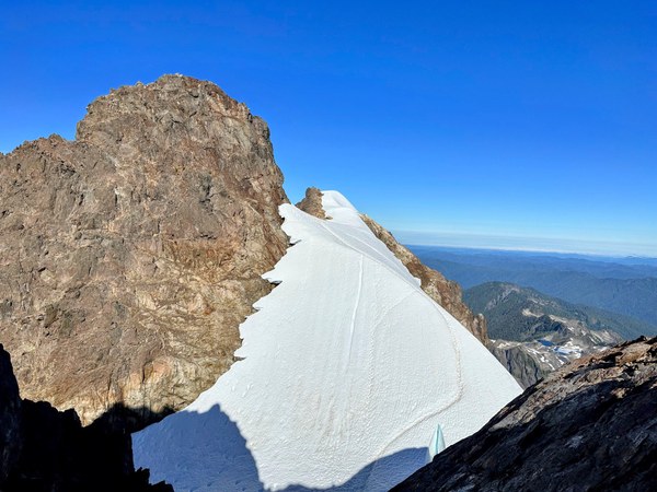 The true summit from false summit. Note the open crevasse down to the right.
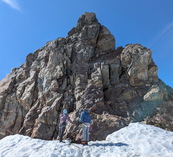
The snow slope up to the base of the summit block looks vertical. The boot path curved up the side and onto a spine, but part of it was above a yawning crevasse, so instead we opted to just climb straight up the slope un-roped. The runout here was good. The top of the slope was flattish and the small moat to the base of the north face climb provided no real challenge.
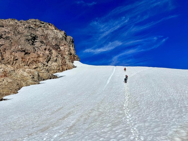 A paper tiger. Just go straight up!
I led the north face with a single rack of cams 0.2-3". I brought, but did not use, a set of offset nuts. We attached a tagline (our 30m rope) to the 60m rope so I could belay someone up, and then have them pull the rope back down with the tagline to send the next person up. Most of the group did not feel comfortable simply prusikking up the rope. While slow, this approach worked well.
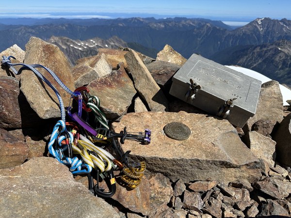
We spent about 30 minutes on the summit together admiring the beautiful weather while another trio did their rappel. Aside from them (who are also Mountaineers) we had the summit to ourselves on a beautiful clear day! A double strand rappel from a 60m rope (effectively 30m) was just enough to reach the base of the climb with a few feet to spare.
The descent was pretty straightforward except for the descent from Snow Dome. Eager to avoid the steep traverse, we stayed high, which eventually took us straight to the blue ice we had seen earlier in the day. The ice was slushy and we could get good steps with our crampons. We set a picket at the beginning to offer some protection and took this section very slowly. It ended up being a little over 200ft long. In our debrief, most of us preferred the ice descent to the steep traverse.
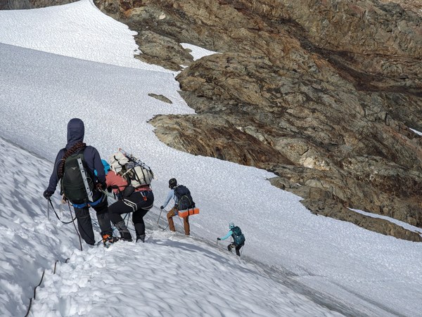 Descending the blue ice.
Once down from Snow Dome, the rest of the descent was pretty straightforward. We returned to Glacier Meadows at 8pm for a lovely 19.5 hour summit day. Oof! With so little time left until dark, we ate and crashed.
Day 4
Woke up to drizzling rain. Packed up and left camp at 8am for the loooong hike out. Ladder wasn't terrible despite the rain. Most chose to use both hands and feet on the rungs. Luckily there was no one else, so this was pretty straightforward. Otherwise the descent was uneventful in the best way! Reached the cars by 4pm, debriefed and headed out for food at Creekside Restaurant in Kalaloch.
 Travis Prescott