Trip Report
Alpine Scramble - Silver Peak
close, but no cigar on a nice cold, windy day
- Sun, Oct 29, 2023
- Alpine Scramble - Silver Peak
- Silver, Tinkham & Abiel Peaks
- Scrambling
- Turned Around
-

- Road suitable for all vehicles
-
Ground frozen at the parking lot in the morning (elevation 1900). Trail portion up to the turnoff at 3200 snow-free. Partially covered with snow during bushwhack afterwards until it becomes more or less continuous past 3500 or thereabouts. An inch of crusty snow lower in the low sections of buswhack in the morning hours becomes up to half a foot of over boulder fields at near the ridge elevation. Dry powder on and between the rocks at the ridge.
This trip was born out of the desire to remain active during the difficult period around November, when it's no longer the summer but winter hasn't started, and the weather makes it difficult to plan any climbing or scrambling trips on more technical terrain.
Since about last weekend when the the long-term weather forecast started to trickle in, we've been expecting a cold spell and snowfall during most of this week, followed by likely a dry weekend. This meant that any trip's difficulty level would be inflated by the conditions. Silver Peak looked like a suitable target. Normally more or less a walkup in the summer and a bootpack during the winter, it would offer additional interesting challenges on what I expected to be thin snow cover on rock, possibly with some spicier icy sections that would slow us down. I posted the trip, warning of mixed conditions, and it filled up within hours.
The reality more or less matched the forecast. We ended up with about 6 inches or so of snow over peaks in the Snoqualmie area, and several days of overnight freezing with clear sky letting the warm ground temps radiate into space, including the night before the trip. The day of the trip would see temps rising from mid-20s in the morning to nearly 40F mid-day, with clear skies, and expected 10mph or so winds, with 20mph gusts. All of that would more or less match what we've experienced during the day.
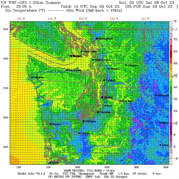
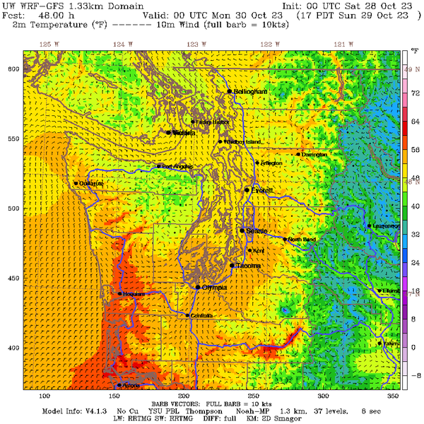
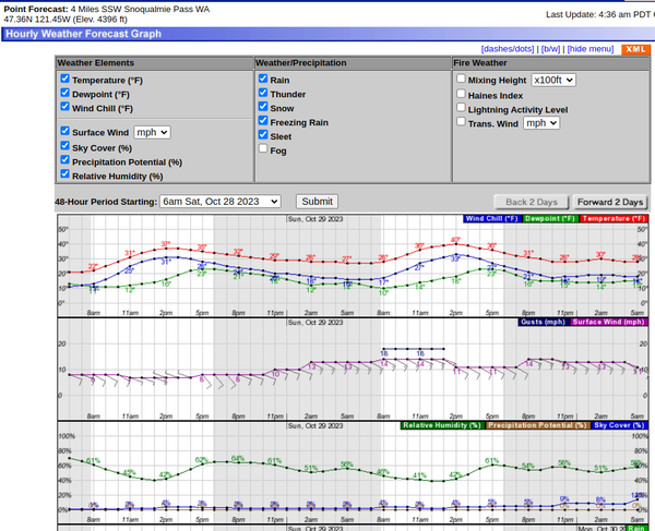
Given the conditions, I asked to bring full on Mountaineering boots, crampons, ice axes, and hard shells for wind protection, all of which proved useful (participants who initially considered sturdy hiking boots for comfort were later thankful for not making this mistake).
We met at 8am at the Annette Lake TH and moved out shortly. We followed the trail until about 3200 when we went into the forest and started the bushwhack. The trail was snow free and very comfortable to walk on. The ground in the morning was frozen in places, but it wasn't slippery.
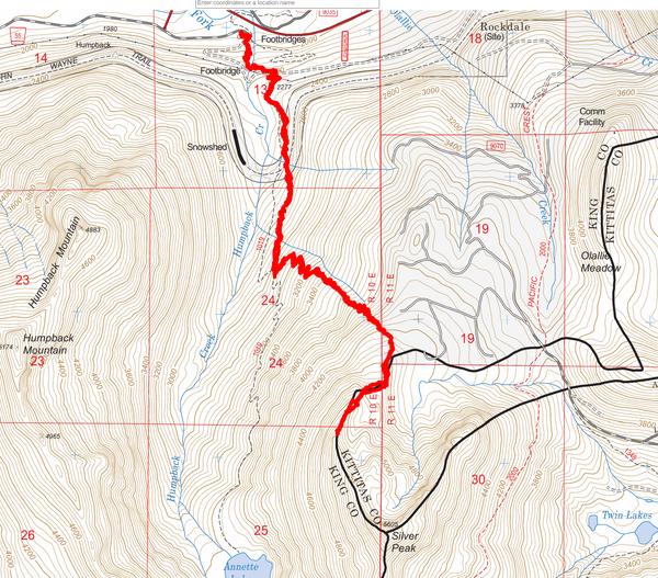
The route we followed is shown below:
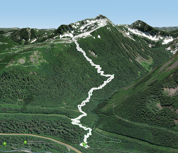
And here's a 3D view of the same:
Past the 3200 or so, we started about a 1000 vertical feet of a bushwhack. There is no climber's path on this section as far as I know. It would be easy to negotiate on during the mid-winter when the brushes are covered, but for us, it was pretty much the full on summer bushwhack experience as shown on the picture below.
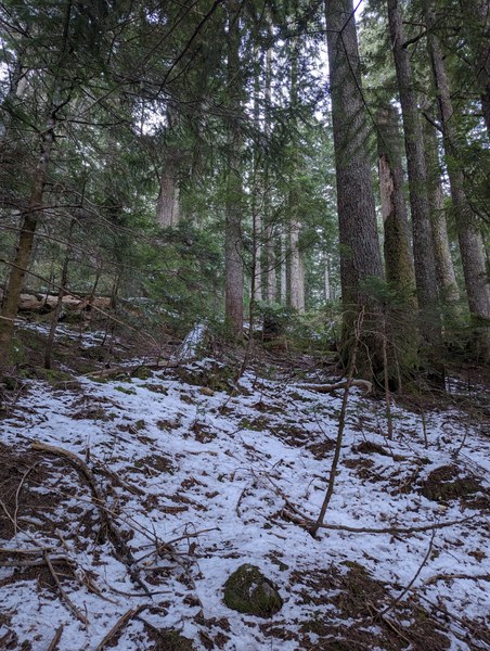
The firt couple hundred feet was only sparsely covered. After about 3500 or so, it has become a more or less continuous cover of an inch or so of thin crust.
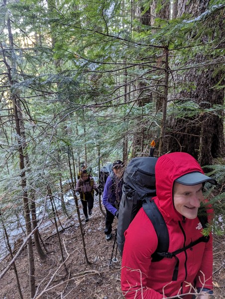
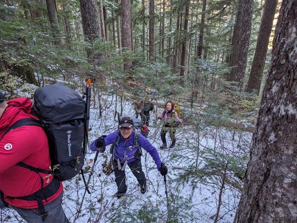
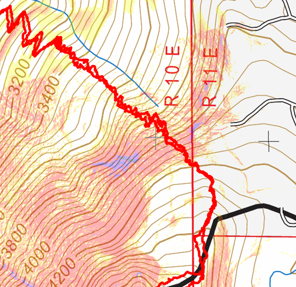
The lower section of the bushwhack was less steep, and the key challenge was keeping both of the eyeballs intact from the constant poking hazard of all the dry branches. Higher up, the terrain steepened somewhat, as can be seen on this slope angle shading map:
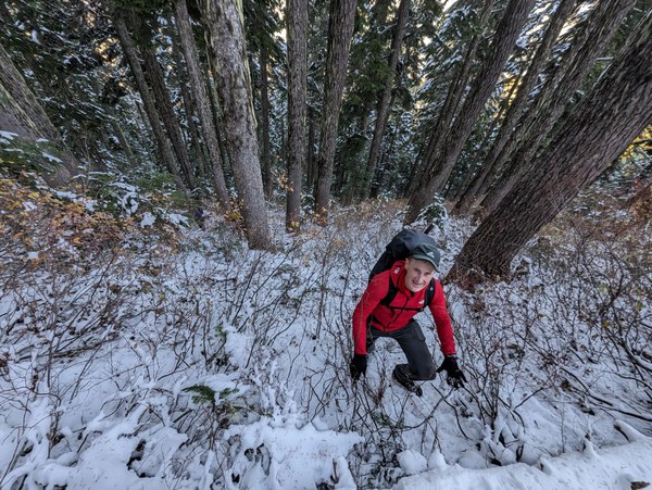
Negotiating the steeper sections higher up:
Finally topping out onto a boulder field:
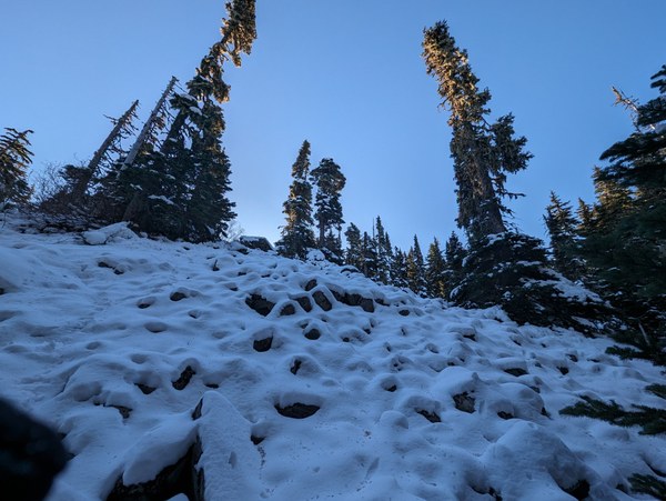
In total, the bushwhack has taken a little over an hour, so not as bad as one might think, although we certainly had expanded more energy during this portion than one would if one were to walk on a pine needle carpet trail with switchbacks.
Once at the boulder field, at 4300 or thereabouts, the terrain flattened out, but the boulders were treacherous to walk on. The thin 6-inch cover didn't provide any protection from getting your ankle trapped and twisted between boulders, but it obscured the boulders, necessitating care at every step. This slowed us down significantly.
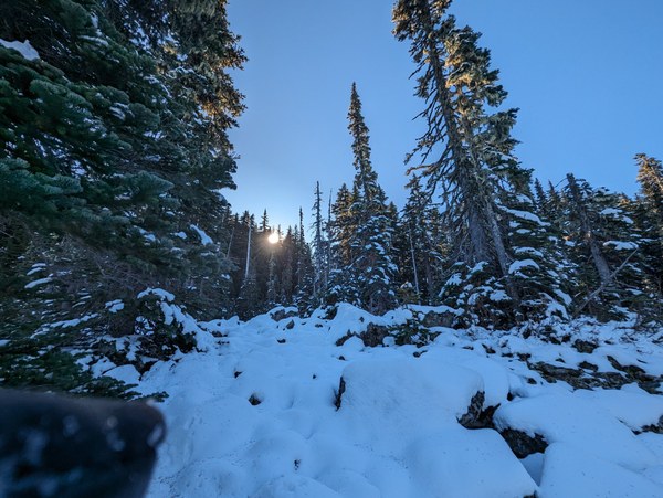
Fortunately, we were able to move left into the trees where we found more of a solid ground, with pine needles, soil, and only an occasional rock to walk on that enabled us to move much faster. We only needed to get through 300 vertical feet or so of mild terrain to get to the first clearing that offered us a glimpse of the remainder. This can be seen on the satellite image below (the 90-degree turn).
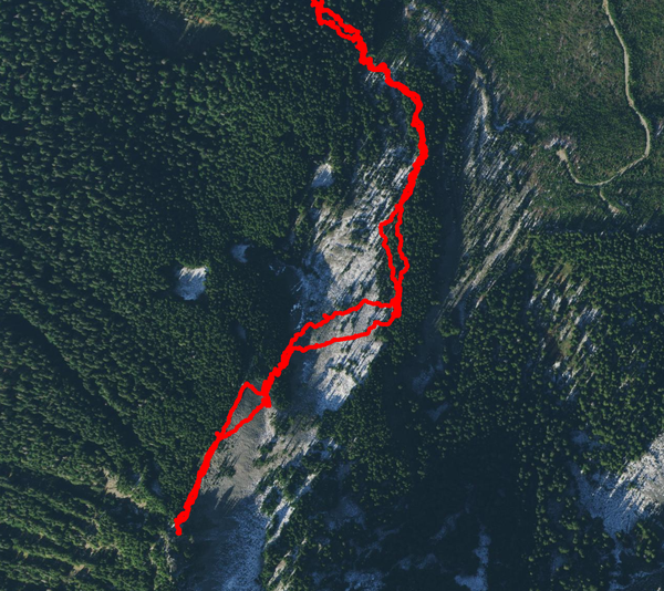
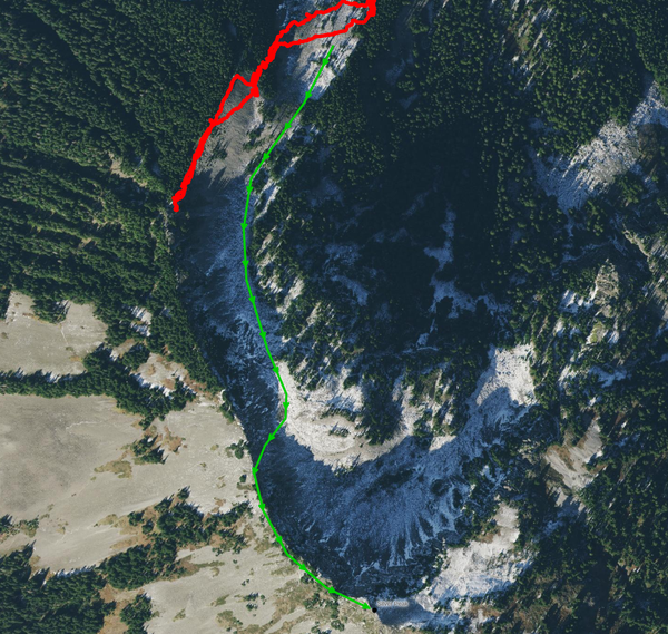
My initial plan from there had been to continue up the valley, as shown below by the green line. However, the difficulty walking over the snow-covered boulders and the resulting slow pace that would put us behind schedule necessitated a change of plan, and I opted to reroute and instead to push to get across the boulder fields into the trees and gain the ridge as soon as possible, hoping to be able to take advantage of more stable terrain in the trees and on the ridge top.
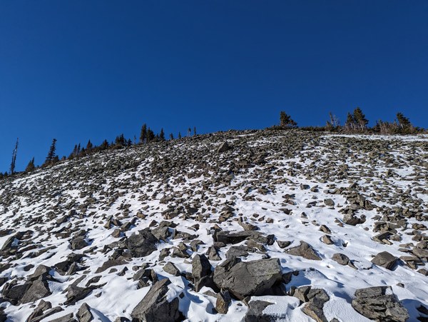
Looking at the ridge before getting on top:
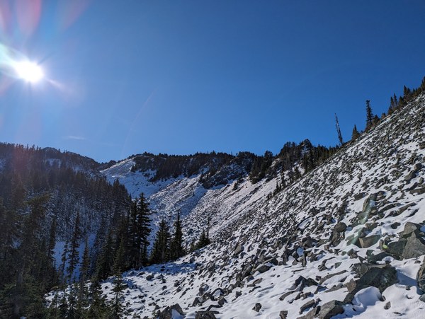
Moving straignt up - this actually wasn't bad at all, and certainly felt easier than the boulders in the valley:
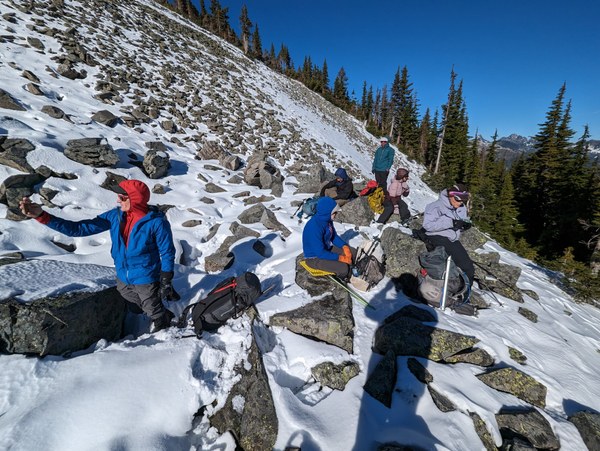
Lunch break at the second clearing at around 4900 feet, right before getting onto the ridge top:
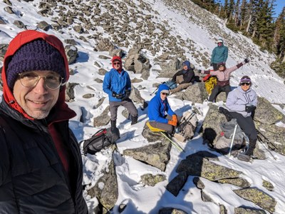
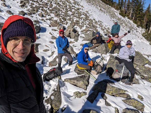
Mandatory group selfie, still in good spirits:
Making our way up - this part was a ton of fun, and I was happy for us to have endured all the bushwhack and made it this far.
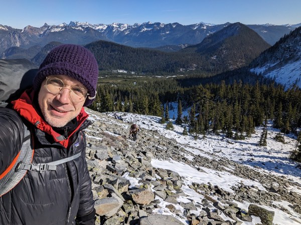
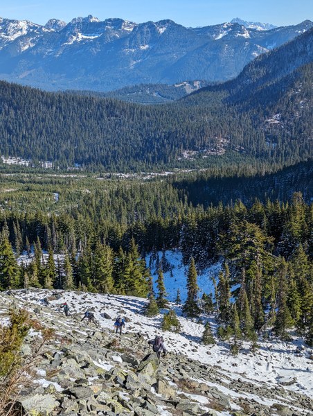
Amazing views on snowy peaks all around:
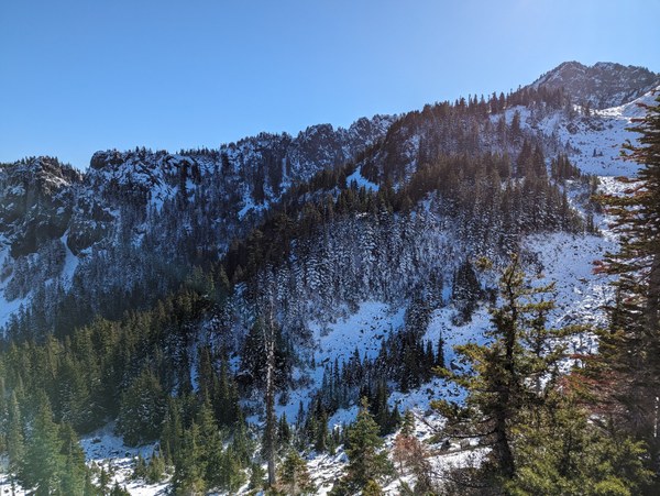
Pretty steep and a lot deeper snow on the Lake Ann side of the ridge:
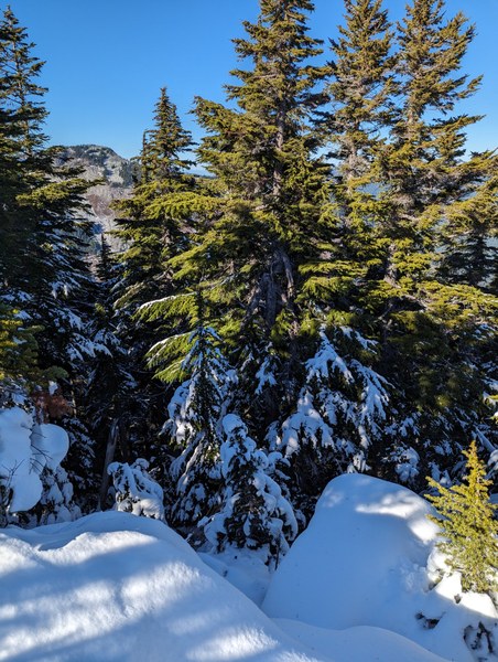
Finally at the ridge, fun terrain at the top - the rest of the route after the change of plans would run along the top of the ridge to the high point near the left side of the picture:
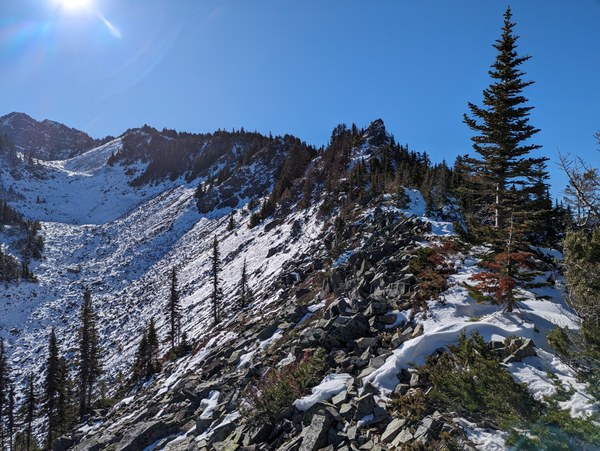
Sadly, not everyone was having fun. After topping out the ridge, one of the participants decided that with the slippery rock and unconsolidated snow, the slightly more spicy terrain made them feel uncomfortable, and offered to bunker up and wait for the rest of the group to finish the remainder of the route and collect them on the way back.
This presented a dilemma. Under normal circumstances, on a day of milder weather, this could have made good sense. On this day, however, temperatures were just barely above freezing, and at the top of the ridge, the wind was blowing pretty steadily at somewhere in the 10-15mph range, with an occasional stronger gust. The participant had plenty of layers and a thick parka, and later claimed they were good to spend the night in these conditions, but leaving anyone motionless for an extended period in these conditions obviously raised concern of a hypothermia and frostbite.
We proceeded just a bit higher to slightly above 5100 feet to scout the rest of the route and to take a closer look at what lies past the nearest gendarme to assess how long it would take to finish. There were a couple more gendarme-like features on the ridge that would need to be negotiated.
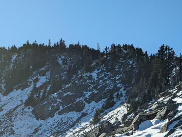
These likely were bypassable by going around on the right side, as shown by the purple-colored dashed line below.
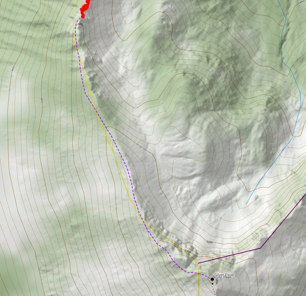
However, we didn't know the conditions of the terrain. The beta warned of "hidden waterfalls and cliffs above Annette Lake", and it specifically pointed out that "the West-facing slopes near the summit of Silver Peak can be extremely icy with possibilities for long uncontrolled slides". Those West-facing slopes would be the very slopes we would want to cross to dodge the gendarmes on the ridge, so that was slightly concerning. It was plausible that there could be a path through the trees, but not clear whether that would be true at any time, including off-season or early-season.
Given this, I estimated that even though we only had 500 or so vertical feet left on mostly low-angle terrain, completing the route from where we were would likely take an hour due to the slippery rock on the jagged top of the ridge and an occasional steeper snow slope to step across that we would need to walk carefully on, and the need for all the routefinding along the way.
We had only been about 4 hours or so into the climb at that point, slightly behind schedule, but not too much, and within the planned margins. Some participants expressed anxiety with doing bushwhack on the way down by headlamps, though. Based on those fears, I had estimated about ~2pm turnaround time. If we were all moving as a group, we should've still been able to complete the trip and get back to the cars before it's dark, with up to an hour of extra margin afforded by the nice easy trail walkout being a no-issue by the headlamps.
However, leaving someone bunkered for 2 hours with the cold wind was a much bigger concern, so I made the call to turn the trip around. Some in the group were understandably bummed by the decision, but everyone understood why this was necessary.
Participants waiting for the results of our little scouting expedition past the first gendarme:
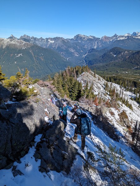
Making our way down:
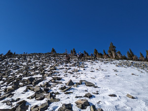
Slightly disappointed, but still smiling:
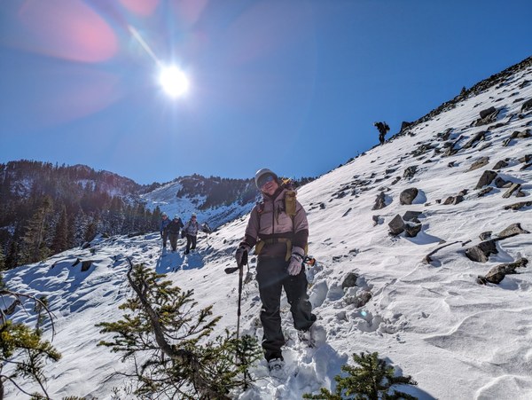
The walkout was pretty uneventful. Bushwhack on the way down was more slippery, as expected, given that the crusty snow softened a bit during the day. There was a bunch of self-arrest where ice axes came handy. Some particiants opted to put on microspikes or crampons for the descent, and were happy to have been carrying them for that occasion.
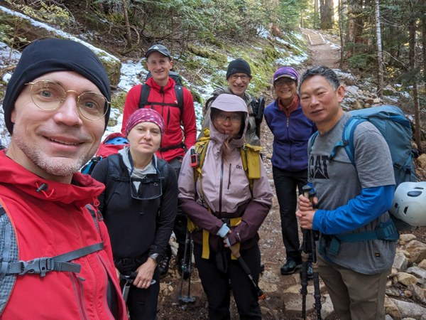
Back on the trail:
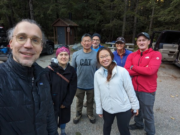
Back to the cars:
Even though we didn't tag the summit, I was very glad that we managed to get out and have some fun doing real scrambling in challenging conditions. Everyone did a great job negotiating the difficult terrain and staying in high spirits throughout the experience.
This is the first time I had to turn a trip around for a reason other than urgent medical condition, so a bit of retrospective is in order.
The main thing that stands out ot me is the need for carrying radios on a trip like this. I normally always carry radios on winter climbs, but didn't anticipate needing them on this easier-than-usual trip. They would have proven extremely handy, though, to maintain constant communication with the participant who opted to stay behind, and this could've easily swayed the decision. With the radios to stay in touch, a cup of hot chocolate in hand, and wrapped in a tarp, one could imagine a person being comfortable for a couple hours even with a less than optimal weather. And conversely, not knowing what may be happening with a person left to wait, having to worry about them at every step, it's hard to justify pushing further for any length of time, and that forces a much more conservative decision-making.
All in all, with the additional twist here and there, this was a lot of fun, so it's 5 stars in my book. Will have to do this again sometime...
 Krzysztof Ostrowski