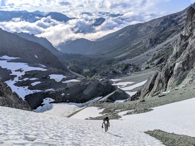
IMG_20200712_191902.jpg

Trip Report    

Alpine Scramble - Baldy—Gray Wolf Ridge—Mount Deception Traverse

A rigorous, sometimes-grueling, and unforgettably rewarding traverse full of breathtaking views and widely-varied terrain. Over four days and three nights we wound our way through a remote and challenging maze of ridges, valleys, basins, and cols, summited four peaks (Baldy, Gray Wolf, Gray Wolf South, and Deception), and, until the last day of the trip, saw no other humans.

  • Road suitable for all vehicles
  • We spent most of Days 1 and 4 on-trail, and all of Days 2 and 3 off. Trail conditions were largely fine and involved nothing more inconvenient or hazardous than occasional blowdown on the Upper Maynard Burn Trail and a few slick rocks when crossing the creek near the trailhead. Off-trail conditions varied widely.

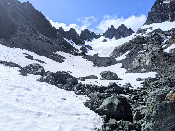
    The first patches of snow we encountered were on the slopes of Gray Wolf (Day 2) at about 6200'. Snow was spotty at and above this elevation until after we began our Day 3 ascent into the basin of Mt. Deception, where snow coverage became mostly consistent. We donned crampons shortly before ascending the basin's glacier at a spot where it narrowed to about twelve feet in height. The glacial ice was hard and slick, and to maintain stability we had to drive our ice axes and crampons in aggressively. Above the basin, the final approach to the summit was largely snow-free, though ascending the summit, itself, required crossing some thick, but non-hazardous, drifts and patches. We did wear crampons through most of the basin, but the only part of the route up Deception that truly required them was our short glacier crossing. The snow throughout the basin was of almost perfect consistency for climbing - well-consolidated but soft enough to kick good steps on the way up and plunge step on the way down.

    After Deception, the next significant snow coverage we encountered was going up the northwest side of Surprise Col. About half of this side of the col was covered in snow. It was somewhat harder than it was on Deception, but we felt secure without crampons. On the other side of the col, the snow was softer, covered the ground consistently, and made for a delightful glissade toward Royal Basin.

Day 1 -

Our party of five left the Upper Maynard Burn Way Trailhead at 8:45 AM. A blue sky was already defying a dismal forecast and would continue to do so for much of our trip. Our ascent up the Upper Maynard Burn Trail began shortly after carefully crossing the slick and mossy rocks of Mueller Creek and would take us from our starting elevation of 3200' up to our high point of the day, Mt. Baldy (el. 6808'), over the next five or six hours. Much of this time was spent traversing montane forests, where at the lower elevations the rhododendron blooms were withered and fallen, but, higher up, were barely past their prime. Somewhere past the midway point to Baldy, the montane forests break out into meadow, and it was here and in among the sparser trees along the high edges of the forest that we got our first taste of the abundance of wildflower species, many of them endemic to the Olympics, that we'd see throughout much of our trip.

Mt. Baldy, itself, was an easy summit. We paused there briefly and enjoyed the views of nearby Tyler, Gray Wolf, and the larger, more-distant peaks of the northeast side of the Olympics. By this point, clouds had rolled in to the valleys and basins beneath us, including Royal Basin. We were above them, and the view of the ridgeline we'd continue along toward Gray Wolf was clear. Around this point, talk among us turned to where we would spend the night. We had three choices - descend to the small tarn west of the main Gray Wolf ridgeline where we would have an easy water source but sacrifice daylight hours and mileage, continue along the ridgeline with the intent of setting up camp somewhere along the way and melting snow, and making our best attempt to push past Gray Wolf and Gray Wolf South to a small tarn on the slopes of Mt. Walkinshaw. The prospect of melting snow on a windy, treeless ridgeline did not sound inviting, and making it to the tarn on the slopes of Walkinshaw in our remaining daylight hours seemed like a stretch. So, reaching the midway point between Baldy and Gray Wolf at around 3:00 PM, we postponed Gray Wolf to the next day and dropped down to the first tarn for the night.
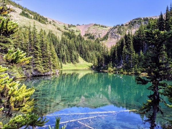
IMG_20200710_170637.jpg

Day 2 -

Our decision to cut Day 1 short and set up camp in the afternoon made for a long second day. I'm still glad we did it. The tarn was pleasant, we had a relaxing evening, my campsite was nearly perfect, and I slept more soundly than I did on any other night of the trip.

We began Day 2 by leaving the tarn by a different route than we had descended the afternoon before. It took us to Gray Wolf's northernmost subridge. Gray Wolf is another easy peak and requires little more than enjoyable T2 scrambling. We paused briefly at the top and made our way down the main ridgeline toward Gray Wolf South where things would soon become a lot more tough.
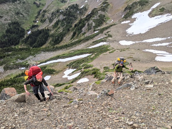
inbound1000273103191176224.jpg
The most straightforward way to the top of Gray Wolf South from Gray Wolf is to descend the ridge to about 6400', turn NW along the slope of Gray Wolf South, and then make a 'U' up the slope and onto the summit. After making the turn and beginning the 'U', we took a route that appeared reasonable but wound up dropping lower than necessary and as a result had to traverse a steep snowfield and a section of loose scree of the two-steps-up/one-step-down variety. The precarious slope angle and a consequential run-out had some on our team more than a little uncomfortable. This stretch slowed us down considerably, but we made it through without incident. The remainder of the route up Gray Wolf South was a simple walk.

We took a few minutes on the summit of Gray Wolf South and headed down the ridge toward Mt. Walkinshaw. Getting past Walkinshaw and on toward the tarn we hoped to spend our second night at involved veering in a westerly direction from Gray Wolf Ridge, traversing game trails across the north side of Walkinshaw, and ascending a slope thick with heather and dense krumholtz. Our progress slowed to a crawl, but we fought our way through and finally emerged on a clear, smooth, snow-covered slope that we'd take for a couple thousand feet before dropping down steeply into a valley. We hoped the valley would provide a straightforward route to the tarn where we planned to camp. At this point, dusk was fast-approaching and our team was tired from a long and more exerting day than any of us had expected. The descent into the valley took longer than I thought it would, and when we reached what I'd been picturing as a pleasant creek that we could walk along toward our tarn with ease, we were instead greeted by a rocky, vegetated morass that didn't appear much more enjoyable to pick our way through than did the krumholtz of an hour or two previously. Fortunately, it soon began to seem that we had descended into the very thickest part of the morass - it only took 15 or 20 minutes of climbing over boulders and pushing through the brush and trees before we were moving considerably more quickly toward the tarn. By this time, however, dusk was upon us, and, coming across a flat clearing with the creek running beside us, we decided the tarn could wait. We set up camp.
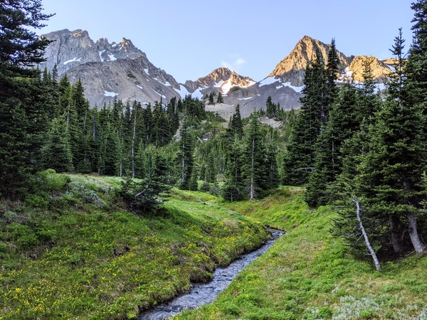
IMG_20200712_070616.jpg

Day 3 -

Summit day. It began with a somewhat early start. By 6:50, we were packed up and moving toward the tarn northwest of Point 7070. The walk along the creek became what I had hoped it was before descending into the previous night's morass. We were moving at a reasonable pace, though some in the party noted that they were feeling quite fatigued from the day before. We reached the tarn, purified enough water for the climb, and stowed the gear we didn't need for summiting Deception. The route away from the tarn ascends sharply and then follows along the west slopes of Point 7070. Travel here is straightforward save for a couple of gullies to cross and occasional krumholtz to pick through.

Once we reached the beginning of our ascent into the basin of Deception, three members of our party decided not to attempt the summit. Two of us were still willing. We stopped briefly, exchanged some gear, and made plans for meeting up at the tarn later in the day - and contingency plans if we didn't. The two of us who were attempting the summit then headed up into the basin. As detailed under Route Conditions above, the snow was almost ideal for climbing, and save for a short stretch of slick ice on the way up the glacier, we moved fairly quickly, entering the basin just before 11:00 and attaining the summit at 1:15. On the way down, we found that the snow and the slopes were perfect for plunge stepping, and we descended from the summit down to the meadow where the climb to the basin begins (el. ~5500') in an hour and a half.

The basin.
While in the meadow, we had the pleasure of seeing a bear at a distance of two or three hundred feet. She was grazing in the meadow grasses and apparently didn't see (or smell) us, at first. When she did, she bounded off into the trees but came out a little later and eyed us curiously while we ascended the slopes of Point 7070 on our way back to the tarn. As remote as this land is, we speculated that she'd never seen a human before.

After our bear sighting, the trip back to the tarn was uneventful. We reached it at 4:30, half an hour after the time we had planned for the others in our group to leave if we had not returned from Deception. We saw them in the distance on our descent to the tarn and signalled so they knew we had made it down from Deception safely and were just a short ways behind them. They remained ahead of us until we caught up with them in Upper Royal Basin at the end of the day.

After collecting our gear and purifying more water at the tarn (I drank a total of five liters on Day 3), we set out on the last segment of the day's journey - heading up Surprise Col - the gap between Mt. Clark and the Needles - and then down into Royal Basin. The climb up the col was strenuous and got steeper and harder as it wore on. The snow had melted or sluffed away due to the sharp angle of ascent on the last 150 feet. This left a field of loose scree and sliding rock and few holds stable enough to trust our weight to. The first portion of this section was the worst. It took five to ten minutes to move up fifteen vertical feet, and many of our steps gained us nothing. It got easier from there, though. We eventually reached the top and were greeted by a most welcome site - instead of the difficult, cramponned decent, possibly on hard snow, that we were expecting, the grade was kind and the runout safe and mostly clear of boulders. We took a few minutes to pull on our rain pants and secure our gear, then glissaded several hundred feet down the col.

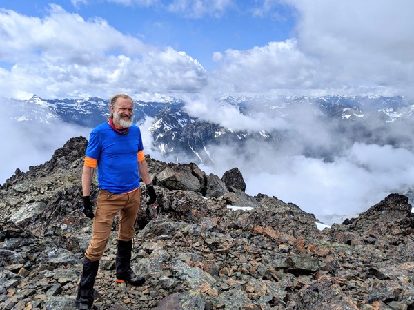
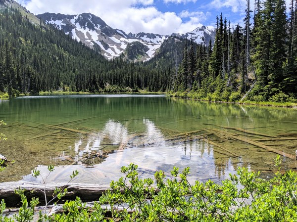
Once we got to our feet again, we traversed a bowl with a startlingly blue glacial lake at it's center and descended into Upper Royal Basin amid alien-looking boulders (possibly pillow basalt), cloud and fog, and portions of thick snow. 15.5 hours after heading out from our second night's camp, we spotted the beacon lamp the others in our team had considerately set out for us. We walked into camp, more than ready for a warm meal and a good night's rest.
IMG_20200712_131922.jpg

Day 4 -

The trip down from Upper Royal Basin, with it's eye-catching lakes, panoramic views of the mountains, and, at lower climes, plush vegetation, was beautiful but tame compared to what we'd seen on previous days. Headed away from our camp site, we saw our first humans, aside from those in our group, since starting out some 72 hours before. As expected, we passed many others on our descent. Before reaching what was probably the busiest part of the trail, we turned left for a quick 400 feet of ascent and a short, level walk that would close our four-day loop just before the Maynard Burn Way Trailhead. Upon reaching our cars, my GPS track had recorded a total of just under 30 miles with 12,400 feet of ascent.

IMG_20200713_115940.jpg

Overall, this may very well have been the most awe-inspiring and physically demanding trip I've been on. For those with both the conditioning  and the drive to experience what must be one of the most pristinely beautiful places in the Pacific Northwest, I can't recommend it more highly.