While much of Zion’s scenery is best viewed on foot, there are a number of must-see destinations that visitors can enjoy with only a modest amount of walking. Of course, nobody can talk about “must-see” activities in Zion without mentioning its two most famous hikes—Angels Landing and The Narrows. This list will give you a sense of how to prioritize your agenda for a first-time visit while also giving you ideas for subsequent visits.
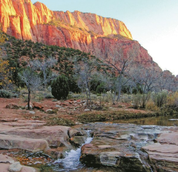 Early morning light along the banks of La Verkin Creek. Photo by Scott Turner.
Kolob Canyons
At this isolated and usually quiet corner of Zion National Park, various tributaries of La Verkin Creek have carved distinct finger canyons bound by soaring red sandstone buttes into the western edge of the Kolob Terrace. The hiking trails in this section tend to receive less visitation, and the La Verkin Creek Trail leads to one of the largest freestanding arches in the world, Kolob Arch. If you aren’t in the mood for a hike, stop at the Kolob Canyons viewpoint at the end of Kolob Canyons Road to survey the finger canyons.
Kolob Arch
Hike 2 in HIKE THE PARKS: ZION & BRYCE CANYON NATIONAL PARKS
Distance: 14 miles (22.5 km)
Elevation gain: 1800 feet (550 m)
High point: 6077 feet (1852 m)
Difficulty: Strenuous
Trail surface: Dirt and occasional soft sand
Map: USGS 7.5-min Kolob Arch
Notes: Suitable for backpacking (permit required); no restroom at trailhead
Tucked deep within a side canyon feeding into La Verkin Creek Canyon stands one of the world’s largest freestanding arches: Kolob Arch, spanning 287 feet high above a heavily wooded grotto. This route, along the La Verkin Creek Trail, offers either an easy backpacking trip or a strenuous day hike through the spacious, quiet confines of La Verkin Creek and Timber Creek Canyons.
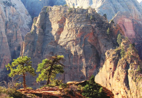 Angels Landing viewed from the West Rim Trail above Scout Landing. Photo by Scott Turner.
Lava Point
This lofty volcanic promontory surveys a vast landscape of plateaus incised by deep canyons. The views alone are worth the trip, but the drive along Kolob Terrace is worth taking even if you don’t go all the way to the point. Several groves of aspen, along with vast thickets of Gambel oak and maple, create a beautiful fall color display beginning in early October and lasting into early November. Several trailheads along Kolob Terrace Road, including the Right Fork, Left Fork, Hop Valley, Wildcat Canyon, and West Rim Trailheads, provide opportunities for long hiking trips or short strolls to stretch the legs.
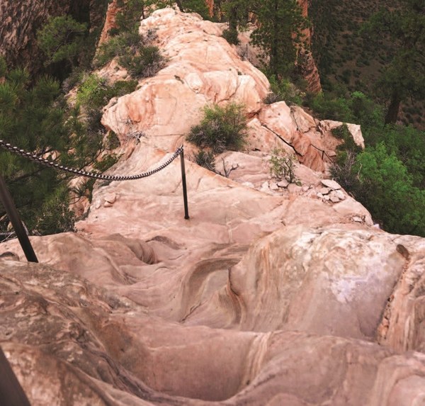 A particularly heart-stopping stretch of trail at Angels Landing. Photo by Scott Turner.
Angels Landing
Hike 14 in HIKE THE PARKS: ZION & BRYCE CANYON NATIONAL PARKS
Distance: 5.4 miles (8.7 km)
Elevation gain: 1800 feet (550 m)
High point: 5790 feet (1765 m)
Difficulty: Challenging
Trail surface: Pavement and a narrow, rocky ridge
Map: USGS 7.5-min Temple of Sinawava
Notes: Day use only; dangerous exposure from steep cliffs; not suitable for children; restroom at trailhead
This world-famous summit ascent climbs away from the Virgin River into the cool confines of Refrigerator Canyon before following the knife-edge of Angels Landing’s summit ridge. Acrophobes will shy away from the thousand-foot drops on either side of the narrow ridge, especially since hikers rely on chains bolted into the rock to maintain balance and footing. Families be warned! This is an especially dangerous route for children.
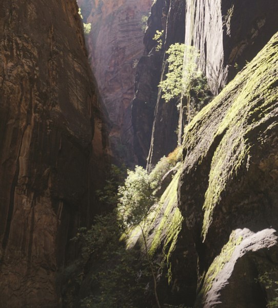 A blast of Utah sunshine cuts through the gloom. Photo by Scott Turner.
Zion Narrows
Hike 20 in HIKE THE PARKS: ZION & BRYCE CANYON NATIONAL PARKS
Distance: Up to 9 miles (14.5 km)
Elevation gain: Up to 350 feet (100 m)
High point: 4728 feet (1441 m)
Difficulty: Strenuous
Trail surface: The Virgin River
Map: USGS 7.5-min Temple of Sinawava
Notes: Difficult terrain; restroom at trailhead
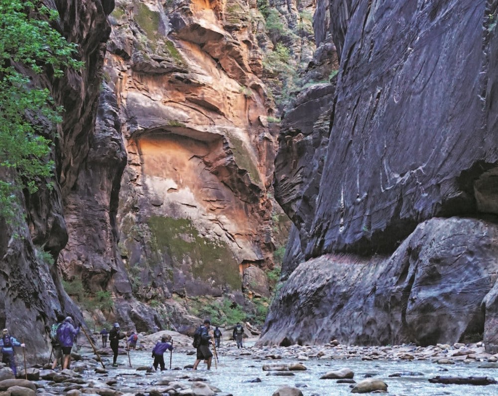
Zion’s other hallmark hiking route penetrates the narrow confines of Zion Canyon, where sheer cliffs rise directly from the banks of the Virgin River. This quintessential, showstopping Zion hike follows the course of the Virgin River, often within the river itself, through a twisting, turning section of Zion Canyon that’s often little more than 30 feet (10 m) across. When you aren’t negotiating the river’s current and the rocky riverbed, you will find yourself staring slack-jawed and in complete awe at towering sandstone cliffs rising hundreds, sometimes thousands of feet directly overhead.
Although the full day hike may be out of reach for more casual hikers, just about all visitors—even those wheelchair bound—can follow the paved Riverside Walk to the beginning of The Narrows to get a taste of this impressive geologic spectacle.
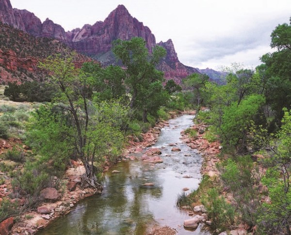 A classic scene of the Virgin River on the Pa'rus Trail. Photo by Scott Turner.
ZION HUMAN HISTORY MUSEUM
The museum showcases Zion’s human history, ranging from prehistoric indigenous habitation of the region through pioneer settlement and into the park’s century-long history. The museum also carries a heavy emphasis on water, which, despite the omnipresence of impressive sandstone formations, may be the single most important element in the park’s human, geologic, and natural histories.
Zion Human History Museum is located at Zion National Park Road north of the Zion National Park Visitor Center. Call ahead for hours of operation, which are subject to change according to the season. Phone: (435) 772-0146.
ZION CANYON SCENIC DRIVE
Although this scenic drive is only possible as a drive during the quiet winter months, you can take a shuttle to explore a number of destinations at any one of the nine shuttle stops between the Zion National Park Visitor Center and the Temple of Sinawava. For some hikes, such as the Grotto Trail and the Banks of the Virgin River Trail, you can use the shuttle for point-to-point routes. Thanks to the lack of automobile traffic, cycling is a popular activity on Zion Canyon Scenic Drive.
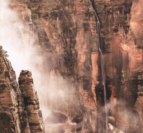 With careful timing, you can witness dozens of waterfalls from Canyon Overlook. Photo by Scott Turner.
Zion–Mount Carmel Tunnel and Canyon Overlook
Completed in 1930, this 1.1-mile tunnel solved a major challenge as to where to place a road that would connect Zion Canyon with the upper reaches of Clear Creek Canyon and beyond to Bryce Canyon. Although you can’t stop within the tunnel, even the short drive through it is memorable. The popular Canyon Overlook Trail, a short route leading to a stunning viewpoint, awaits at the eastern end. Please note that larger vehicles require a permit to enter, since the road is too curvy and narrow for them to safely navigate two-way traffic. The park adjusts traffic from two-way to one-way at certain times of the day to accommodate larger vehicles.
Canyon Overlook Trail
Hike 22 in HIKE THE PARKS: ZION & BRYCE CANYON NATIONAL PARKS
Distance: 1 mile (1.6 km)
Elevation gain: 150 feet (45 m)
High point: 5278 feet (1609 m)
Difficulty: Easy
Trail surface: Dirt and sandstone
Map: USGS 7.5-min Springdale East
Notes: Day use only; good for kids; steep drop-offs; restroom at trailhead
If you’re looking for a place where you can enjoy some stunning views of Zion Canyon from a high vantage point, but you don’t have the time or the inclination to take a more challenging hike, consider the Canyon Overlook Trail. This 0.5-mile (0.8 km) trail leads to a viewpoint where you can take in much of the southern reaches of Zion Canyon from an elevated perspective. The rocky scenery closer at hand also has some enjoyable qualities, including a few hanging gardens and hoodoos to spice up the approach to the overlook.
Photo at top: Working upstream in The Narrows. Photo by Scott Turner.
Excerpted and adapted from Hike the Parks: Zion & Bryce Canyon National Parks. See the book for more details, along with 23 additional routes to explore Zion (and a guide to Zion's stunning neighbor, Bryce Canyon National Park!).
Planning more park vacations? Check out the other volumes of the Hike the Parks series of guides to national parks, including Joshua Tree and Redwood National Parks.
Looking for more of Scott's recommendations? READ HIS SUGGESTIONS FOR LOW-KEY, EASY HIKES IN JOSHUA TREE NATIONAL PARK.
 Scott Turner
