Climbers, scramblers, hikers, snowshoers are all keen to find good beta for the next adventure. Sometimes a simple, downloadable map customized for the trail or route is enough. Other times we want tracks to follow when traveling in questionable terrain. There is no shortage of private and public collections of maps and tracks online, but we want to make these materials more accessible to you.
To help us decide what we're going to add to our website next, we host feedback site to gather ideas, collect votes, and scope projects. One of our members posted a feedback idea to add a "materials" folder to the collection of current and future Routes & Places. This new feature is now live on our website!
We can add files that are custom maps and tracks to these folders. Maps are most often a PDF or image file generated from a source like Gaia GPS (we have a member benefit for this). GPS tracks files should be in the GPX format. We can also add links to online resources like CalTopo and PeakBagger. To be added, we need three elements for each of the materials:
- A title that includes the route/place title and the type of resource (e.g. Mount St. Helens/Monitor Ridge - Winter Route Map).
- A summary is a brief description that should give a few more details about the resource, how it was created and who created it. (e.g. The winter scramble route from Marble Mountain Sno-Park via Monitor Ridge. Map created from CalTopo and submitted by C. Las Fiver, Seattle Scramble Committee.).
- For Files: A filename in a format that includes the route/place title, source and type (e.g. mount_st_helens_monitor_ridge_gaia_gps_winter_route_map.pdf).
- For Links: A URL, the web address (e.g. http://www.mymaps.com/wa/mount-st-helens-monitor-ridge).
Our website searches are optimized on titles and summaries, so a team of staff and volunteers will vet submissions, to ensure they are appropriate, in the right place, and easy to find.
Do you have some resources to add to our Routes & Places? If you find a route/place that needs to be improved or corrected, or if you have new images or resources to add, please complete the Route/Place Updates, Images & Resources form. You'll need to log in or be logged in to complete the for , and remember that all text, images and resources must be your original work or we must have permission to use them.
Leaders, learn more about adding new Routes & Places including some resources on our Requesting New Routes & Places how-to page.
This effort also needs navigation-oriented volunteer support. Are you interested in the idea or helping vet materials? Let us know!
Originally published in Sep 2016 as a "Coming soon" blog and Adapted From Navigation Northwest, Vol 4, Issue 3, September 2016. Visit the Seattle Navigation Committee's Publications folder for the this and all the issues of Navigation Northwest.
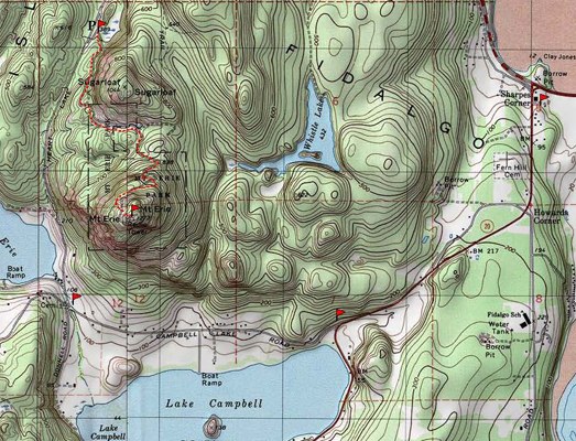
The map image above is of Mount Erie near Anacortes, WA and was produced by the author using National Geographic TOPO! software (©2000) for the Intermediate Alpine Climbing Course Rescue Methods Field Trip.
Add a comment
Log in to add comments.How about the Mountaineers pays for a subscription to CalTopo (Pro version for storing 200 (+) maps). The Program Center would manage the account; as members we would submit our maps + tracks, that would then be added to the Mountaineers account. Since a share link exists within CalTopo for the map, that link can be added to a route, feature, peak, mountain, etc.
As a Mountaineers member, I would like to see CalTopo (Matt) be supported by our organization --he has done a tremendous amount in support of SAR, and many members of the Mountaineers uses CalTopo services.
I'm happy to volunteer my IT KSA's for consultation.
While I am not certain of the best platform, David is right on with his support of CalTopo and Matt's work. CalTopo is remarkable. Each map can support a large number of uploaded GPS tracks. The user can load the track of interest to their GPS.
I would call the folder "Online Resources".
Russ Hamerly
We added the capability to add a “Resources” folder and tab to our Routes & Places. I will work with Peter Hendrickson on the process for creating these folders and adding materials.
Here’s an example: https://www.mountaineers.org/explore/routes-places/sam-hill
 Jeff Bowman