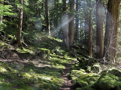
North Fork Sauk River
An 11 mile hike with 1,000 feet of elevation gain though old growth forest along the North Fork Sauk River in the Glacier Peak Wilderness.
Getting there
Drive the Mountain Loop Highway to 16 miles south of Darrington or 26.2 miles east of Verlot. Turn east onto Forest Road 49 and drive 6.4 miles to the North Fork Sauk River Trailhead (2,100 ft).
on the trail
North Fork Sauk River
11 miles round trip with 1,000 of elevation gain, 3,100 ft high point
An old growth forest hike suitable for spring through fall, this trail also accesses the Glacier Peak area for backpacks. The first 5.5 miles follow the river valley upstream with many small ups and downs. At 5.5 miles is Mackinaw Shelter and the turn-around point for day hikers. The forest section does not have many views, but near the beginning of the trail is a junction with the Red Mountain Lookout Trail, which climbs 700 feet in a mile to a viewpoint of the area.
Sloan Creek to Glacier Peak Meadows
24 miles round trip, 4,600 feet of elevation gain, 6,700 ft high point
From Sloan Creek Campground, follow Trail No. 649 along the North Fork Sauk River. After 5.5 mi, reach the Mackinaw Shelter. Camping is possible here, but not recommended for a 3-day trip. Continue on Trail No. 649, which soon begins switch backing for about 2,500 ft gain. Some water may be available here from snowmelt in numerous spots. Continue on the trail which does a rising traverse to White Pass, intersecting the Pacific Crest Trail just prior to the pass. Early season you may need to break your own trail here.
At White Pass look for the Foam Creek trail and follow it as it does an ascending traverse under White Mountain to below the eastern-most col along the ridge above you on climber's left. Leave the trail and head up to the col at about 6,600 ft.
At the col you will get your first views of Glacier Peak. Head down the slope about 400 ft traversing to the right. Continue onto low angle terrain at the Glacier Peak Meadows near the edge of the White Chuck Glacier at about 6,700 ft. Numerous campsites are available here on flat snow and among rock islands. Look for possible nearby water sources.
- Suitable Activities: Backpacking, Day Hiking
- Seasons: April, May, June, July, August, September, October
- Weather: View weather forecast
- Difficulty: Moderate
- Length: 11.0 mi
- Elevation Gain: 1,000 ft
- 3,100 ft
-
Land Manager:
Mount Baker-Snoqualmie National Forest
Glacier Peak Wilderness, Darrington Ranger District (MBSNF)
- Parking Permit Required: Northwest Forest Pass
- Recommended Party Size: 12
- Maximum Party Size: 12
- Maximum Route/Place Capacity: 12
- Green Trails Sloan Peak No. 111
- Green Trails Glacier Peak No. 112
- Trails Illustrated Glacier Peak Wilderness
- Green Trails Mountain Loop Highway No. 111SX
This is a list of titles that represent the variations of trips you can take at this route/place. This includes side trips, extensions and peak combinations. Not seeing a title that fits your trip? Log in and send us updates, images, or resources.
- Sloan Creek to Glacier Peak Meadows
There are no resources for this route/place. Log in and send us updates, images, or resources.
