Trip
Stewardship - Church Creek–Satsop Lakes
Join us on National Trails Day to work on our branch's adopted trail. We will be working on the Church Creek (east, Skokomish valley) side of the trail, cutting back a year's growth of brush, and doing some crosscut saw work and repair of a switchback. Trail work description may change and group size may be increased significantly after May 11 scouting trip.
- Sat, Jun 1, 2024
- Olympia Conservation & Stewardship Committee
- Stewardship
- Adults
- Moderate/Strenuous
- Moderate
- Mileage: 4.0 mi
- Elevation Gain: 1,380 ft
- High Point Elevation: 3,250 ft
- Pace: 1.5 with stops for work
- 9 (14 capacity)
- 1 (4 capacity)
- Cancellation & Refund Policy
Meeting time and place:
Participants can carpool, meeting at 7:00 am at Haggen's, West Olympia, or, if coming from the north, at the fish hatchery parking lot on Skokomish Valley Road near US 101. Driving distance is about 25 miles from Haggens to the fish hatchery, and about another 25 miles from there to the trailhead at the end of Forest Road 2361-600. Details will be emailed to registered participants a few days before hike. No pass or fee is required for parking. Trailhead parking is limited, and good ground clearance is needed. For info on good carpooling practices and how to contact other participants for carpooling, please see this Mountaineers article on "Carpooling and Mountaineers Activities/Courses": https://www.mountaineers.org/blog/how-to-opt-in-for-carpooling
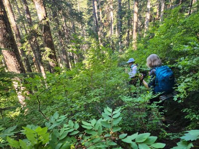
This trail connects the Skokomish and the Wynoochee watersheds. We will be hiking from the east end, starting at 1,870' elevation. It's about two miles to the top of the divide, with about 1,380' elevation gain. The lower part of the trail consists of switchbacks through stands of huge firs and cedars, and passes by many remnants of past trail work on fallen giants. Many of the trees are towering and magnificent, truly a cathedral of the forest. The topography is rugged, but made manageable by a series of well-designed and constructed switchbacks, with the trail overlooking near-vertical drops into the Church Creek gorge. The middle part of the trail passes through open areas with berries and wildflowers in season, and then a small alpine meadow by a dramatic rock face. The upper section continues from there to the top of the divide on switchbacks through forest, where our likely work sites are located.
We plan to have a brushing party hike to the top of the divide and work back down the east side. This was not brushed out last year, and was starting to encroach on the trail by last September. There will be a lot to do. We have in mind a large log-out saw project and a trail construction-repair project, both in the upper section. Our scouting trip may reveal more work needed and different priorities, so this may be revised.
The trailhead is about 15 miles past the end of cell phone coverage, and it is pretty remote and isolated. If you have an In-Reach or other pocket-sized satellite communications device, bring it. Three miles of approach on Forest Road 23 are badly potholed. The trailhead is at the end of Forest Road 2361-600, a spur road. The spur is about two miles long and has 28 water bars which require good ground clearance and some maneuvering. An SUV, truck or other vehicle with at least 6.5" ground clearance is recommended.
CAUTION: There is an active nest of ground bees or yellow jackets next to this trail in the upper section. If you are allergic, bring your epi-pen. Please let one of the leaders know if you have an insect sting or other potentially serious allergy or a medical condition which might become an issue during the trip.
Badges
participants will earn:
leaders will earn:
Church Creek–Satsop Lakes
-
Green Trails Mt Tebo No. 199
Green Trails Grisdale No. 198 - See full route/place details.

 Stewardship Credit