Field trip: Conditioning Hiking Series
CHS 2 Hike - Royal Basin
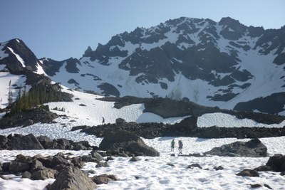
The trail cuts through the Royal Creek valley to a lake beneath snow capped mountains. From the lake we'll head up to Upper Royal Basin and up close views of Mount Deception, Mount Mystery, Mount Fricaba and Hal Foss Peak. CHS hike led at a CHS 2 pace (2.0-3.0 mph).
- Sat, Jul 14, 2018
- Seattle Hiking Committee
- Day Hiking
- Adults
- Strenuous
- Moderate
- Mileage: 16.0 mi
- Elevation Gain: 3,000 ft
- High Point Elevation: 5,700 ft
- Pace: 2.0-3.0 mph
- 2 (11 capacity)
- Cancellation & Refund Policy
We will meet at 7am at the Mercer Island Park and Ride.
Royal Basin is one of those beautiful hikes where you see wild Rhododendron, berry bushes, blue rivers and turquoise lakes. Most of the hike has the shade of the trees, opening up to lakes and a bit rockier ground as you get toward the end. We will be heading up to Royal Lake, where the beautifully colored lake is set against the dramatic grey rock faces.
Royal Basin
-
Green Trails Olympic Mountains East No. 168S
Custom Correct Buckhorn Wilderness
Custom Correct Gray Wolf - Dosewallips
USGS Mt Deception - See full route/place details.
Required Equipment
Ten Essential Systems
- Navigation (map & compass)
- Sun protection (sunglasses & sunscreen)
- Insulation (extra clothing)
- Illumination (headlamp/flashlight)
- First-aid supplies
- Fire (waterproof matches/lighter/candle)
- Repair kit and tools
- Nutrition (extra food)
- Hydration (extra water)
- Emergency shelter (tent/plastic tube tent/garbage bag)
