Field trip: Conditioning Hiking Series
CHS 2 Hike - Middle Fork Snoqualmie: Upstream
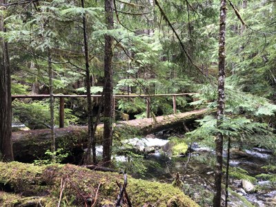
Hike upstream along the Middle Fork Snoqualmie River to Rock Creek Trail in the Alpine Lakes Wilderness. This trail leads to a beautiful overlook of Rock Creek Falls, one of the tallest waterfalls (1200 feet) in the Alpine Lakes Wilderness. Enjoy old growth forests, beautiful ferns and mosses, stunning mountain views, and several river and stream crossings (some on bridges, others not!) during our hike along this little-used but scenic trail. This trail is also a “backdoor” to the popular and heavily visited Snow Lake, though we will not go all the way there. This trail gets little use due to the difficult 6-mile heavily pot-holed road that leads to the trailhead. Please see note below regarding the need for 2 drivers with vehicles that can make this drive.
- Sun, Jun 5, 2022
- Seattle Hiking Committee
- Day Hiking
- Adults
- Moderate
- Moderate
- Mileage: 11.2 mi
- Elevation Gain: 2,100 ft
- Pace: 2.0-2.5mph
- FULL, 1 on waitlist (9 capacity)
- Cancellation & Refund Policy
We will meet at the Tibbetts Valley Park & Ride at 7:00 am, consolidate hikers into carpools and depart for the trailhead no later than 7:15. We will need two other drivers with high clearance vehicles to drive to the trailhead (PLEASE SEE LEADER NOTES BELOW). Please bring a mask for carpooling.
From the Park & Ride, it’s a 38 mile drive to the trailhead that takes around 1.5 hours each way. The last six miles on a heavily pot-holed road take around 30 minutes. We highly recommend carpooling for this hike. However, if you choose to drive straight to the TH, meet us there no later than 8:30 a.m. Allow plenty of time to get there.
Directions to the Tibbetts Valley Park & Ride
Take exit 15 (WA-900 W/17th Avenue NW) off I-90 eastbound. Take a right at the bottom of the ramp. Drive approximately ½ mile and turn left on Newport Way NW. Take the first right into the Tibbetts Valley Park & Ride. (Not the multi-level parking garage on your left.) Drive past the Skate park. We will meet at the far end of the parking lot.
Directions to the trailhead
From Seattle, drive east on I-90 to exit 34. Turn left onto 468th Street and follow it to the junction with the Middle Fork Snoqualmie Road. Turn right and continue up the Middle Fork Snoqualmie Road. At the fork, take the right road, and drive 10 miles to the large Middle Fork trailhead parking area on the right. Pass the parking area and turn right onto a gravel road immediately after crossing a large concrete bridge. The road is marked for Dingford and Dutch Miller Gap. Continue six miles on a road with many potholes and several washouts. Outhouse is available at the trailhead. Northwest Forest Service pass required.
As mentioned above, the final 6 miles of the drive to this trailhead are challenging. Depending on the number of hikers, we will need 1-2 other drivers with vehicles with high enough clearance to make the drive and with drivers who are comfortable driving on rough roads. I recently made the trip in my Honda CRV without incident, and I will drive on our hike day. The 6-mile drive took about 35 minutes. Around half of the cars in the parking lot were Subarus, so they also made it to the trailhead. Please contact me (annr1825@gmail.com) if you are willing to drive or want more details. We hope to know in advance that we have enough drivers for the hike. We will ask riders to reimburse drivers for the 76 mile round trip ride from the park & ride to the trailhead and back. A recommended rate is 15 cents per mile (~$12 per person).
Trekking poles are helpful on this hike, which has several stream crossings and some slippery areas. I would also recommend boots over trail runners as parts of the trail are quite wet. If it’s a rainy day, I also recommend rain pants along with your other rain gear, as the Rock Creek Trail gets brushy.
This hike will be a full day so please don’t sign up if you need to be back at a specific time. We will likely make a quick stop by Rio Bravo in North Bend for a meal/snack on the way back.
Please review the hike on the WTA website if you would like more information: https://www.wta.org/go-hiking/hikes/rock-creek-falls.
Middle Fork Snoqualmie River
-
Green Trails Skykomish No. 175
Trails Illustrated Alpine Lakes Wilderness
Green Trails Mt Si No. 174
Green Trails Stevens Pass No. 176
Green Trails Snoqualmie Pass No. 207
Green Trails Middle Fork Snoqualmie No. 174SX
Alpine Lakes Wilderness (ALPS) - See full route/place details.
Required Equipment
Ten Essential Systems
- Navigation (map & compass)
- Sun protection (sunglasses & sunscreen)
- Insulation (extra clothing)
- Illumination (headlamp/flashlight)
- First-aid supplies
- Fire (waterproof matches/lighter/candle)
- Repair kit and tools
- Nutrition (extra food)
- Hydration (extra water)
- Emergency shelter (tent/plastic tube tent/garbage bag)
