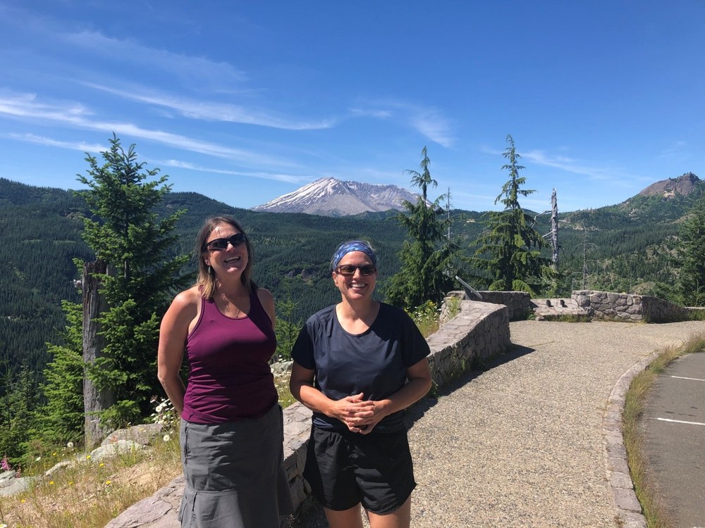
Mt. St. Helens is an exciting place to explore; a true-to-life science experiment, fun for both children and adults alike. My hiking partner and I decided to hike and explore the seldom traveled Windy Ridge Side of Mt. St. Helens. Here you get an up-close and personal view of the destruction done by the lateral blast that rolled over the landscape on May 18, 1980.
Most folks spend their time on the Johnston Ridge side of the mountain, taking the Spirit Lake Memorial Highway to visit the two interpretive centers, Coldwater Lake (with the easy access to trails like the Hummocks), and the Loowit viewpoint trail. More adventurous explorers hike up to Harry’s Ridge with overviews of Spirit Lake or traverse the Boundary trail, which starts at the Hummocks trail and leads towards Mt. Margaret, Norway Pass, and beyond. Hardy explorers will take the Loowit Trail, which circumnavigates the mountain. Some even make the yearly summit climb on Mother’s Day via the Monitor Ridge Trail. However you choose to see Mt. St. Helens, bring your camera, a sense of adventure, and a willingness to learn about volcanoes.
Windy Ridge, off Forest Road 99, is the hidden secret of Mt. St. Helens National Monument, as it is rarely as crowded as the Johnston Ridge side of the mountain. Driving and hiking this side of the mountain affords an up-close and personal view of the destruction from Mt. St. Helens’ explosive eruption in May 1980. The landscape is littered with gray-white bleached trees, lying in the direction of the lateral blast. The area is rocky, with pumice, ash, and magically, 40 years of new plant growth. Lupine and other nitrogen fixers were the first to establish themselves among the sterile ash.
The road is narrow with steep drop offs, and definite road slumping, so we did not drive fast. The views are amazing, especially on a clear day, with glimpses of Mt. Adams and Mt. Hood. We even caught a glimpse of Mt. Rainer from a spot on the road just above the lookout for Harmony Falls.
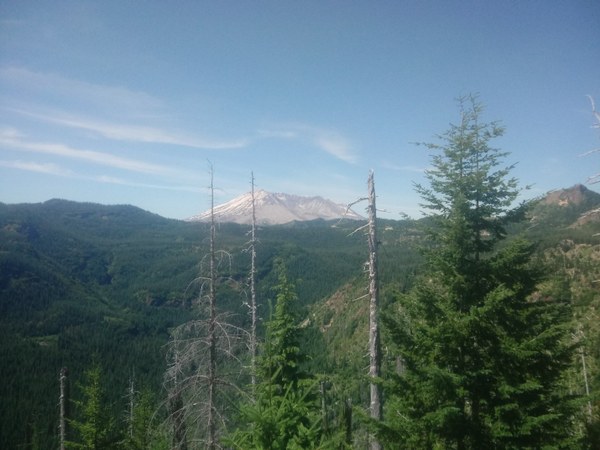 Clearwater Valley re-growth and Mt. St. Helens as viewed from the Blast Edge Viewpoint.
Leaving the Blast Edge Viewpoint, we continue west towards Windy Ridge. Our next stop is the Miner’s Car and Meta Lake.
Stopping at the Miner’s Car interpretive site is a misnomer. The car did not belong to the miners in the area, but to the brother of a miner. This rusted, squashed car is a grim reminder that many individuals lost their lives the day Mt. St. Helens erupted.
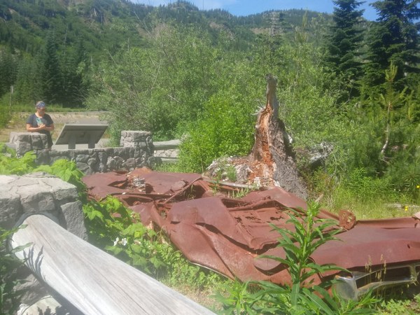 1972 Pontiac Grand Prix.
The Meta Lake interpretive Trail is a short 0.3-mile, paved trail that winds to Meta Lake. Along the way, you can learn about how plants and animals survived the Mt. St. Helens eruption, existing under a blanket of winter snow. These small trees later became important early habitat in the blast zone.
Meta Lake has changed quite a bit since my prior visits in the 1980s prior to the eruption, and my return visit in the late 1990s. In 1998, the hillside across from Meta Lake was still quite barren. A short row or two of fir trees were beginning to reestablish themselves. The blown-down trees of the old growth forest that had become bleached white by the sun were still visible, lying in the direction of the blast. The viewing platform at the lake was accessible, with views of the crystal clear lake unimpeded by brush, and the kiosks on the platform were readable, providing visitors with valuable information of the surrounding area.
The initial band of trees I had witnessed in 1998 has grown, extending their reach far beyond the previous boundary. Berry bushes and alpine wildflowers are more prevalent, bringing with them more birds, reptiles, and amphibians. As the habitat changes, so do the plants and animals that inhabit this region.
Another change from my 1998 visit is that the lake is deeper. The viewing platform has sunk below the water line and the trees, shrubs, and bushes now stand taller than I do. Following the short paved trail from the parking lot, look for small wooden posts. Some are becoming hard to spot.
In order to protect fragile lakeshore habitat, please remember to stay on trail. There is no swimming, fishing, or camping at Meta Lake. This area is still an important research area and a living science laboratory. Straying off-trail can damage fragile plants and wildlife habitat.
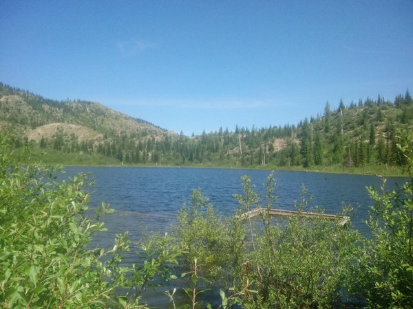 Meta Lake brimming with water and teeming with life.
On the way to Harmony Falls, we stopped briefly at the Cascade Peaks Interpretive Site, on the left-hand side of Forest Service Road 99. Usually visitors can obtain information regarding Mt. St. Helens. They can even purchase food and drinks, and hang out in the parking lot admiring the view of Mt. St. Helens. Due to COVID-19 restrictions, the site is closed. We stopped just long enough to take a couple of photos and have a brief chat with a family visiting from Seattle.
For the next stop on our adventure, I took my friend to Harmony Falls. I honestly do not know how I ever could have overlooked this trail. I had hiked on the Windy Ridge side before, many times, and yet somehow I missed Harmony Falls. Never in my wildest dreams did I ever think this short little trail would hold such magnificent surprises.
Harmony Falls
Gain: 650 ft.
High point: 4060 ft.
Length: 2.4 miles, round trip
From the parking lot of Harmony Falls, head downhill behind the gray rock wall to the left, minding your step, as the severely overgrown trail has many holes and dips that could lead to a twisted ankle. Beware of slumping parts of the trail that could toss someone head over heels downhill. I found that the dense green shrubs and bushes provided much needed shade on our hot summer day. I definitely sighed in appreciation when we came upon a small rock outcropping with a steady stream of clear, cold water trickling down between the rocks and ferns. On that hot day, I stood under that trickle, thankful for the small pleasures of great friends, a magnificent view, and cold water. The joys of nature here are pure bliss! From the grotto, continue downhill, minding your step as the dense understory is beginning to make its way over the trail.
A few short switchbacks later, we popped out onto a plain of pumice, sand, and ash; a striking difference from the cool shaded traverse we had just come from. Here the bushes are farther apart, lower to the ground, and sparsely appointed. The trail widens and the sand and rocks become the norm. Even in its barren, stripped-down state, life still manages to eke out a foothold. Ants, beetles, and spiders make their way across the rocky path. Bees flit dreamily from flower to flower, laden with pollen. Purple lupine, scarlet paintbrush, and fir trees glow bright green with new growth in the hot summer sun. Slowly, surely, nature reclaims herself amidst the moonscape.
My hiking partner and I continue to move forward towards a line of trees. Some are just beginning to stand tall. We saw the lake – a mere glimpse of blue water, gray floating logs, and Harry’s Ridge in the distance. From here, the trail dips downward to the left, with two short switchbacks to a small waterfall. The sound of water is a welcome relief in the hot blazing sun.
At the base, a small pool of clear, cold water looks deep and inviting; one to take off the boots to soak hot sweaty feet in. Please refrain from doing so, as this area is still a protected wilderness area. The edges were teeming with tadpoles and little toads. This area is still reestablishing habitat for the animals and plants, even 40 years after the eruption. From here turn left, and make your way towards Spirit lake. There are many places to sit, contemplate the mountain and its destructive powers, and the take in the view.
From Harmony Falls, we made a quick photo stop at the Cedar Creek Viewpoint and Interpretive site. Here, we had views of Spirit Lake, Harry’s Ridge, Mt. St. Helens, and Mount Margaret.
We passed by the Smith Creek viewing area as there was only a small pullout for two or three vehicles and it was surprisingly full. At Smith Creek you can access the Upper Smith Creek Trail #225, take photos of Mt. Adams, or have a picnic and enjoy the views of the Smith Creek river valley. We are saving this trail for one of our future adventures to the Windy Ridge side of Mt. St. Helens.
Forest Service Road 99 ends at the Windy Ridge Interpretive Site. This area took the full impact of the Mt. St. Helens eruption. Head up the iconic stairs to the top of the ridge and take in the views: to the north, views of Mount Margret; to the west, views of Spirit Lake, Harry’s and Johnston Ridges; to the south, Mt. St. Helens crater, lava dome, and pumice plains and to the east, views of Mt. Adams. The interpretive kiosk on the ridge gives information regarding the surrounding area.
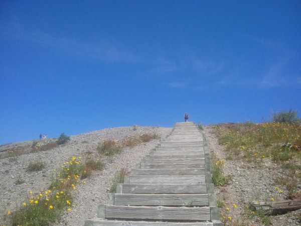 The iconic stairs to the top of the Windy Ridge Interpretive Site.
From the southern end of the parking area at Windy Ridge, access to the 5.7-mile Truman Trail #207 is via a gated gravel road built by the U.S. Army Corps of Engineers to access the Spirit Lake pumping station. The pumping station was built shortly after the 1980 eruption, to alleviate rising water levels in Spirit Lake that threatened to breach the debris dam and slam down the Toutle River valley. The pumping station was in service until the completion of the 1.6-mile long outflow tunnel in 1985. The outflow tunnel allows for the water from Spirit Lake to drain down into North Fork Toutle River via the South Coldwater Creek to prevent flooding.
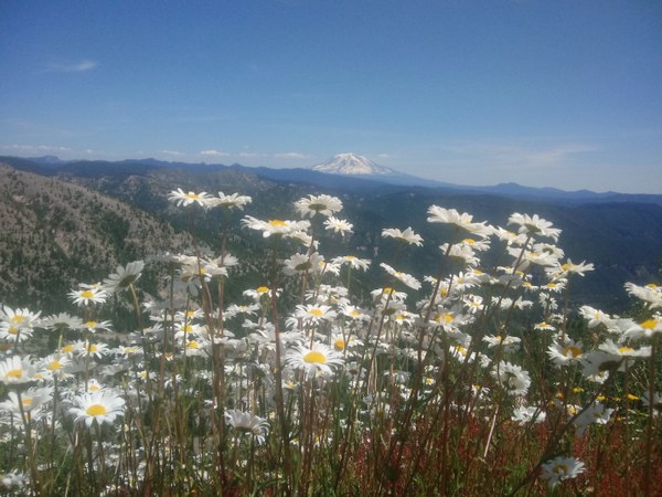 Ox-Eye Daisies and Mt. Adams to the east.
From the road, looking eastward, views of Mt. Adams are outstanding. Looking westward, there are views of Mt. St. Helens, the southern terminus of Spirit Lake, Harry’s Ridge. Hikers along the road stated that the views of Mt. Hood further down the road were impressive. My hiking partner and I did not hike very far; we wanted to scope it out for a future hike. There are very few trees along this road, and even fewer down towards the Plains of Abraham. Due to the intensity of the heat at midday, our access to shade was our first priority, so we turned around with the intention that we would plan a longer hike for next time. We planned a route through the Plains of Abraham, out to Loowit Falls, up to Johnston Ridge, and back again.
I hope you get out to the Windy Ridge side for a grand adventure.
Pass/Entry Fee: Discover Pass, Northwest Forest Pass, or America the Beautiful Pass.
Hours of operation: Mid July-November
Restrictions:
- Day use area only.
- In order to protect sensitive natural vegetation there is no off-trail travel. Please stay on the trail and practice LNT Principles. Please do not pick the wildflowers or disturb vegetation as this area is still being monitored for scientific purposes.
- Bicycles and animals prohibited: dogs are not allowed- service dogs are the exception.
- No fishing, camping, or swimming at Meta and Spirit Lakes.
- General overview map of Mt. St. Helens. Drones are prohibited in zones 1 and 2, see map for drone free areas.
- Access: Some of the trails are suitable for individuals with disabilities, easily accessible via paved trails.
Summer Weather
When traveling during summer months at Mt. St. Helens, the heat and sun can seem relentless and overbearing, as there are few trees to shade trails. The day my hiking partner and I went, it was 85 degrees in the shade. In the full sun, the temperature exceeded 100 degrees. There were no places to refill water bottles or get food. Some of the trails are suitable for individuals with disabilities, easily accessible via paved trails.
Bring
Plenty of water, food, and snacks, sun protection (including a broad brimmed hat, long sleeves, and sunglasses), the Ten Essentials, bug spray, camera for capturing the views, and a sense of adventure.
Directions
From Randle, WA head south on WA State Route (SR) 131 until the road forks (at one mile), stay to the right following State Route 131, this becomes Forest Service Road 25. Travel south on Forest Service Road 25 for 19.8 miles until you reach the junction of Forest Road 99. Turn right onto Forest Service Road 99; continue for 16 miles to Windy Ridge Interpretive Site.
Educational Resources
The Mt. St. Helens Science & Learning Center is a collaborative effort of the Mount St. Helens Institute and the U.S. Forest Service, Mount St. Helens National Volcanic Monument. Our mission is to connect people with nature through science, the arts and adventure recreation. Learn about the Mt. St. Helens 1980 eruption.
 Regina Robinson