
The day we set off to hike from Norway Pass to Mount Margaret was unbearably hot. The summer sky was dim and eerie as hazy smoke from the wildfires filtered out the sun and the threat of thunderstorms hung in the oppressive air. After careful thought and review of the weather, we decided to cautiously proceed with our hiking adventure.
We started our hike from the parking lot of the Boundary 1 Trail, where we would intersect the Independence Trail (227A and the Norway Pass Trail) after about a mile. The trail is inches deep in dry, dusty ash remnants from the Mount St. Helens blast of May 1980. The trail is enveloped in fir trees, mountain elm, vine maples, fireweed, paintbrush, willows, fireweed, salmonberry, and goat’s beard.
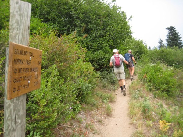 Hiking partners on the trail heading to Norway Pass.
Along the trail, bleached white logs that were once lush old growth trees are still visible amid the new growth. Some lie matchstick-style strewn about, showing the direction of the ferocious lateral blast, while others stand tall and still, silent sentries to the devastating event.
Switch-backing up the hillside, we gained a different perspective of the blast zone. Vegetation is slowly making its way back: asters, yarrow, paintbrush, lupine, among others contribute splashes of color to the semi-barren landscape. Cottonwood, mountain ash, mountain hemlock, and silver fir are beginning to grow back, providing much needed shade and creating a cool habitat for song birds, plants, and other animals to inhabit.
We crossed a short 30 foot patch of packed snow and ice (a treat to find on a hot, muggy day at the end of July!). We saw several patches of avalanche lilies, pearly everlasting, penstemon, and paintbrush. We even found a menagerie of mushrooms a short distance away, safely ensconced on a few downed logs.
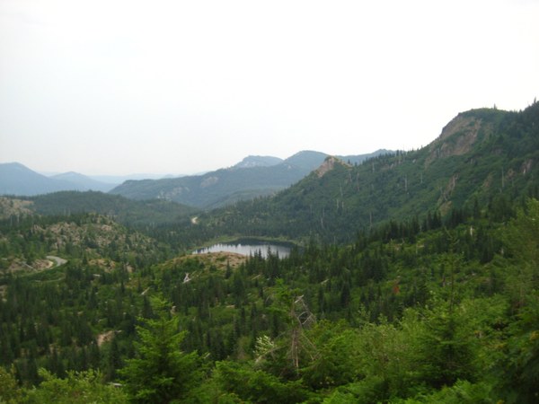 Meta Lake.
Just over a short ridge, views of Mount Adams snowy cone peaks shyly on the westward skyline. This lends a sharp contrast to the gray-blue, murky sky. Meta Lake makes an appearance, gray in the hazy, late summer sun. The lake, along with many trees and ground burrowing animals, survived the eruption, because they were lucky to buried deep beneath May’s blanket of late spring snow.
We reached the trail junction of Independence Pass and the Boundary 1 Trail at just under a mile. The left fork takes you directly to the Independence Pass Trail #227, the right fork leads to Norway Pass. The trail is narrow, due to the fact that vegetation is growing up and over the trail; in addition, in several hard-to-see areas, the trail dips and falls away completely leaving gaps on the trail. As we traversed this area, the views were limited.
After 2 miles through lush alder and goat’s beard, we rounded a corner and the trail opens up to fantastic views. Norway Pass has expansive views of Spirit Lake, Mount St. Helens crater and Pumice Plain.
Our destination, Mount Margaret, lies four miles down the trail. The climb is exposed to the elements; in some places it is a fairly steep and rocky trail, with no shade. During summer, this portion of the hike can be taxing with the blazing sun beating down. It is best to hit the trail early in the morning to avoid excessive heat.
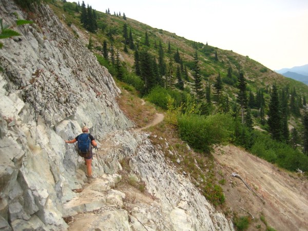 Hiker on the Boundary Trail 1.
Heading up the Boundary Trail 1, the trail is dusty, rocky, and in one point there is a section that can be unnerving to some, as it crosses over a rocky steep ledge. Once past the rocky ledge, the trail moves quickly uphill, traversing just below the ridgeline. Expansive views look out onto the Green River Valley. After cresting the ridgeline, the view of Mount St. Helens is stunning, even when shrouded in a smoky haze.
The views continued to get better and better as we traveled upwards on the sandy trail. At one point, looking just over your left shoulder one could see the snowy top of Mount Adams lying sleepily to the east. Ribbons of twisted, rusted deep orange metal rope, remnants of mining operations that surprisingly survived the eruption, could be seen interwoven alongside patches of arnica, paintbrush, western wall flower, and lupine.
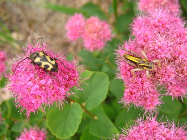 SPIREA AND UNIDENTIFIED INSECT FRIENDS SPOTTED ON THE TRAIL.
A little further on, we arrived at a junction to Bear Pass and the Lakes Trail #211. Our trail was lined with false hellebore, spirea, and bistort. At this point, we took the short trip up the northward hill. With views of Spirit Lake and Mount St. Helens behind us, we turned our attention to Goat Mountain and Grizzly and Boot Lakes, their deep turquoise waters inviting, nestled amid tall firs. Here we stopped for a quick snack and water break, not really speaking, but breathing deeply while we took in the views and embraced the silence.
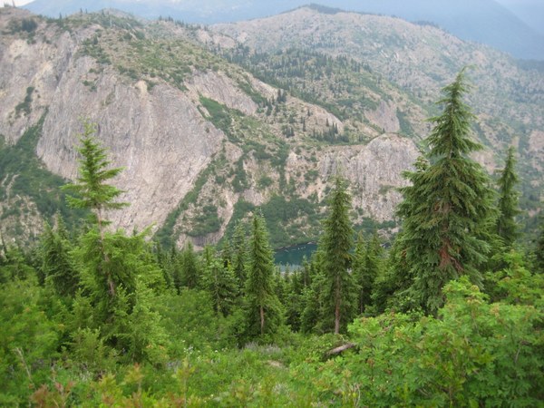 Views of Grizzly Lake and Goat Mountain in the distance.
From this vantage point, the views in all directions are spectacular. I can only imagine what it would have looked like on a clearer, sunnier day.
After our brief pause, we got back on the trail. We passed through an area with beautiful fir trees standing up right amid hillocks of ash. Grasses and flowers are slowly taking hold. Down trees are silent testaments to the force of the blast. Wildflowers gently hug these ghost trees, a reminder of nature’s penchant for hope and renewal.
Pushing uphill, the hike continues past two rock spires, which looked like staunch guardians watching over weary hikers, encouraging us forward to the next amazing view. As we continued, the trail was still wide enough for two to pass comfortably. We rounded a bend, passing through a field of bistort and purple pink heather. Nearby, a steep rock wall sported fields of pink monkeyflower, blue cusick speedwell, and orange paintbrush.
Then, the trail opened up to a landscape bearing a huge lava dome to the right. As the trail wound to the left of its base, we passed more blueberries, paintbrush, hellebore, and pearly everlasting. Still traversing the side of the ridge, we knew we were close. We could see that we had one last ascent (which, frankly, looked intimidating!). One last bend to the ridge, but it was not without struggle: the wind kicked up, blasting us forcefully with cool air and a fine dusting of sand.
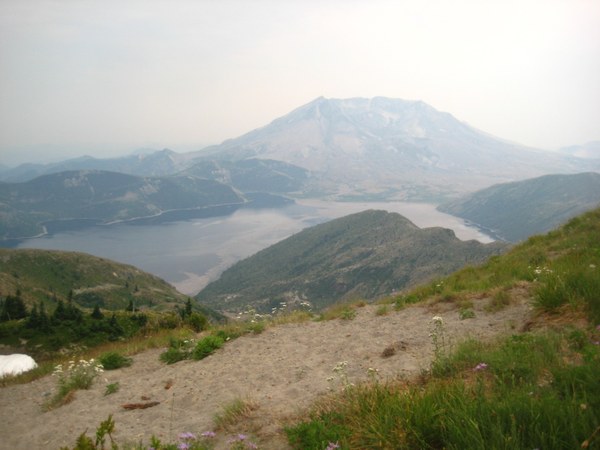 Daisies on sandy ground.
Here the vegetation is low-growing, a green carpet filled with daisies. One narrow path leads off to the Coldwater Peak Trail on the Boundary Trail, and the other rises narrowly uphill. Finally, we have reached the trail for Mount Margaret. We climbed steadily uphill, all the while the wind was blowing hard, sand whiling into our eyes, making them water from the sudden cold and dust.
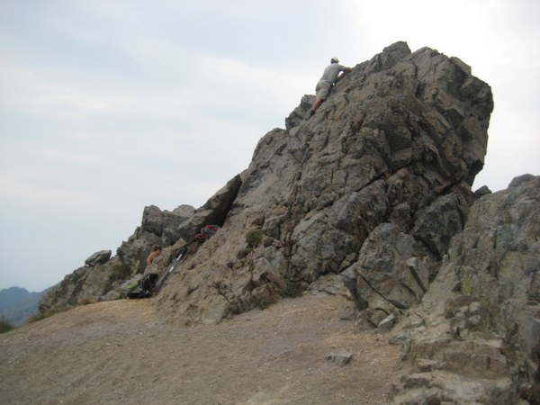 Summiting Mount Margaret’s highEST point.
Once on the landing we quickly out down our gear so that we could climb to the highest point on Mount Margaret. The climb was short, small, and rocky. We achieved the summit, took a quick photo, and then high-tailed it downhill to get out of the fiercely blowing wind.
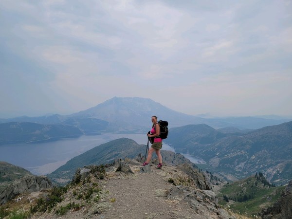 Regina at a view point just below Mount Margaret. Photo by Oscar Churchill.
Visiting Norway Pass and Mount Margaret
Trip info
- Mileage: From the parking lot to Norway Pass is 4.5 miles roundtrip with 860 feet of elevation gain. The hike to Mount Margaret is 12 miles roundtrip with 2,300 feet of elevation gain.
- Difficulty: Moderate/Difficult
- Pass/Entry fee: Northwest Forest Pass or America the Beautiful
Directions
From SR-12 and Randle, Washington: travel south on State Highway 131 (Forest Roads 23 and 25) for 2.8 miles. Veer right in 1 mile at the Y of Forest Road 23 and Forest Road 25. Follow Forest Road 25 for 17.9 miles and turn right onto Forest Road 99 towards Windy Ridge. Follow Forest Road 99 for 9.2 miles and then turn right on Forest Road 26. Follow Forest Road 26 for 1 mile and arrive at the Norway Pass Trail Head on your left.
Rules & Regulations
- Pets, bicycles, stock, and off trail are not permitted.
- Camping is not permitted in the blast zone (the area between Spirit Lake and Mount St. Helens).
- Road closures dependent upon weather. FS road 99 usually closes in early November through mid-May. June through October is the best time to visit.
- Please practice Leave No Trace Principles.
Notes
- Mountain weather changes rapidly. Be sure to carry the 10 Essentials, as well as a hat and sunscreen.
- There is very little shade once you pass Norway Pass and head up towards Mount Margret. The trail is exposed and there is limited water. Carry plenty of water.
- Boot Lake Basin, St. Helens Lake, and all areas south of the Boundary Trail are still under scientific study, and they are off-limits in order to protect and preserve the delicate rejuvenating habitat.
Looking to explore further?
If you have time, drive 6 more miles up to the Windy Ridge Viewpoint. The Windy Ridge area has a viewpoint – climb up a mere 368 widely spaced stairs for a bird’s eye view of Mount Margaret, Independence Pass, Spirit Lake, and the crater. The gravel parking lot south of the main parking, offers an additional 1.8 mile walk on a wide gravel road for a more up close and personal view of the Pumice Plains of Abraham at the base of the crater. On a clear day you can also see Mount Adams.
 Regina Robinson