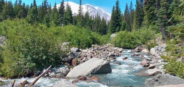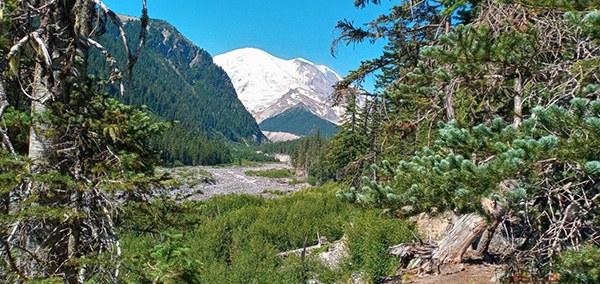
We explored Sunrise the old-fashioned way, by foot! This strenuous loop hike starts at the White River Campground, climbs to the first and second Burroughs back to White River campground, continues to Shadow Lake via the Sunrise Rim Trail, and then takes the Wonderland Trail back down to the White River Campground.
My suggestion for taking hiking this loop is to leave early! We left Olympia at 7am and we were on the trail by 9:30am. The White River campground parking lot fills quickly. From what we observed, this trail is pretty well traveled, even during the middle of the week.
History
Once a mining road along the Inter Fork of the White River, this route was converted into a trail when the area became a national park. Although an effort was made to mine copper ore in this area in the late 1800s, nothing of commercial value was ever extracted and mining efforts were eventually suspended, making for a beautiful and historically-rich trip. To this day you can still see some remnants of mining artifacts along the Glacier Basin trail, an abandoned access road which was constructed to allow better access to the mines that once doted the valley.
Inter fork white river. Photo by Regina Robinson.
The Hike
The trail gradually winds through dense forest, crossing many fast flowing water features. I was amazed to see the many creek crossings, at least four in the first several miles, and the water was still raging at the end of July. We saw frogs, salamanders, chipmunks, and birds.
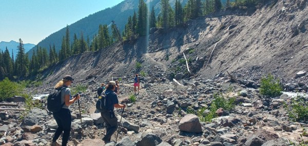 Hikers crossing the Inter Fork White River on the Emmons Morraine Trail. Photo by Regina Robinson.
As you move along the old road, the trail is thickly-lined with vast swathes of gray’s lovage, lupine, penstemon, yarrow, mountain ash, and alpine asters. Keep your eyes peeled for old mining equipment. Core samples taken from the older growth forest indicated that some trees began their lives in the 17th century.
Glacier Basin
From the Emmons Moraine Trail, we hiked on towards Glacier Basin. The climb becomes much steeper and the forest gives way to meadows and better views of the braided river bed. Watching climbers heading up to the mountains’ higher summits, seeing mountain goats, watching chipmunks dart to and fro, flower-filled meadows, cold mountain water, and blue skies. Most of all, the Glacier Basin views are majestic! What more could one ask for?
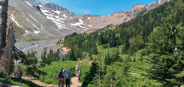 Hikers on the way to Glacier Basin. Photo by Regina Robinson.
We ate lunch and spoke with other hikers coming into the basin. Everyone said pretty much the same thing, “This is my favorite hike.” I can see why! Next time I would like to even spend more time here.
After we finished eating, we left the Glacier Basin and headed down trail to the junction for Sunrise via (2nd) Burroughs Mountain. At the junction we had a group discussion about making our trip into a loop. We discussed food and water supplies, energy levels and did we think we could make it. The answers were yes, yes, and yes!
From Glacier Basin to the Burroughs
Heading uphill from Glacier Basin and the Inter Fork White River Valley to 2nd Burroughs is no joke on a 95 degree summer day.
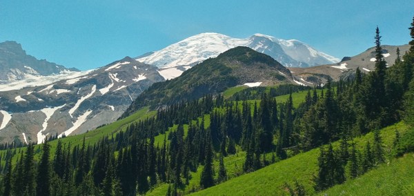 The view from Glacier Basin halfway up to 2nd Burroughs. Photo by Regina Robinson.
Although the climb is beautiful as you make your way upwards through flower filled meadows, brief interludes through shade-filed forests with peek-a-boo views of Goat Island Mountain, it is still a steady uphill climb with many switchbacks. Keep in mind that the trail is exposed to the hot sun in many areas, especially as one climbs out of the timber zone and up into the alpine. Thankfully there were many places to stop along the way to take a breather, eat a snack, and enjoy views of the mountains and the wildflowers in full bloom.
Every time I stopped to rest, I took in the views. Of course the mountain was the main view, but the alpine meadows put on a grand show with bracted louseworts, spirea, alpine aster, beargrass, lupine, arnica, and scarlet paintbrush. Bees and butterflies flitted among the flowers, and I even had a lady bug land on my hand!
Hiking uphill around noon, with the sun beating down directly overhead, we stopped gladly at every little creek to dip our chilly towels in the frigid waters to cool our hot, sweaty bodies down. Many of the water crossings had an abundance of pink lewis monkeyflower overflowing the creeks sides. We saw many bees merrily dancing and weaving between the blooms, buzzing to their hearts’ delight.
The Burroughs is one of my most favorite areas because of its unique environment. Mt. Rainier erupted several times between 2,500 -2,000 years, spewing pumice and rocks the size of small hail on the Burroughs, and you can still see the remnants of pumice strewn along the ridgeline. Today, it’s one of the most accessible tundra ecosystem in the Cascade Mountain range, where delicate plants are able to survive (and thrive) in harsh environments. Next time you’re there, notice how these plants are lower to the ground where they can better resist drying winds, colder temperatures, and shorter growing seasons.
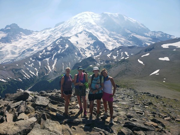 The group on top of 2nd Burroughs. Photo by a very cool random stranger visiting the mountain.
Looking around, the Burroughs is a great vantage point for viewing Skyscraper Mountain, Berkley Park, Mt. Fremont, Frozen Lake, Goat Island Mountain, and the Tatoosh Range.
From the Burroughs to Shadow Lake via Sunrise Rim Trail
Once we gained the Burroughs, the crowds increased. Why. The answer is simple: mountain goats. The much sought after mountain goats were sighted lounging on snow packs that had not yet melted away from the summer’s heat wave. Crowds lined the trails binoculars in hand, tracking their every move.
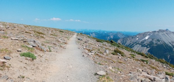 Sunrise Rim Trail. Photo by Regina Robinson.
Traversing the Sunrise Rim Trail can be hazardous if one does not pay attention their footing. However, it was difficult for some of us to keep our eyes on the trail because of the incredible views. With sightings of Goat Island Mountain, the Emmons Glacier, and Mt. Rainier, the views are spectacular. Even the dusty trail fascinates in the way the stones were built up to form a sort of wall. Near the end of the Sunrise Rim trail be sure to stop at the Emmons Glacier Viewpoint, and observe the “snout” of the Emmons Glacier.
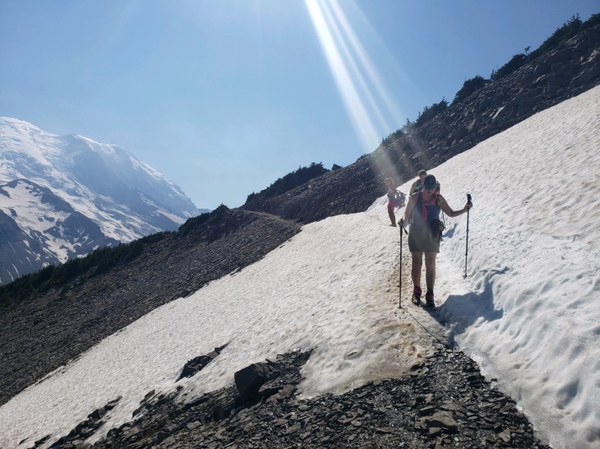 Crossing a snow patch on the Sunrise Rim Trail. Photo by Tracy Speck.
Heading from the Emmons Glacier Viewpoint we hiked down the dusty trail to Sunrise Meadows through subalpine fir and whitebark pine. As we followed the trail it meandered through the second meadow, the pink and white mountain heather slashed bold dashes of color across the landscape. The wide cut trail lined with alpine buttercup, sitka valerian, lupine, cinquefoil, bistort, paintbrush and spreading phlox made for a delightful jaunt as we headed towards Sunrise Meadows and Shadow Lake.
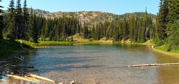 Shadow Lake. Photo by Regina Robinson.
We stopped for a break at Shadow Lake, where we gingerly dipped our tired, hot feet into the cold refreshing water. After lunch part two, and with cold pruny feet, we felt refreshed to take on the last portion of the trail. We knew the car was less than four miles away.
Returning to the White River Campground on the Wonderland Trail
We headed downhill on the Wonderland Trail to the White River Campground. Do you know how the Wonderland Trail got its name? Roger Toll, a Superintendent of Mount Rainier National Park, once described the trail that circumnavigates the mountain as leading “through a veritable wonderland of beauty and grandeur.” The word “wonderland” stuck.
The trail descends in a series of long switchbacks, the landscape changing from lush meadows filled with columbia lilies, false hellebore, broadleaf lupine, groundsel, columbine, and mountain dandelion back to dense forest.
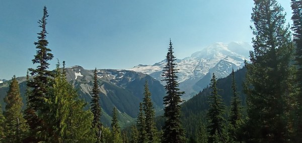 The return. Photo by Regina Robinson.
On this last portion of the loop, I would advise being especially conscious of your footing. It was easy to get into a sloppy rhythm downhill, but when I took my eyes off the path for a moment, I fell. It wasn’t a gentle fall. Rather, it felt like the earth had grabbed my ankles, picked me up, and slammed me down. I lay dazed in the trail for about 5 minutes before I felt like standing up. Luckily I was okay, but that fall made the last mile back to the car pretty yucky.
You know you are close to the campground when you cross the second stream. The smell of campfires made us instantly have growling tummies.
Trip Info
- Hours of operation: Late June/early July to September/early October. Closed in winter.
- Mileage and Elevation Gain: Most trail tips state that the loop trail is approximately 11 miles with 3000 feet of elevation gain, but we clocked a little over 16 miles in 5.5 hours, with an elevation gain of 4500 feet.
- Pass/Entry Fee: National Parks Pass or America the Beautiful
- Dogs: Dogs are not allowed, services dogs allowed.
Notes
- The trail to Glacier Basin/Emmons Glacier View begins at the upper end of the D Loop of the White River Campground. Be sure to park in the hiker/climber parking area.
- Sunrise closes seasonally, so be sure to check the Sunrise Road status and trail conditions at Mt. Rainier before your trip.
- Bring the 10 Essentials, a camera, and hiking poles.
Directions
Head east on 410 for 43 miles to the White River entrance to Mount Rainier National Park (Sunrise side). Turn right onto the Sunrise Road and follow it for five miles, cross the White River then turn left onto the White River Road. Follow the road to its end at the White River Campground. Trail begins at upper end of D loop in the campground.
 Regina Robinson
