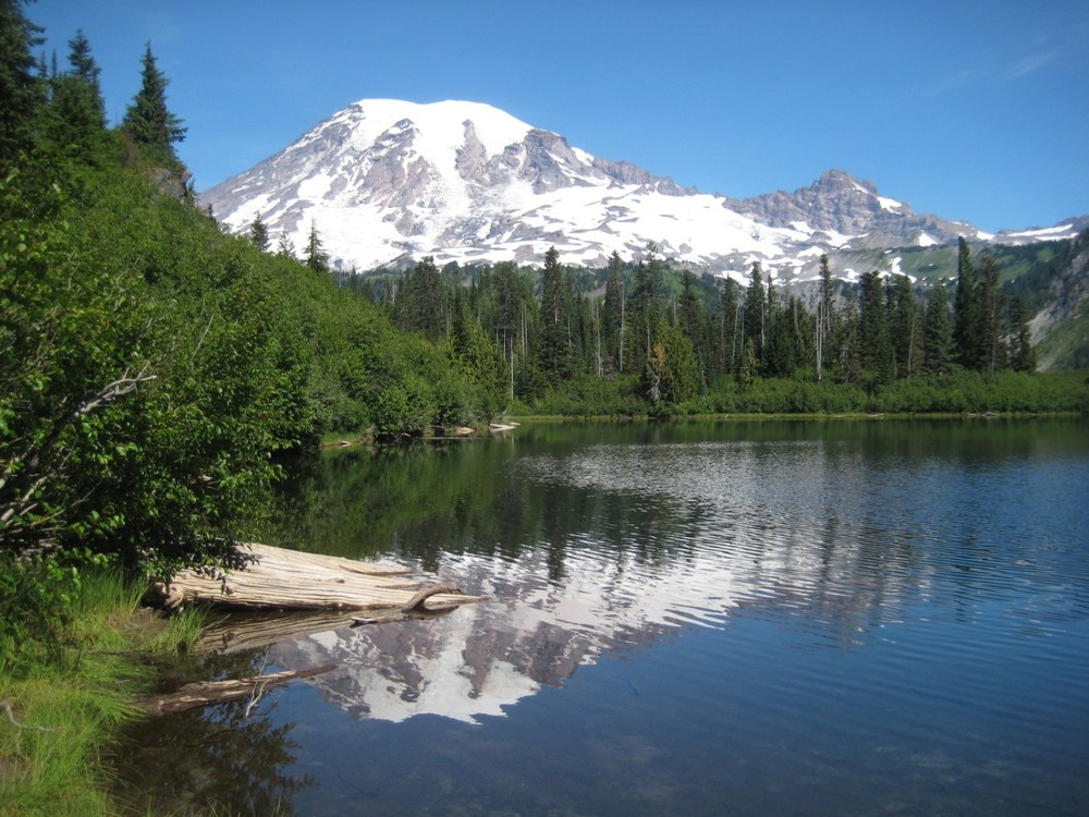
There is so much to see an explore in Mount Rainier National Park that sometimes it's temping to trail hop. That's exactly what we decided to do one hot summer day, and I'm happy to share with you a detailed report of our adventures so that you can plan your own trip to this gorgeous part of the park.
Bench and Snow Lakes
Although the Bench and Snow Lakes trails are essentially a 1.1 mile out and back hike, this trail packs a hearty punch. Bench Lake is accessed via the Snow Lake Trail, and it starts off briskly heading uphill.
Gaining elevation quickly, the trail is lined with ocean spray, mountain spirea, and sitka valerian. The trail has several log foot bridges which are fun and a tad awkward when you are trying to look at all the flowers blooming and while also trying to maintain balance. Beware that the trail can be steep and uneven in many places; definitely be mindful while soaking up all the beauty around you.
Take your time strolling through the meadow, as it’s filled with prolific wildflowers like bear grass, arrow-leafed groundsel, lupine, and fleabane. Glimpse southwestward across the meadow for views of peaks in the Tatoosh range. Ponder the silver forest of dead trees cutting a swath across the meadow. These silver snags are the remains of trees from a wildfire.
Towards the end of the meadow look down to see a shallow tarn below to the left - this is the northern terminus of Bench Lake. From here the trail climbs to a large outcropping with magnificent views of Mount Rainier.
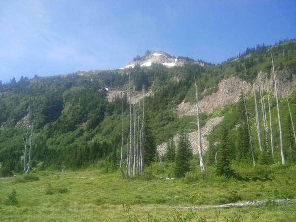 Dead trees in the meadow from a long-ago fire. Photo by Regina Robinson.
Shortly after the large rock outcropping, the trail splits at the 0.75 mile mark. The left trail heads downward towards Bench Lake, and the right takes you to Snow Lake.
For our first exploration we chose to head down to Bench Lake. The trail is thickly brushed, with a sandy, unmaintained trail. Watch your foot placement, some steps drop down further than expected. The trail quickly forks again, unsigned, in each direction. We chose to head left. Do not head left!
The left-hand trail is covered in feces and toilet paper debris, and there was no lake access. We returned to the fork and chose the trail to the right. This trail is thickly covered in dense brush. It heads down steeply; the steep drops are uneven “steps”, dropping more than 2 feet downward. Once again, be careful of your foot placement. At the bottom of the trail you go right, duck under the low hanging, densely-packed alders, and pop out onto the unexpected sandy shoreline of Bench Lake.
Bench Lake rivals any views of Mount Rainer from Reflection Lake. With temperatures in the high 80’s, the breeze rippling across the lake was welcome. My hiking partner and I were both tempted to go for a short swim, but we decided against disturbing the amphibians found along the shores of the lake. The identified threats and decline in amphibian populations at Mount Rainier encouraged the park to develop and establish long term monitoring programs of sensitive habitats around aquatic areas. Amphibian declines are having profound effects on forest ecosystems.
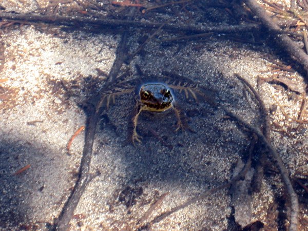 This Cascade Frog and his friends were on the shoreline at Bench Lake. Photo by Regina Robinson.
What I enjoyed most, besides the view, frogs, and the lake, is the bounty of white rhododendron (Rhododendron albiflorum) found along the lake. They are one of my absolute favorite wildflower tree-like shrubs. They typically reach heights of five feet or more and to see them towering over the trail was just splendid.
Returning to the main trail we continued our adventure to Snow Lake. The trail continues through the meadow, crossing a short wooden bridge. From here the trail climbs steadily up and then down, as it crosses a series of low ridges. Cross another wooden bridge through a wetlands meadow area and start the climb uphill again.
At just under 0.5 miles you'll reach the junction up to Snow Lake. This time we headed left, which started another steep climb uphill. At the top of the hill the trail split again. Left headed up a short rise before heading towards the pit toilets, two backcountry campsites, and the northeast side of the lake.
We decided to explore the right trail junction first. The right-hand trail quickly split again. The left trail dips down to the east towards the lake and offers two access points for viewing Snow Lake.
We choose to head right towards the cirque and scree fields, and as you get closer the west end of the lake, the trail becomes wide and sandy, opening up to a huge wetland area that someday will become a full fledged meadow. The area is breathtaking.
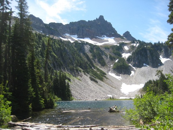 Snow Lake and Unicorn Peak. Photo by Regina Robinson.
Here the trail heads in a westerly direction taking you through a meadow filled with red mountain heather, sitka valerian, and purple rock penstemon. Looking left of the trail the beautiful blue of Snow Lake sparkles in the sunlight. Stop to take photos and contemplate the majestic beauty before coming to the end of the maintained trail. Duck through a short dense stand of firs, spruce, and pine to clear babbling Unicorn Creek. Here is a great place to take a breather, filter water, and eat a snack before heading up the climbers boot path towards the southwestern edge of Snow Lake.
Just southwest of the lake lies a slightly discernible climber’s boot path along the cirque wall that leads uphill along the scree field. This accesses trails for experienced climbers with expertise in class IV and V scrambles along the Tatoosh Ridgeline. Only experienced climbers should attempt climbing and scrambling in this area. Unicorn creek flows below the loose scree, and the water is indiscernible; it is only heard crashing below the unstable rocks. Caution is advised in this area. We explored up the scree for another hour or so before stopping to admire the views and to listen to the water crash and turn under the scree field.
After our scree field adventure we chose to head over to the backcountry campsites to check them out for future adventures. The sites were well maintained and quiet. My hiking partner and I chose a spot close to Snow Lake to eat lunch. I waded in the lake to cool my feet, the bottom a combination of sand and smooth rocks.
Gain: 700 ft
High Point: 4725 ft
Length: 2.5 miles roundtrip, although my hiking partner and I managed just shy of 5.5 miles with additional exploration.
Pass/Entry Fee: National Park Pass
Bring: Bug spray, camera, sun hat, sunscreen, water filter. If you are choosing to adventure on to the scree field sturdy leather boots and trekking poles are recommended.
Notes:
- With all the lakes, streams, wetland areas, please remember to use the bathroom at least 250 t away from water sources, and pack out all feces, toilet paper, diapers, etc.
- Bikes, horses, dogs, are not allowed on trails within Mount Rainier National Park.
- Park Lands & Roads Accessible - Facilities Remain Temporary Closed: Following guidance from the CDC and state, local, and NPS public health officers, park visitor centers & Paradise Inn remain closed. All park roads are open, along with associated trailheads and restrooms.
- The Stevens Canyon Road is highly susceptible to seasonable flooding and road closures are common.
- Always check the current trail conditions before heading out, trails and bridges are susceptible to winter and storm damage causing trails and bridges to wash out.
- Summer months bring a lot of visitors to Mount Rainier; parking may be limited.
- Weather changes rapidly on the mountain, check weather conditions and carry the 10 Essentials, even on “short” day hikes.
- The day we hiked the trail, there were cars lined all the way up the road to the viewpoint of Lake Louise. Be prepared for limited parking during high traffic times within the national park.
Directions: from the west, head 13.5 miles east of Elbe on State Route 706 to enter the west entrance, Nisqually Entrance, to Mount Rainier National Park. Drive 15.3 miles on the Longmire- Paradise Road to the junction to Stevens Canyon Road. Go right on the Stevens Canyon Road, it is signed “Ohanapecosh, Sunrise, Yakima.” Drive 2.7 miles, passing Reflection Lakes and Louise Lake on the left, to a sign reading “Snow Lake.” Parking for Snow Lake is on the right side of the road, with space for approximately 20 vehicles.
Box Canyon Overlook
After our adventure at Bench and Snow Lakes we were not quite ready to go home, so we headed down the valley to the Canyon Overlook Trail, a short trail into the box canyon scoured by long ago glacial activity. Box Canyon has an exhibit that describes the geological history of the area, where the Muddy Fork of Cowlitz River churns its glacial silt laden waters through fault-weakened bedrock.
From Snow Lake head east on the Stevens Canyon Road, approximately 5 miles to the Box Canyon Overlook Trail. The road wait time is worth it just to see the views of Mount Rainier from the Box Canyon vista, while admiring the glacier smoothed grooved rock along the Box Canyon Overlook Trail.
The Stevens Canyon Road joins the Paradise and Ohanapecosh sides of Mount Rainier during the summer months. The Stevens Canyon Road is often subject to flooding, winter damage, and closures. I suggest calling ahead to ensure that all roads are cleared and open for your drive and hikes. This year, the Stevens Canyon Road has had delays of up to 30 minutes due to repair work on a portion of the road that suffered major winter damage.
The Stevens Canyon Road offers peek-a-boo glimpses of Mount Rainier before it traverses the side of Stevens Ridge. What I find fascinating is that you can actually see the powerfully deep avalanche scars scoured into the hillside that come shooting down Stevens Ridge on the north side of the road. You will also see broad sweeping views of the Tatoosh Mountain Range to the south, Little Tahoma on the north side of the road, and below nearest the box canyon is the Muddy Fork Cowlitz River.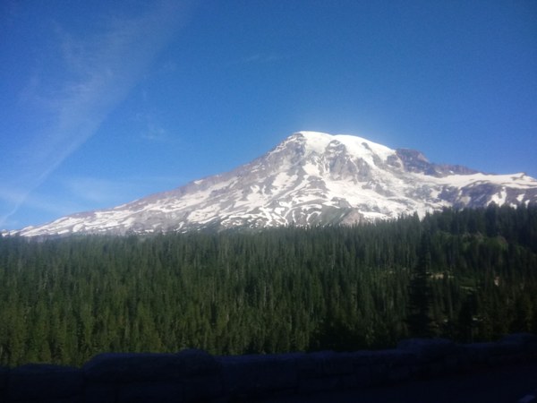 Mount Rainier as seen from Stevens Canyon Road. Photo by Regina Robinson.
Access the Box Canyon Loop trail from the Box Canyon Overlook area. Crossing Stevens Canyon Road, the trail loops northward along the Muddy Fork of Cowlitz River. The trail and muddy river sit far below the Cowlitz Divide. The trail is a brief paved pathway that is only a 0.5 miles long, and offers views of Mount Rainier, glacier striated rock, and the distinctive glaciar-fed muddy water.
From the trail peer over the side of a stone bridge, the churning water 115ft to the deep slot canyon below.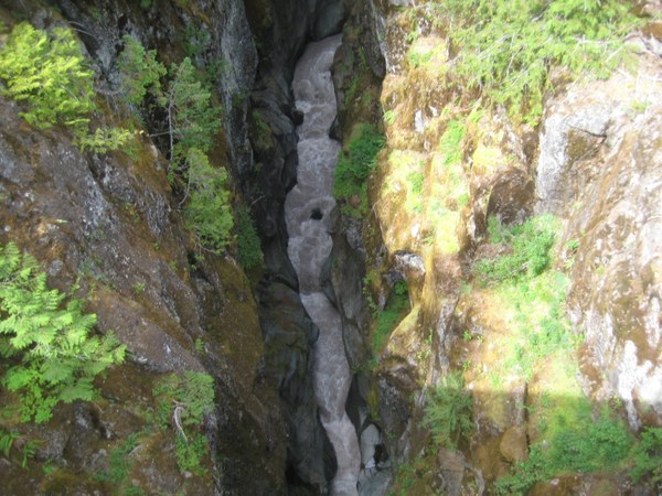 Water working its magic as it cuts deep through rock. Photo by Regina Robinson.
Cross the stone bridge and the paved trail gives way to a groomed dirt pathway. Stop to take in the deep dense forest lining the path. Here I spied a scant bunch of almost ripe huckleberry. I was happy to leave them for the birds and the bears to enjoy.
About 30 feet up the dirt pathway the trail splits. Left heads back to the road and overlook viewpoint, and right goes uphill to join the Wonderland trail, coming out over Stevens Box Canyon Road at the picnic area just northwest of the overlook parking area.
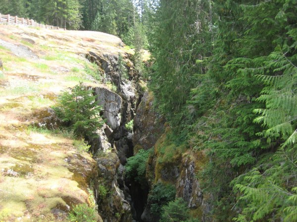 Shallow views of the deep canyon. Photo by Regina Robinson.
Directions: From the Snow Lake trail head, the Box Canyon Overlook Trail is approximately 5 miles down the Stevens Box Canyon road to Box Canyon.
From Ohanapecosh: Located on Stevens Canyon Road 12 miles west of Ohanapecosh.
 Regina Robinson