As Mountaineers, we are committed to learning from our experiences. We examine every incident that happens on a Mountaineers trip for opportunities to improve the ways we explore and teach. Our volunteer safety committee reviews every incident report and picks a few each month to share as examples of ‘Lessons Learned’. The trip report below describes what happened on this trip, in the leader’s own words, and outlines the lessons the leader has identified. In some cases, we offer additional key learnings from the incident.
Sharing incidents creates an opportunity to analyze specific incidents and also identify larger incident trends. We appreciate every volunteer trip leader who takes the time to share their incidents and near-misses so that others can benefit. We ask that readers engage critically and respectfully in the spirit of sharing and learning.
Ptarmigan Ridge Trail, Mount Baker area – 14 September
FROM THE INCIDENT DATABASE: LEADER INCIDENT REPORT
LEADER
As we were returning from a scramble of The Portals/Coleman Pinnacle, we provided assistance to a hiking party of three in their early 20s, who were lost on the Ptarmigan Ridge Trail.
They were attempting to do the Chain Lakes loop trail, starting and ending at Bagley Lakes trailhead, going counterclockwise (about 7 miles). When they reached the T-junction with the Ptarmigan Ridge Trail, they had turned right on the Ptarmigan Ridge Trail instead of turning left to stay on the Chain Lakes Trail.
There was a signpost at this T-junction, but it was poor - it only marked two of the three trail segments. The segment of the Chain Lakes Loop Trail to Artist Point was unmarked, as if it was not a maintained trail.
When we encountered them, they were a full three miles south of the T-junction and still headed in the wrong direction. They asked for directions, and we said, "Just follow us, we're headed back to Artist Point, which is the route you want".
They did not have a map or appear to have a mapping app on a phone. They did not know where they had started, other than it was at a "stone bridge", so I recognized that as Bagley Creek. (I must admit, I don't know the name of that trailhead either, other than its part of the Chain Lakes Loop. I would call it the "Bagley Lakes" trailhead.)
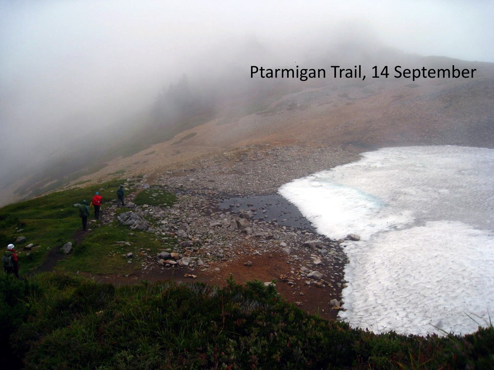
It was potentially serious hypothermia conditions. It rained heavily for 45 minutes, the wind was gusting up to 40 mph, and the temp was about 50F. There was also heavy fog, which could have further contributed to difficulty in finding their way back to their car. Fortunately, they had good rain gear, but they only had one small backpack between the three of them, so could not have had much extra clothing. The photo of our party, above, shows the conditions.
They followed us to Artist Point and proceeded to head towards their correct endpoint near Bagley Lakes in heavy, horizontal rain; still seemed in good condition and spirits. Their unplanned detour added six miles onto their planned 7-mile hike (almost doubled their mileage). Fortunately, they were in good conditioning - they were able to keep up with us for the full three mile exit.
Glad they asked for help.
Lessons Learned
LEADER
- Carry a map
- Know where you're going
- Pay attention to signage
- Carry extra clothing
- Each member of the party should carry the Ten Essentials
Add a comment
Log in to add comments.We have a badge for stewardship. Let's consider a badge for assists by Mountaineers to those encountered in the wild. Thanks for the guidance and support to innocents.
 David Shema