For three Novembers in a row my husband and I have traveled to Asia, hoping to avoid the worst of the Seattle weather and a certain amount of election news hysteria, always with the goal of exploring by hiking rather than just hitting the classic tourist spots. We travel on our own, no tour group, just three nights booked ahead in a hotel and figure it out from there. We spent four weeks in Taiwan in 2016; three weeks in Hong Kong (no, it’s not just skyscrapers) in 2017; and this year three weeks in northern Thailand, starting in Chiang Mai.
Finding hiking trails was considerably more difficult in Thailand than on our previous trips, in several senses: identifying places to hike, finding the trailheads, getting to the trailheads, and following the trails once we got there. I don’t think Thailand has the hiking culture that exists in Taiwan and Hong Kong (or Korea, from what I’ve heard), which means there are far fewer trails and some seemed abandoned. The abundant national parks often had only a couple of short trails.
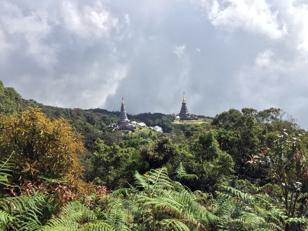
 Temples in the distance in Doi Inthanon National Park. Photo by Lynn Graf.
We couldn’t find any good area maps. I would add that a comparison of the Lonely Planet and Rough Guide to Thailand had us leave the Lonely Planet at home. In our experience, the Rough Guides are much more useful for info on outdoor activities and less traveled areas.
Navigating, both on trails and in towns, was very different. We had gotten spoiled by the accurate USGS topo maps available on Gaia on our smart phones, which made it easy to work with a combination of GoogleMaps and Gaia in our earlier travels. That didn’t work well in Thailand because the few old trip reports we could find often described trails which no longer existed or had been blocked off by new development; and the Gaia maps were not very accurate and lacked contour lines.
 Rhododendrons along the trail near Doi Inthanon. Photo by Lynn Graf.
What proved most valuable in the end was the AllTrails app, something I had never used before. I did need to ante up for a year’s subscription for the Pro version, to be able to download maps for offline use, but it was well worth it. Not many officially named and GPS-recorded trails were on it but maps were very accurate, easily zoomed to see contour lines, great for just walking around towns and biking as well as hiking. We still had to juggle back and forth between AllTrails and GoogleMaps because only the latter also had location names in Thai script, necessary for communication with bus and taxi drivers and local people. Printed maps were basically nonexistent.
Was it worth it? Of course! Except for that one trail with the abundant leech population.
 Lynn Graf
 Photo by Lynn Graf.