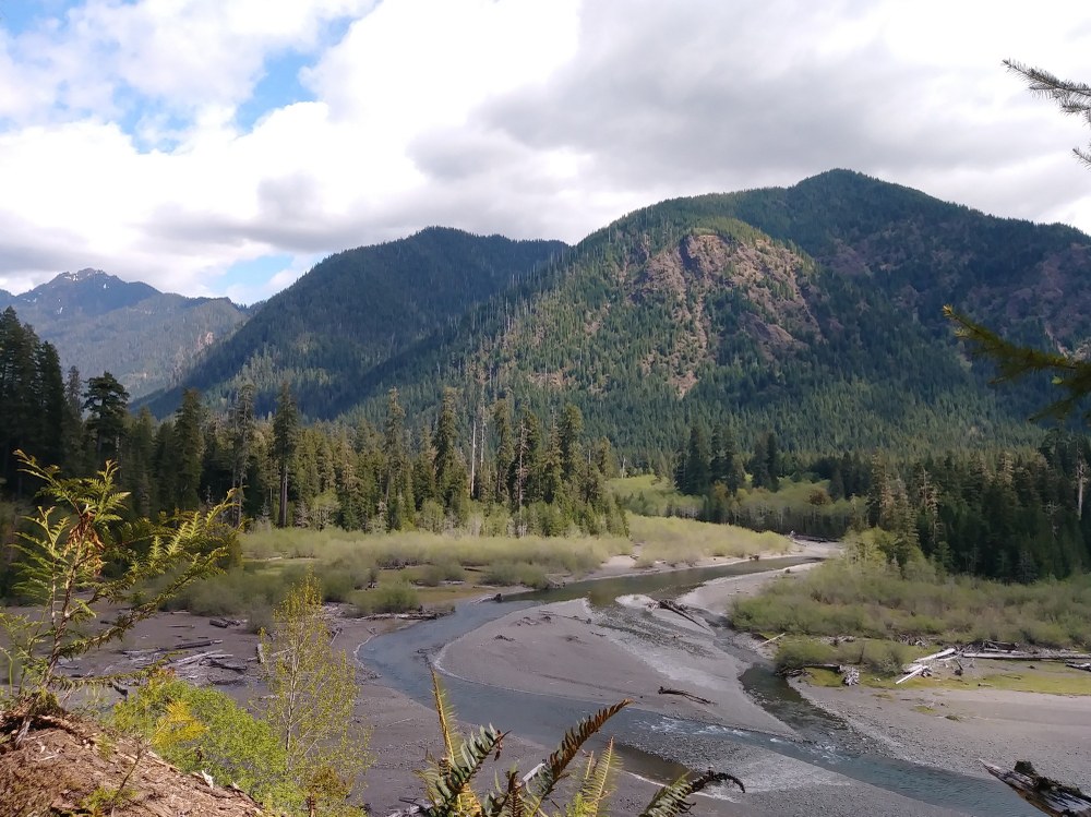
Wynooche Lake is a remote, hidden gem in the southern Olympic Peninsula. Framed by steep, rugged peaks, the lush conifer and hardwood forested shores of Wynoochee Lake provide many opportunities for recreation. With just over 13 miles of shoreline, two campgrounds, boat access, Roosevelt Elk, a river, and many waterfalls, Wyoonchee Lake will be your next weekend getaway.
The first weekend in May found the Olympia Mountaineers at Wyoonchee Lake, working in conjunction with WTA to maintain the well-loved Wynoochee Lakeshore Trail. While we practiced our cross cut skills, logged out several large trees that had come down over the trail, brushed, and raked, I dreamed of hiking this welcoming trail.
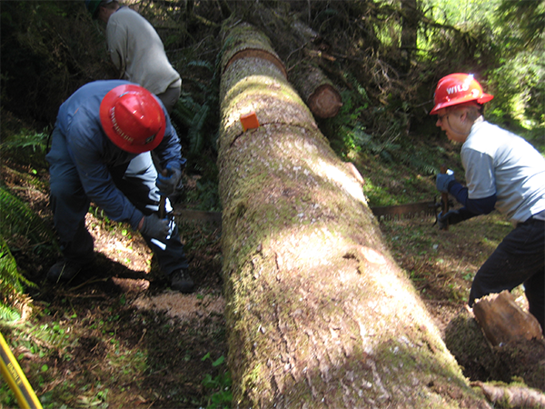 Photo by Regina Robinson.
I once mountain biked this trail with several buddies when it was in bad shape. It wasn’t so much a ride as a long haul, with us carrying our bikes for roughly 16 miles. My friends and I laughingly forged the river with our bikes balanced precariously over our heads, wondering what happened to the trail when we crossed the other side. We had started our "bike ride" around the lake counterclockwise. Once we forded the river the trail was nowhere to be seen. At this point we'd put our bikes down and scouted the area. We eventually found the trail, but had to climb up a short 30-foot cliff to get to it. Wowser. That was the last time we biked that trail.
I hiked on the west side of the lake twice, a year ago. The first time was after working with the Oly Mountaineers and WTA on trail maintenance, and the second was with my best friend to show her all the work we had completed and the projects slated for next time. This trail is well-used and much loved, especially during summer weekends when hordes of folks flock to the lake for summer respite in the fresh mountain air.
This trail is magic, and I dream about getting back out there to do the loop. With many small streams and waterfalls nestled amid dense, lush forests and giant sword ferns, the trail has an almost Jurassic Park-like feel to it. You can really feel the prehistoric vibe as you hike among old-growth and second growth trees, and it isn’t difficult to see why this trail is so special. Although the trail is mostly shaded with dappled sunlight peeking through, every once in a while it opens up to give you shy glances of the lake. It is not very steep, but it does continue up and down, making it a lovely, much-needed jaunt in the woods. The further you travel from the campground and boat launch the trail the quieter it becomes, as many folks do not travel the full loop.
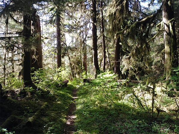 PHOTO BY REGINA ROBINSON.
The trail is 6 miles along the lakeshore, extending another 2 miles upriver to the bridge, then returning to the Coho campground in 8 miles on the opposite side of the lake. If you want a longer hike, the trail continues along the east side, making the loop around the Wynoochee River for a total of about 16 miles. However, your ability to do the loop depends upon whether or not you can safely ford the river. If you wish to spend your day on the lake instead of hiking, there are two boat launches, one on each side.
Once you get down near the dam you have panoramic views of the lake and a pretty neat view of the dam. Completed in 1972, the Wynoochee Dam is owned by the city of Aberdeen and is located in the foothills of the Olympic Mountains in Grays Harbor County. It was built by the U.S. Army Corps of Engineers to provide flood control, irrigation and industrial water storage for Aberdeen. The dam formed Wynoochee Lake. At the dam you will find restrooms with toilets and hot running water. Quite a few placards tell the story of Tacoma Public Power, and free group tours are offered of Tacoma Power's hydroelectric facilities by appointment.
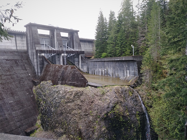 PHOTO BY REGINA ROBINSON.
Wynoochee Lake
- Length 12-16 miles roundtrip
- Elevation Gain: 1100 ft
- Highest Point: 950 ft
Know Before You Go
- No parking pass/entry fees required
- Prohibited: motorized vehicles and stock
- Leashed dogs & mountain bikes allowed
- Activities: day hiking, camping, mountain biking, bird watching, wildlife observation, fishing, boating, and swimming
- There are no commercial services available at Wynoochee Lake or Coho Campground. Motorists should have sufficient fuel for the return trip.
- Download the Wynoochee Lakeshore Trail Map
- Camp at Coho Campground
- Camp at Satsop Center Campground
- Explore points of interest at the Wynoochee Lakeshore Trail
- See the Olympic National Forest Recreation Opportunity Guide
Camp Grisdale
On the way to Wynoochee Lake be sure to check out the old Simpson Logging Company's Camp Grisdale. Camp Grisdale was a logging camp from 1946 to 1986, making it one of the oldest logging camps in the PNW. The camp was named instead of numbered, as was the usual protocol for logging camps at the time, for two brothers, J. William and George M. Grisdale, who were nephews of the Simpson logging founder Sol G. Simpson.
This “new” style of logging camp was home to 300 hundred single men and 52 families, designed for working men who had families. The logging families at Camp Grisdale lived a life of luxury compared to most logging camps, with houses instead of bunk-style dorms and a camp cook who whipped up delicious, hearty meals. The residents also had a recreation hall, school, and church services.
Folks who lived in the logging camp were living in one of the rainiest portions of the state, with the Olympics often receiving upwards of 160 inches of rain a year. As a result the logging company provided several forms of entertainment to keep the many men, women, and children from getting bored. They offered a bowling alley, movie theater, pool hall, card tables, sporting events, concerts, and dances held at the auditorium.
When the camp closed in 1986 it was one of the longest-running logging camps in the United States. Grisdale residents continue to stay in contact with one another through a Facebook page and annual reunions. I think that is pretty nifty considering that it was a company town. The residents forged a lifelong friendship that continues to this day.
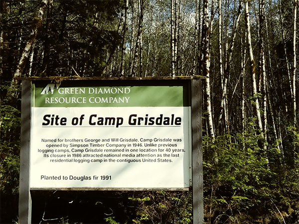 Photo by Regina Robinson.
Nearby Hikes
Maiden Hair Falls
Meander through a stand of impressive old growth trees along the northern section of Wynoochee Lakeshore Trail to Maidenhair Falls. This trail is just about a mile long.
Directions:
From Olympia, travel north on Highway 101 towards Shelton for about 19 miles. Take the exit towards Matlock and travel approximately 15 miles on Dayton-Matlock Road. From Matlock, continue straight at the junction onto the Matlock-Deckerville Road, which turns into the Boundary Road. Drive 8.8 miles, make a right turn onto Cougar-Smith Road and drive about 5.5 miles to Forest Service Road #22.
Turn right on Forest Service Road #22 and drive 15 miles on Forest Service Road #22 to a major intersection and take Forest Service Road #2270 on the east side of Wynoochee Lake towards Wynoochee Falls.
Wynoochee Falls
Wynoochee Falls will entice you to spend more time than you’d expect on a one-mile round-trip hike. The falls are pretty, and the pool at the bottom is nice for wading. There is a gravel bar that is perfect for picnics, and there are some good rock scrambling options.
Directions: take the Devonshire Road exit off of Hwy 12 just west of Montesano. Cross Devonshire Road, then cross Pioneer Ave and continue on Wynoochee Valley Road/FR 22, following signs to Wynoochee Lake. If you have an older Gazetteer Atlas or are using Bing, the road is labelled Wynoochee Rd. Drive past the turnoff for Coho campground (approximate 35 miles) on the left and stay straight on a forest road along the east side of Wynoochee Lake. Most sources call this FR-2270, but Google calls this FR-2312. Reset your trip odometer at this turnoff. Just about 8 miles past the turnoff for Coho campground, find a small parking area on the left. There was once a big sign here, but all that remains is the base. This trail is also just about 1 mile long.
 Regina Robinson