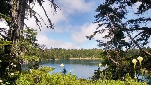
If you’re eager to find a place to take in the beauty of the natural world, the Summit Lake trail ought to be on your list. Bringing you to a crisp alpine lake with spectacular views of Mt. Rainier, this trail is a treat for hikers and naturalists in any weather.
Gain: 1,300 ft, 2,000 ft if including Bearhead Mountain
High Point: 5,800 ft
Length: 6.1 miles roundtrip, 9 if you include Bearhead Mountain
Pass/Entry Fee: Northwest Forest Pass
Note: If staying overnight no campfires are allowed at Summit Lake within a quarter mile, leashed dogs are okay, and as always practice LNT principles.
Bring: 10 Essentials, swimming gear, plenty of food and water, bug spray, and sunscreen.
Directions
From SR 165 turn left onto Carbon River Road. Just before the entrance of Mt. Rainier National Park, turn left on Forest Road 7810 (also called the Cayada Creek Road). Cross the bridge over Carbon River and follow the main road approximately 6.8 miles. The road parallels the river to its end at 4,400 ft. If you reach the Carbon River Entrance to Mt. Rainier National Park, you have gone too far.
The Hike
I absolutely dig this hike, although the drive is less than desirable. Driving up to Summit Lake is pretty bad – it consists of six miles of an uphill, single lane, very narrow logging road, with steep drop-offs and few turnouts. Caution is advised as someone was shooting over the road while we were driving up it. The park rangers were already at the Summit Lake parking lot, as several other folks had called in to warn of shooting over the trail. As with any hike, you should determine your comfort level before proceeding. I was going to call it quits until the rangers assured us that they had it under control.
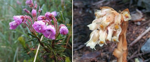 Mountain heather and pinesap. Photos by Regina Robinson.
We hiked and climbed through a dense understory of Oregon grape, salal, beargrass, and devils club. My favorite flowers are all found along this trail, including mountain bog gentian, phlox, asters, paintbrush, lupine, beargrass, western anemonies, and mountain heather. Broomrapes, indian pipes, pinesap, and berries make this trail awesome.
The trail winds through a fairly young second growth forest with a dense, lush underbrush with ferns, mosses, and mushrooms covering the forest floor. At just under a mile you will reach Twin Lakes and the trail will split. Going right will bring you to Bearhead Mountain in 3.5 miles, and going left you will arrive at Summit Lake in 2.5 miles. Both are easy to do in one day, so we decided to visit Bearhead Mountain first then go to Summit Lake. The goal of our trip was to visit Summit Lake and see the Celery Meadows.
Walking through the old growth forest is a real treat. It has Alaska cedar, western hemlock, Douglas fir, and western red cedar, making this area prime habitat for elk, cougar, mountain goats, deer, bear, squirrels, raccoons, and even marmots and pikas. I found a lovely big piece of mountain goat hair on the Rooster Comb. Birds, squirrels, and chipmunks keep up a constant chatter during the summer.
“Wilderness is not a luxury but a necessity of the human spirit, and as vital to our lives as water and good bread. A civilization which destroys what little remains of the wild, the spare, the original, is cutting itself off from its origins and betraying the principle of civilization itself.” –Edward Abbey
At the split, the trail begins to climb gently towards the lake, and upon reaching the crest of the ridge you pop into an open meadow where the trail continues gently downhill towards the lake, passing several small tarns on the way. Once the lake comes into view, you can either continue heading north or split left and head west around Summit Lake. We chose to head left, skirting the lake and looking for a side trail to take us down to it. We found a short steep downhill trail closer to the western-most edge, the trail leading to a wide sandy spot. Here we ate lunch, soaked up the sun, and dipped our toes into the icy cold lake.
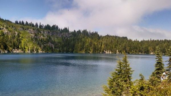 Our lunch view. Photo by Regina Robinson.
After eating a hearty lunch at Summit Lake, we decided to continue our hike down to Rooster Comb to camp at Celery Meadows. After packing up, we continued around the north side of the turquoise lake, climbing steeply uphill and enjoying beautiful views of it.
From the west end of the lake we quickly circumnavigated it, dropping down towards the camp grounds on the east side of Summit Lake. Here we split and headed north on a nondescript trail that went downhill between two tall dense bushes.
Heading over Rooster Comb is no joke; this is a climber’s trail, not for the faint of heart, the unprepared, or unskilled in scrambling. This rock scramble is steep, has a lot of exposure, and should not be done on a whim.
Heading downhill, the trail seemed quite easy until it dropped nearly 15 ft at an angle that appeared to be almost straight down. I had to turn around and back down the steep incline, trying not to topple over backwards as my overnight pack jutted out like a turtle shell. Regaining my balance, I marveled at how steep the trail became.
 ON THE TRAIL. PHOTO BY REGINA ROBINSON.
At one point we came across what appeared to be a stacked wall, long abandoned and in disrepair. We continued slowly upward, coming to a sort of headwall that needed to be climbed with our heavy packs on. At this point I was terrified, because at the top we would meet a steep side traverse before popping out between two trees, standing on the backside of a several hundred-foot drop. As I clung from tree to tree for support, willing myself to move forward, I reached the next short climb. My climbing partner went first, spotting me and making sure I wasn’t heading too close to the steep drop-off. I had made it to the top, finally!
If I thought the uphill was scary, the downhill was downright abominable. We found old wire strung around a tree, presumably to be used for support as you moved down the steep hillside. Upon testing it the wire was easily pulled and became looser, and we were glad we didn’t rely on it for protection.
It took another hour of travel before we finally came the a rock wall. We climbed up and came out onto a level rock ledge with astounding views of Mt. Rainier. I was in shock from the climb and the views. I wanted to stay longer, but daylight was quickly retreating and we needed to get down and set up our tents. We still had to travel around the backside of this hill, over a snow field, then head into a deep forest with few meadows.
As we descended we came across an open meadow filled with Hellebore flowers and small mounds of dirt and holes, which made twisting an ankle very easy. We contemplated pitching our tents here, but I insisted we head downhill. I’m so glad we did! It took us an hour and a half to finally walk into Celery Meadows on the Clearwater trail.
What an amazing area. It was damp and full of water, flowers, and mude. As I watched the setting sun, we continued through the meadow and up into the forest. Here we found the most amazing campsite ringed in beargrass and nestled in the woods right above the meadow. It was obviously a favorite of someone, because there was a three-legged tripod over a fire pit and space enough for 2 tents, with the sounds of a burbling stream nearby. Thankfully we carried bug spray and nets for our faces, as the bugs were absolutely delighted that we were staying overnight.
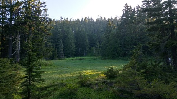 Celery Meadows. Photo by Regina Robinson.
We set up camp and ate a hearty taco dinner. Getting up early the next morning, we ate breakfast on the go as the bugs had not let up. We took the Clearwater trail until we couldn’t go any further, ending up in a swampy patch of devils club where we quickly turned around.
On our way back to camp, a portion of the trail I was ascending collapsed. The soft dirt and roots caused me to come down chest-first onto a log with the full weight of my pack, cracking three ribs on my left side. I could not breathe, the pain was excruciating. My hiking partner evaluated my injuries. The best advice that was given was, “We cannot stay here, there is no rescue going to happen today, so we have to keep moving.” I didn’t cry, instead concentrating on breathing and praying my way back to camp. We made it back a little after 7pm. We ate a quick dinner, cleaned up what wounds we could, and I took some over the counter pain relievers and went to bed. Staying that night was the right choice, as climbing over Rooster Comb in the dark (and injured) was quite unappealing.
 Regina Robinson
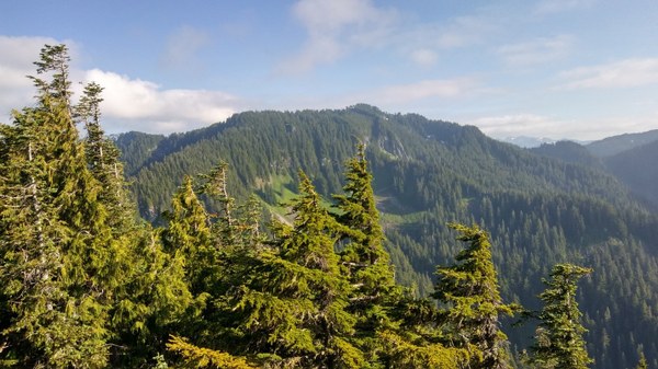 Rooster Comb. Photo by Regina Robinson.