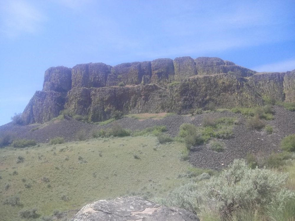
Steamboat rock is composed of Miocene Columbia River basalts, and sits 800ft above the desert floor. This monolithic basaltic rock overlies a much older intrusive igneous rock, and it sits in the channeled scablands in Eastern Washington, known as the Grand Coulee. Hiking the trail towards this magnificent rock you are walking on a soft, deep, sandy trail reminiscent of the beach. Steamboat Rock sits on a sand dune, a remnant from the past massive floods.
History
The Cordilleran ice sheet covered southwestern Canada as well as the northern areas of Washington, Idaho, and Montana over different periods roughly 2.6 million years ago. At over 1,150 meters thick, it had three main lobes: the first lobe, called the Puget Lobe, scoured out the Puget Sound; the central lobe, called the Okanogan lobe, blocked the Columbia River near the current location of the Grand Coulee dam, and this blockage formed the Glacial Lake Columbia; The third lobe, called the Purcell Trench Lobe, dammed the Clark Fork River several times, forming the Glacial Lake Missoula, 2,000 feet deep and containing more than 500 cubic miles of water, that stretched more than 200 miles. The floods began when last bit of ice blocking the Clark Fork River failed.
When the ice dam breached it sent the Glacial Lake Missoula and chunks of rock and ice racing across Idaho and into Washington, passing through the Wallula Gap at a height of over 400 feet. It raged at more than 65 mph, moving through the channels of the Columbia River. Dozens of massive cataclysmic floodwaters roared across the landscape more than 13,000 years ago, not once, but many times, due to the Cordilleran Ice sheet’s continual southward advancement.
This repeated flooding, known as the Ice Age Floods, continued to scour this area for over 2,500 years as the Cordilleran Ice sheet routinely built itself up to form mammoth lakes. The ice dams would build themselves up and then fail repeatedly, moving thousands of gallons of water down into the Grand Coulee. It scoured everything down to the bare bones of the earth, leaving deep scars across the surface and creating the channeled scablands and the coulees we see today. These canyons are more than 50 miles long, up to five miles wide, and in some areas are 1,000 feet deep.
The Hike
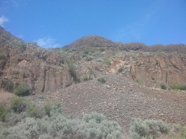
From Steamboat Rock parking lot, head east on a deep sandy trail to a large scree field. Here the trail begins its climb, so go slowly and plant your feet firmly as the rocks tend to shift frequently. Most folks wore trail runners, but I chose my heavier leather boots for two reasons: venomous snakes and unstable rocks. I used my trekking poles coming up and going down this section of the scree. The trail was dry and dusty, and slippery in some sections. In the rain this section is dicey and should be approached with caution.
 Scree field on Steamboat Rock Trail. Photo by Regina Robinson.
As you proceed up the path, find a safe place to turn around and look out behind you. The views across the scabland are magnificent. Continue heading up the trail - the first notch brings you up to the first set of terraces on Steamboat Rock. This area is definitely worth exploring.
Once we crested the top of Steamboat Rock the yellows, greens, and purples from the grass, balsam root, sage, and lupine were stunning. Continue heading up to the top of the plateau to see 600 acres spread out before you. The trail splits left and right.
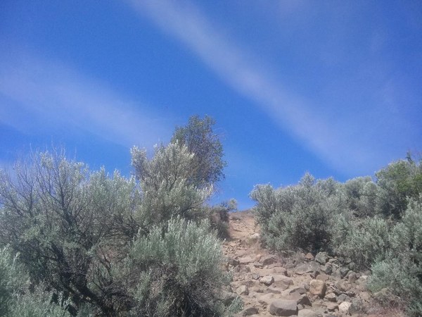
We chose to take the more moderate path to the right, heading across a wide open prairie filled with lupine, pincushion buckwheat, western wallflower, and miniature daisies. It was difficult to not stop every few minutes in awe at the views. I suggest watching your feet on the steeper sections as some parts of the trail meander mighty close to the edge of the rock, giving you views of the 800 feet below you. I tripped twice as I readjusted my hat as the wind kept trying to fly it off - it was quite the surprise on the second trip to find myself looking straight down through a v-shaped break in the basalt.
 Sagebrush line the trail. Photo by Regina Robinson.
There is a brief climb right before the next summit, which puts you above Banks Lake. The views here are impressive. If you look closely you can see the flood debris and markings on the land, and across from you you’ll see Steamboat State Park and Northrup Canyon.
From here the trail meanders northward, eventually making a loop around the plateau. There is very little shade so bring a hat, extra water, and snacks. Heat exhaustion is a very real thing here. We hiked early in the morning, when the birds were out and the wind was up. I can’t imagine this hike in the heat of the day and no breeze.
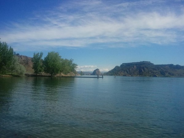
Banks Lake is 27 miles long and was formed as a reservoir in the upper Grand Coulee, located between the North Dam at Grand Coulee and the South Dam at Coulee City. Water is pumped up from the Columbia River and impounded at Lake Roosevelt just below the Grand Coulee Dam. Banks Lake water is released at Coulee City for irrigation as part of the Columbia Basin Irrigation Project.
 Banks Lake. Photo by Regina Robinson.
We drove to Grand Coulee Dam after a picnic in the shade. From the state park it is about a 15 mile drive and took us approximately 30 minutes. After exploring the dam we decided to head down to Dry Falls to get in one last hike before returning to camp.
Trip Info
- Mileage: 2.5 miles roundtrip to the top of the plateau, the loop trip is 6 miles (perimeter walk)
- Gain: 800 feet, has exposure and is steep in some areas
- Facilities: restrooms
- Camping: sites available, but reserve early because they fill up fast
- Boating & Fishing: See Requirements
- Dogs: Permitted, please keep on leash
- Fees/Passes: Discover Pass
Notes
- Bring plenty of water. Extreme heat conditions are typical during summer months.
- Bring sunscreen, a hat, sunglasses, binoculars, camera, and a long sleeve cover up. Do not forget to treat clothing for ticks.
- Respect and be cautious of local wildlife. Bears, mountain lions, coyotes, ticks, and venomous creatures such as rattlesnakes and bees are common in many areas. When encountering wildlife, maintain your distance and remain quiet. Keep pets under control and on leash.
- Severe storms with lightning and flash-flooding may occur. Always stay out of washes and seek shelter if lightning occurs.
- Please use existing trails.
Directions
Steamboat Rock State Park
51052 Highway 155
Electric City, Washington 99123
(509) 633-1304
Head east on I-90 to exit 151 for Ephrata/Soap Lake. Drive through Ephrata to the junction with State Route 17 in Soap Lake. Continue on SR 17 through Soap Lake and continue 21 miles, turning right onto Hwy 2. Drive for 4.3 miles then arrive at another junction, where you'll merge onto Hwy 155. About fifteen miles from the Y junction, turn left onto Steamboat Rock Park Entrance Road. You'll be heading out on a peninsula that juts into Banks Lake. Proceed through the entrance station, and begin looking for the day use parking area, on the right shortly after the entrance station.
 Regina Robinson