"The world is all the richer for having a devil in it, so long as we keep our foot upon his neck." - William James
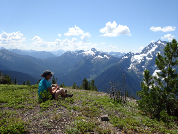
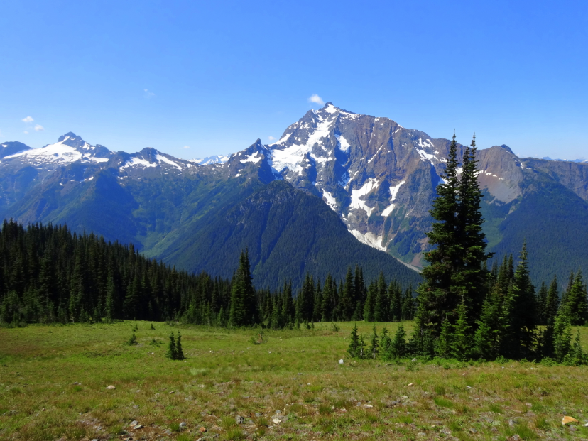
We climbed up and up. The vistas unfolded with the massive glaciered crag of Jack Mountain – the “King of the Skagit” – revealing itself close enough to touch and the Picket Range and Mt. Baker gathering up the thunder clouds on their crests to the far west. This is what calls me to the wilderness, the power to amaze and dwarf my mind and re-awaken my sense of wonder. Our little group spread out across the top of Devil’s Dome to turn around and around and around – no way to capture the breadth and depth of it.
This was our third day backpacking the Devil’s Dome Loop, a 43-mile view extravaganza and test of will all in one. We started at the 1,900 ft. well-signed Canyon Creek trailhead, taking the loop counter-clockwise so that the views would build slowly and so that we could descend the steep brushy six miles from the ridge to nearby Ross Lake as a reward at the end rather than ascend them at the beginning.
Regardless of your starting point, this trail makes no pretense of gentility – it gets to climbing near the start, and the climbing doesn’t let up for miles.
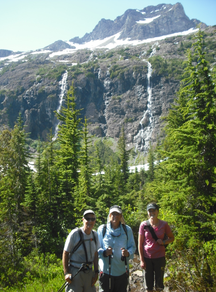 In the amphitheater below Crater Mountain.
Those who named the landmarks in this country certainly thought it a devilish place, with Devil’s Creek, Devil’s Park, Devil’s Pass, Devil’s Dome, and Devil’s Junction, not to mention Hell’s Basin, all ascribed to notable points on the terrain. Perhaps it was the pouring sweat from this trail’s constant steep ups and downs, multiple blowdowns, and rough and rocky sections of tread that made those earlier explorers call forth Lucifer’s name. I can tell you that the forces of Good do win out when the final score is read on this amazing loop – if you’re a believer in Heaven, I think you can touch it from here.
From our Canyon Creek start, the trail first heads east through the trees, crossed Granite Creek, then turns west again to cross a log bridge over Canyon Creek, ziggs east again, and began switchbacking up. Heads down, back and forth, the uncounted switchbacks passed surprisingly quickly, and as the trail finally flattened we reached a buggy opening and unsigned junction at 3.9 miles and 5,300 feet. Dropping packs, we made quick work of the trail up to Crater Mountain with a lake at its base, which opened up in 1.5 miles first to southward vistas and camps by an unnamed creeklet and then to a stunning amphitheater with cascades dropping all around and flower-filled meadows with a rather non-descript algae-fied pond nestled at its base.
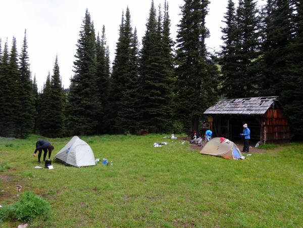 Camp at Devil’s Park.
A climbers’ trail cut off to the right to traverse to the Jerry Glacier and the summit ridge of Crater Mountain. With miles yet to cover that day, instead of climbing more we chose to flop into the grass, soak up the sun, and sink our feet into the cool mud on the lakeshore.
After a half-hour, oh-so-reluctantly, we donned boots again and headed back to our packs to continue on to our first night’s camp. MacMillan Park was a two-mile stretch of lovely meadows with patches of deep green spruce and silver fir and peek-a-boo views of Crater Mountain, now due west of our path. Alas, an easy route was not our chosen lot, and shortly the trail took us first westward down into the drainage of Devil’s Creek, then laboriously back eastward and up over a long ridge; 1,000 ft in a final painful 1.5 miles to finally reach the trees and expansive meadows of Devil’s Park. A mostly-intact but somewhat leaky shelter rested near the edge of the trees with a small adjacent meadow, a lovely flower field, and a clear running stream.
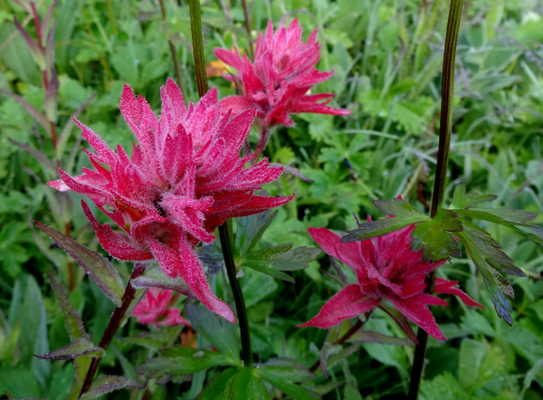 Dew on the paintbrush at Devil’s Park.
We were lucky to reach Devil’s Park when we did – devilish weather had been building through the afternoon, and as soon as our tents were pitched the thunder began to echo off the low ridge on the opposite side of Devil’s Park and a deluge was released. We were able to cook our dinners between drips under the intact sections of roof in the shelter.
By morning the sun was showing warm on the tents. In short order, tent flies and rain gear were hanging from every branch to dry while breakfast was cooked and consumed. A young buck and doe, either curious or offended at our occupation of their space, circled our camp until we packed up and left. In the meadow by the creek, every flower, blade of grass, and fir frond was flocked with dewdrops that captured the bright morning light.
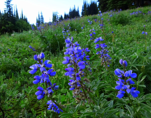 Lupine in Devil’s Park.
On day two, we cashed in on the investment we’d made with the steep climbs of the previous day, with almost non-stop views. Traversing up an open ridgeline, the meadows and views across Devil’s Creek opened up, first Crater Mountain and then its big brother Jack dominating the vista. Paintbrush, asters, and late-season fluffy anemone decorated our path. The scene was deep green from the recent rain. The trail wound to a saddle at 6,800 ft under a conical peak (noted as 7,288 on our map) standing at the southern end of Jackita Ridge.
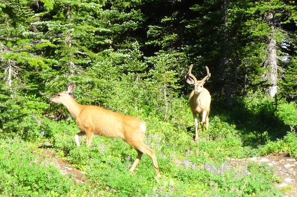 Some early morning visitors.
From the saddle dropped a set of steep switchbacks on a long talus slope, marked ‘Difficult for Stock’ on the map (you’d want to be sure the snow was fully melted on this north-facing slope before attempting it without an ice axe). Peak 7288 called us from above, so after a short snack break with our legs dangling over the dropoff, we angled our way up through the meadow tufts, rock, and Krummholz conifer to the top.
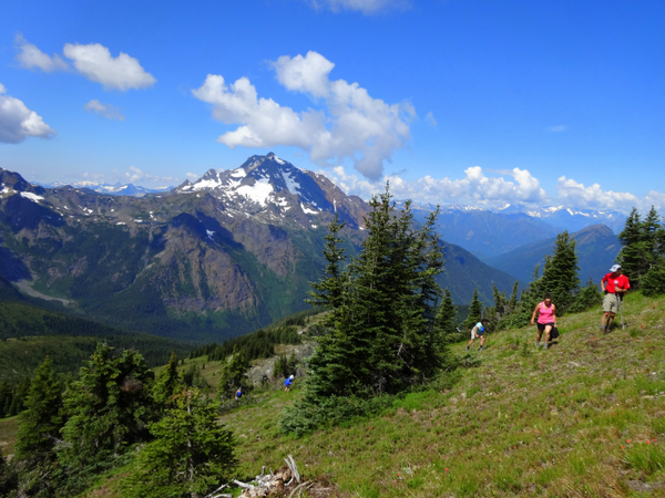 Climbing the knoll above Jakita Ridge.
Oh the views! Eastward, tracing the path of highway 20 toward the crest at Washington Pass, northward along the PCT and up to Castle Peak, westward to Jack Mountain filling the entire field of view, southward to the high peaks and glaciers of Ragged Ridge, Mount Logan and Black Peak. The valleys dropped precipitously to our west and east, with a tiny lakelet showing blue in a still snowy basin just south of us at the head of Friday Creek.
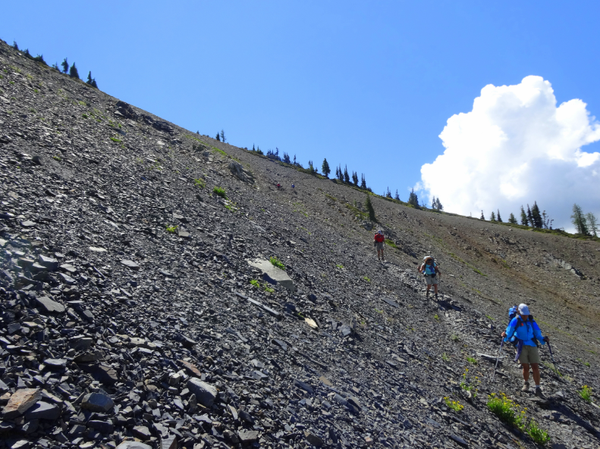 Descending the scree slope from Jakita Ridge.
But once again, the thunderheads were gathering, instilling a sense of urgency to finish the remaining five miles to our night’s planned camp at Devil’s Pass. Down the peak to the saddle, up with the packs, we wound down and up the serpentine trail through the talus. The next three hours were a saga of 200 feet down, 300 feet up, round a ridge, drop to cross yet another tributary of Devil’s Creek, up again to round another long ridge, and a seemingly endless drop on poor rocky tread nearly due east to a refreshing waterfall and then a junction with the Anacortes Crossing trail (with some lovely camps). As the trail turned due north and traversed up out of the forest into more meadows and increasing Jack Mountain views, stark crags in stacked color blocks of silver gray, cinnamon, and brown loomed above the talus and green ridges of Jackita Ridge, now behind us to the south.
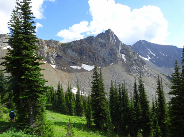 Climbing toward Devil’s Pass.
This trail truly began to be reminiscent of the Wonderland Trail, with Jack Mountain’s massive black face and large Nohokomeen Glacier standing in for Mt Rainier. The trail ascended and descended successive ridges and river valleys to show us every face of the peak. Wondering when the black clouds would open on us, we climbed over a knoll and descended down to a broad saddle and spacious camps at Devil’s Pass, finding one skeletal thru-hiker with weeks of beard and an ultralight tarp setup already installed.
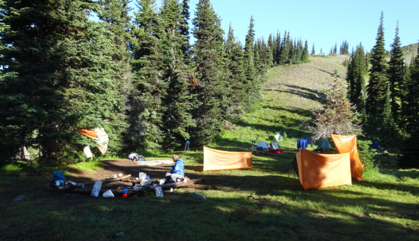 Drying our tents after a deluge at Devil’s Pass camp.
Though clearly a man of few words, he welcomed us to set up in the meadow and surrounding trees, and we collected water from the little spring below and got our shelters established just in time for a booming electric light show with hail and heavy rain. From our perch on this saddle with long drops on both sides, it seemed as though the clouds and thunder were rolling up from below. Yet again, the clouds receded in plenty of time for us to prepare our dinners, and left blue sky behind by the time the next morning came.
Our third day would take us along spacious ridgelines to Devil’s Dome and down a seemingly endless overgrown and blowdown-strewn descent to the Devil’s Junction Camps on the east bank of Ross Lake. We traversed in the wide-open for several miles, now looking nearly due south at the huge massif of Jack Mountain, its several large glaciers and snowfields clinging to its steep faces, and multiple waterfalls draining them into Devil’s Creek below us.
Devil’s Dome was indeed a wide-open, gently rounded dome of a hilltop, decorated with the firepit of a very scenic but likely quite windy and dry camp, and peaks stretching north all the way into Canada. From there, we got our first glimpses of Mt. Baker peeking over the shoulders of the Picket Range. Ross Lake was only barely visible between the shoulders of the ridges defining the Devil’s Creek valley far below and to the west. What happens on the Dome stays on the Dome, but suffice it to say that naps were had in the warm sun.
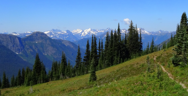 The expanse of the North Cascades looking west near Devil’s Dome.
Nothing was left for us but to look ahead to the soothing waters of Ross Lake, so we packed up and headed down. After rounding the scree slope to the west of the dome and descending past a clear perennial stream, one of the few reliable water sources in this stretch, we entered the trees and began the long switchbacks down toward the lakeshore. The south-facing forested slope was exceedingly brushy with dozens of small blowdowns to haul ourselves over, and the afternoon was warm enough to make this section a sauna in the thick vegetation.
Enjoying the sun and views from Devil’s Dome.
Our entire party was of frayed temper and bruised spirits when – at last! – we came across the sign to the Devil’s Junction boat camp, nearly 6.5 miles from Devil’s Dome. Less than a half-mile further and the sparkling reflected light of Ross Lake showed through the trees just to the right of the trail.
Finally, there it was, the lake, shimmering and glorious, stretching north and south as far as we could see. We were greeted by nice camps by the boat dock, complete with a fragrant outhouse, bear locker, picnic table, and plenty of tent space. But the water and the warmth of the afternoon played a siren’s song, and first two, then three, then all of us were in the water, floating and chattering happily. The evening passed easily (and free of thunderstorms!) into a lovely rosy sunset reflected off the water.
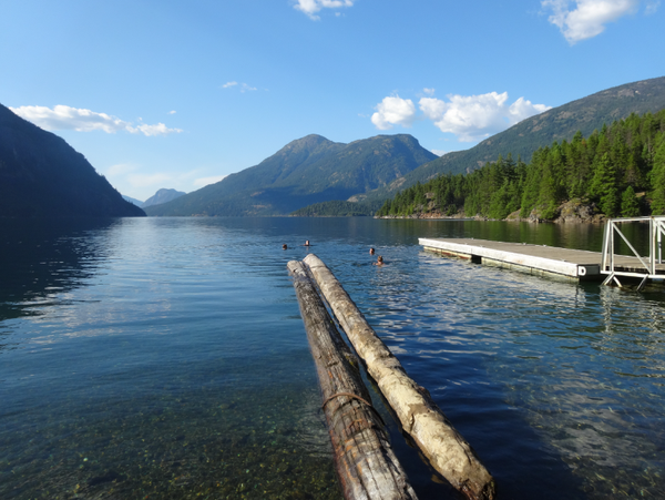 Refreshing dip in Ross Lake by Lightning Creek camp.
Day four was an easy and short day, with the boat shuttle from Ross Lake Resort arriving at 8:15am to pick us up for the 20-minute ride to the dock just upstream of Ross Dam. From there it was a short climb up the road and then up the winding Ross Dam trail to the parking lot.
Loading into our cars for the long drive home, we reflected on newfound friendships cemented by our shared experience of having completed a significant objective, our perseverance through no small amount of physical challenge, and the simultaneous violence and amazing visual and spiritual gifts of the wilderness. If you’re ready to give what it takes, this loop will give back immensely more.
Add a comment
Log in to add comments.When was this trip?
This is a compilation of experiences and photos from two backpacks on this route, one in 2011 and one in 2015.
 Cheryl Talbert
