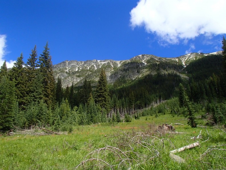
My husband Bri and I love backcountry adventures, particularly to remote places without crowds and high routes without trail. We’ve explored much of the Cascades, but when we eyed a trip into the Pasayten Wilderness we felt that the driving distance and spectacular scenery warranted a longer expedition than usual. We decided to go before Slate Pass Road opened, when the high peaks in the area still had snow blanketing their scree slopes and the travelers on horseback had not yet arrived.
We started down the Robinson Creek Trailhead midday on Thursday, July 7, 2016, hiking the eight miles out to a lovely meadow with a large sitting rock we’d set camp at before. Our plan was to travel along the Middle Fork Pasayten River to the Tatoosh Buttes, traverse Ptarmigan Ridge, Mt. Lago, and Mt. Carru to the Shellrock Pass area, then head back via Doris Lake and the Middle Fork Pasayten River to our car. We had nine days’ worth of food, allowing plenty of extra time for steep off-trail travel and side trips that caught our fancy along the way.
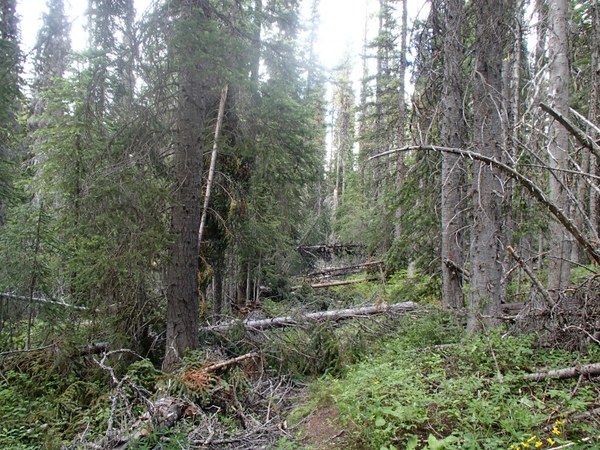
The next morning we reached Robinson Pass. We saw quite a few freshly cut downed trees, along with two backpacks, tools, and a sling from the trail crew. As we carried on, the trail started to devolve into a mess of blowdowns. We met a hiker who told us that things did not improve down the trail; he’d camped at the Tatoosh Buttes and snowy Doris Lake, coming back in a big loop to avoid the mess a second time.
We continued through the blowdowns, meeting two forest service employees along the way. They had been tasked with clearing the trail before Slate Pass Road opened that weekend, but managed less than 0.5 miles of trail in two days. We continued, hoping we’d already passed the worst of it. We traversed every kind of blowdown: big, small, multiple trees, trees across the trail, trees along the trail. We generally travel 2.5-3 mph on rolling trail, but were barely covering 1 mph now. We ended up with the crotch fully ripping out in Bri’s pants and my legs covered in bruises.
By evening we’d covered over ten miles, five of them very difficult, with over 100 blowdowns per mile. There were signs of bears in the area, including some of the biggest fresh claw marks we’d ever seen. We camped beyond the junction to Doris Lake/Shellrock Pass, spending the evening sewing the torn pants. We decided to try for the Tatoosh Buttes the next day, hoping conditions would improve.

We spent Saturday morning traipsing over, under, and around the blowdowns for another five agonizing miles. At the Pasayten River ford we found a weathered handwritten sign stating that the trail ahead was impassible to livestock due to a landslide and downed trees, suggesting a detour by fording the knee-deep Middle Fork Pasayten River. We were tired of the blowdowns, so we decided to take the detour and carried on.
The forest was alive with the sounds of animals and trees creaking in the increasingly harsh wind. We turned right at the junction for the Pasayten Airfield, finding another sign that warned of a landslide and declared that the trail was impassible for livestock. The whole trail had slid, many trees having fallen into the river. We were able to easily get above the landslide, but it was not easy to descend back onto the trail beyond the slide. I took off my pack and lowered it onto the trail before taking a controlled, three foot feet-first dirt slide onto the trail. I was cautious, because if I slipped too far it would mean falling into the river twenty feet below.
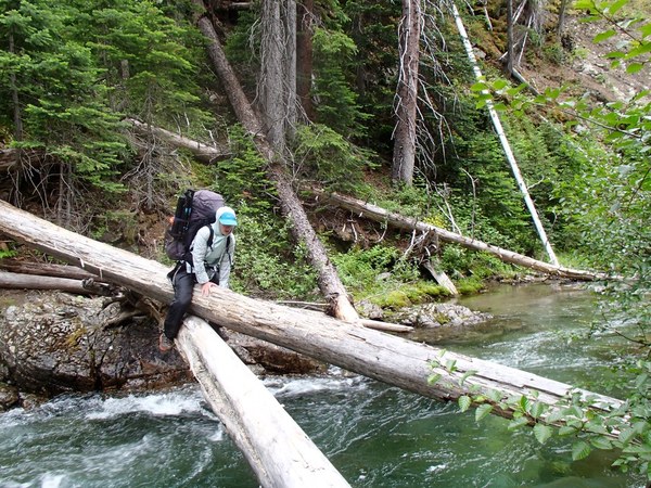
The water was deep, and we could hear large rocks moving in the strong current. We did not think a ford was safe. We found a slippery two-tree crossing; our options were changing trees mid-river, or staying on the log that ends a couple feet short of the riverbank. I chose the latter, jumping from the log and barely catching the brush on the riverside, pulling myself onto the bank.

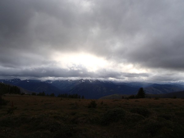
We finally arrived at the Tatoosh Buttes trail, starting off in beautiful open forest. We passed a marked junction for Lease Lakes with no trail in sight. We put on raingear to block the light drizzle and viciously biting wind as we ascended. We camped on Tamarack Ridge, a stunning and starkly beautiful place with the call of wolves in the meadow below. We put on all of our layers but I was still shivering in the cold. We could see that Ptarmigan Ridge and the saddle west of Mt. Lago was ice ax terrain. The patches of snow at our elevation were firm and we'd likely need crampons for the traverse. We only had microspikes and poles.
Our original plan began to look bleak; we didn’t want to go back through the hundreds of blowdowns, and we were down two pairs of pants: my repair job had quickly ripped out that morning and the rain pants Bri had been wearing instead were now critically torn as well. We joked that hiking without pants was the new ultra-light thing, but didn’t want to test our theory. I repaired the pants a second time, using a square of spare tent mesh for extra support.
We examined the maps for areas adjacent to our planned trip. The rangers had mentioned that the Hidden Lakes Trail was freshly logged out. We thought the hiker we met said he had come from Shellrock Pass via the Monument Creek Trail, which was marked on the green trails map as a dotted line, indicating a passable unmaintained trail. Instead of traversing the peaks without appropriate gear, we decided to instead sleep at the Hidden Lakes the next night and head to Shellrock Pass the following day.
We started down the trail the next morning, hurried along by the cold and snow showers. A mile from the Hidden Lakes, freshly cleared trail finally began to show itself. The lakes weren’t visible until we were upon them, true to their name. I wanted to find the Monument Creek Trail junction before setting up camp, but as we continued past the lakes we saw no junction. We pulled out the map and GPS, returning to the outlet stream of the last lake where the trail should be.
We found trail markers, bushwhacking with difficulty through thick underbrush and finding old cut blowdowns along the way. I cried, realizing the trail was gone. We backtracked to the Hidden Lakes to set up camp. We pitched our tent in the rain - things were not looking good for us now. Bri had no pants, I was covered in lumps and bruises, and our backup route didn’t exist without miles of dense bushwhacking. We did not want to go back the way we had come, but we did have enough food left to do so if we had to.
We texted a friend with our DeLorme messenger, who told us that there was a taxi in the area called Mountain Transport. They gave us the number and we called on our satellite phone, but Mountain Transport declined to pick us up. We promised to call again in case they changed their mind, and on our second call Mountain Transport agreed to get us at the Billy Goat trailhead 17 miles from camp, at 3pm the next day, for $279. We gave them our credit card information and reserved the pickup.
We were on the trail by 7am. We made good time on the logged out trail, completing five miles within the first two hours. We passed one party of two carrying an uncomfortable looking raft, headed to the Hidden Lakes. Three hikers and two forest service employees were the only humans we saw in five days.
From Lucky Pass we descended down a steep rocky path, with no sign of the single long switchback on our map. The trail descended, crossing Drake Creek just after a junction stating that the Billy Goat trailhead was four miles out. In my haste I hadn’t read the map carefully - there was 1,000 feet of elevation gain to Eightmile Pass before the descent to the trailhead. We hurried along the trail, tired but relieved to be at the trailhead by 2:30pm.
The taxi driver advised us to go to campgrounds if we ever hike out into the Pasayten Wilderness again as even the ones in remote areas are regularly checked by Forest Service employees. In an emergency, you might find a ride out, or a forest service employee can radio out to call you a mighty expensive cab ride. I carry $100 emergency cash in my 10 essentials kit, but in this case they required a credit card number to reserve the cab ride.
Although this trip did not go as planned, we still had a wonderful time and view it as one of our best adventures. We were flexible and kept our equipment and abilities in mind when choosing what we were and were not comfortable with. In the backcountry, the unexpected happens every day. You cannot know what conditions you might face with certainty - particularly early in the season. We kept our sense of humor intact and made the best of the not-so-great situations whenever possible. It’s so helpful to have a hiking partner to commiserate with when things are not going right and to enjoy the sublime with. We’re looking forward to another week in the Pasayten!

Lessons Learned
- Call the ranger station before your trip to learn about trail conditions. They may not have the most up-to-date information, especially early in the season, but they will be able to tell you if a trail was passable the previous year. You may want to ask about the other trails in the area as well, so you know what your options are in an emergency.
- Maps may not be up-to-date. Bring maps for the adjacent regions in addition to those you expect to need. Also keep in mind that Green Trails maps have a small scale, sometimes requiring your compass’s magnifying glass to ensure that you are reading the elevation correctly.
- Know your limits for river fords and log crossings.
- Bring a good repair kit.
- Bring adequate clothing. If you wind up wearing everything you brought in the conditions you expected, you didn’t bring enough for colder than anticipated conditions.
- Even in the summer, it can snow.
- Turn around when conditions are not appropriate for your equipment, skills, or experience.
- A messenger or satellite phone is a valuable tool in emergencies. Save the numbers for local cabs and emergency services into the device before you leave.
- If you need to take a different route out, consider hiking to the nearest campground to seek assistance.
- Bear safety is critical, especially in remote areas.
 Selena Eon