Trip Report
Day Hike - Upper Dungeness River
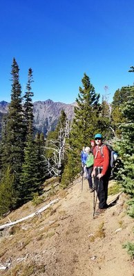
This was a great hike starting out with static air at 32 degrees at the start and ending 3000 feet higher in blue skies and great sunlight. Sadly, no Mountaineers were present except the leader.
- Sun, Oct 14, 2018
- Day Hike - Upper Dungeness River
- Upper Dungeness River
- Day Hiking
- Successful
- Road suitable for all vehicles
-
Plenty of water on the way, people were scarce and bear scat was present on the trail in 3 locations. Mushrooms were aplenty.
We went 500 feet above Boulder Shelter and GPS mileage varied from 15.3 to 14.7 miles. Total Elevation work was 3120 feet. Buckhorn was visible from the turnaround point, as was Constance Pass.
Three hunters in Neon Red were in the vicinity and were alert to hikers in the area.
All the conditions were great except for the start temperature at freezing.
 Douglas Terry