Trip Report
Basic Glacier Climb - Mount Logan/Banded Glacier
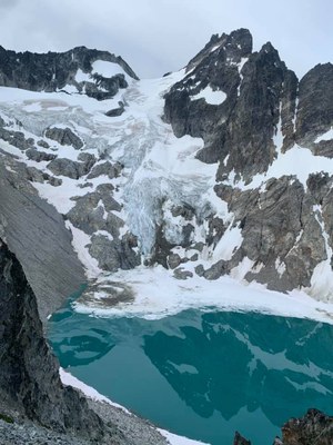
A fantastic alpine adventure to a remote and incredibly beautiful area of the North Cascades. The views into the Banded Lake and glacier were otherworldly!
- Fri, Jul 12, 2019 — Sun, Jul 14, 2019
- Basic Glacier Climb - Mount Logan/Banded Glacier
- Mount Logan/Banded Glacier
- Climbing
- Successful
-

- Road suitable for all vehicles
-
With the rapid melting this year snow level is high and this route is more challenging than it would have been a month ago with more snow. Did not find snow until about 6000 feet and even then it was not continuous requiring on-off crampon transitions a total of 10 times! This climb this year may have been best done a month earlier. Crevasses on the upper part of the glacier are open but can still be skirted avoided without much detouring. For the summit scramble from the Banded glacier is critical to transition to rock on a point at about 8800 directly on the NE ridge. We found low snow and a deep moat on what looked like the correct transition place which made us decide to descend 40 feet and go around the ridge from the left from a convenient saddle which had an inviting system of ledges. The good ledges though led us to a terrible chossy and very exposed section of rock. Getting up back on the ridge from there is un-necessarily dangerous. Had we realized this, we would have found a way to get on the rock from the deep moat spot.
In this report I included many pictures which I hope will be helpful to future leaders and teams doing this route. Unfortunately no matter how hard I tried, I could not get the portrait ones to turn within this template. Please bear with me for this issue and if anyone has any pointers on how to fix it, please shoot me a message or comment here.
This was a 3-day trip of 30 miles, 12,300 gain and 12,300 loss. I had a strong team of 5 men, one co-leader, two intermediate students and two basic students. While this route is classified as a basic glacier climb, I think the term basic is pretty stretched here. While it is true that there are no challenging rock moves (at most class 4 scrambling) and at this time no alpine ice, the remoteness, abundance of objective hazards and overall committing nature of the trip, should make any leader very careful about choosing basic students as participants for this trip. We vetted each participant very closely and we were lucky to have them all. They were a very strong and competent group but I can see how this could have been a turn-around with less capable or less fit individuals. We had 6 people (max size for this area) but a smaller team may have been more efficient and rock fall hazard may have lessen in the gully below Christmas Col.
Day 1: 12.5 miles, 4000 ft gain, 8 hours
We started at 6:20 AM and covered the 3.9 miles and 2000 ft of gain to Easy Pass in good time. We took a brief stop here and caught the first views of Mount Logan from the Douglas glacier side. Then continued down the tight switchbacks to the Fisher Creek basin and followed the Fisher Creek trail past Fisher Camp, Cosho camp and finally to the place where we leave the trail at 3600 feet to scramble up to the lake where we would make camp. This spot is pretty easy to find as it is immediately before two back-to-back log bridges.
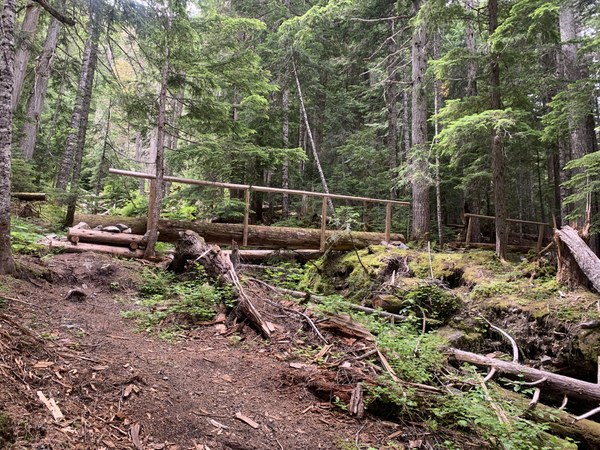
The very faint boot path is visible from the main trail right before the last dry creek before the two bridges. While it is easy enough to find, it is much harder to follow it as it almost immediately disappears into the forest floor and only on the way back we were able to follow this faint boot path most of the way down. The key in this very unpleasant section is to stay close to the creek (which has many beautiful waterfalls) but not so close to having to scramble cliff bands which are loose rock mixed with mud and moss. At the beginning it is easiest to stay on a ridgelet but when that ends, veer climber's left and follow a system of gullies not ridges. There will be a decent amount of serious bush-wacking no matter what but the gullies on climber's left avoid the most dangerous cliff bands. Once we finally emerged in the lake basin, the new challenge was to get across the creek outlet and the bog on the east of the lake. Earlier in the season with snow this may have been easier but we had to climb a small ridge to the east mostly bordered by cliff bands and then find a way to descend it down to the bog. Brian found a good way down after several earlier attempts. That steep brushy slope delivered us to the bog where we took off climbing boots and changed into wading shoes to traverse it and then headed to the rocky area on the SE corner of the lake where we set camp. Camp was on rocks. Only a couple of small semi-flats spots, no real established camp sites.
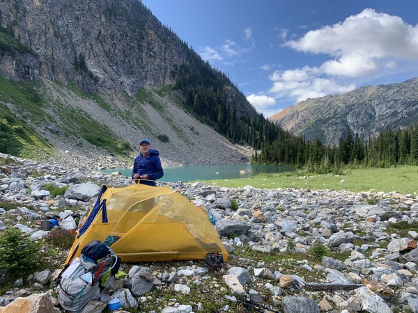
Unfortunately this pristine and beautiful lake was swarming with mosquitos and almost everyone had to wear bug nets at all times. I generously applied 100% DEET on any exposed skin surface but I still had many bites and the mosquitoes were able to bite through clothes too. After water-filtering and a good meal we retreated to our tents to sleep.
Day 2: 5 miles, 4200 ft gain, 15 hours. 10 crampon transitions!
We woke up at 3:15 and left camp at 4:20 knowing we would have a very long day ahead.
The route from camp is quite different than seen in previous reports in that there was no snow for a good while. This is what it looked like from the lake the day before:
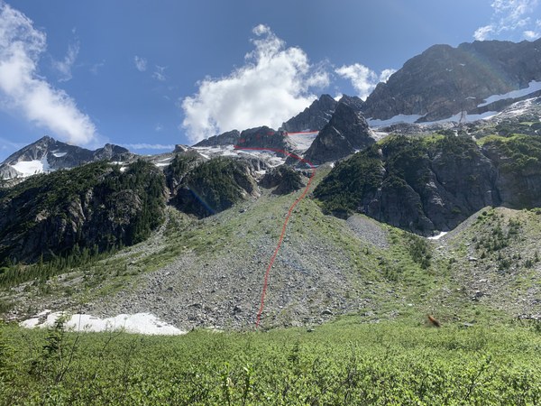
First we had to ascend the talus fan, then veer left in the direction of the snow ramp below the triangular rock-shaped rock, then followed ramps of snow, around the ship-shaped striped rock (see below)
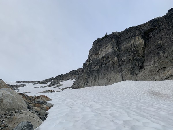
and then and up towards the upper ridges where the Christmas tree col is (the only passage through them). Once we hit snow we donned crampons since the snow was very firm. After you get around the ship-shaped striped rock, we veered back to climber's right and then went up until we saw this.
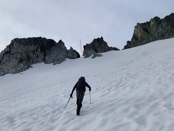
The left gully with the batman ear pointy rock leads to the Christmas Col, the hidden passage to the other side to entry into the magical Banded Glacier basin.
The Christmas Col is an a stunning viewpoint and a worthwhile in itself. But we were there to climb Mount Logan! We reached it in good time, 2 hours after we left camp.
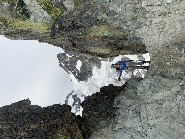
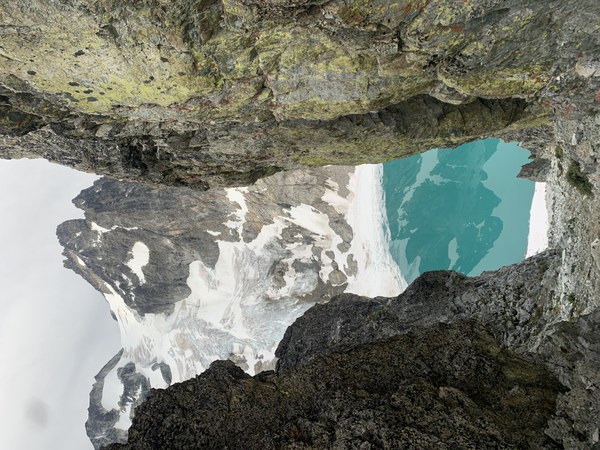
From here we could see our entire route, down to the Banded lake, traversing left of the lake on talus (and a little snow), then up the talus to the second snow patch, then on a left leaning snow ramp, then more rock, then finally on the glacier staying left near the rocks and then traversing high above the crevasses on the left and again skirting most crevasses staying left and finally to the Banded-Douglas Col, then gaining the NE Ridge to the summit (see route overlay on next picture)
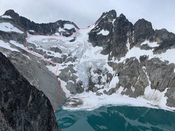
But before we could get to it we had to descent the infamous gully below the Christmas Col. Even with the most extreme caution it was very hard to avoid moving rocks and we had to do a combination of staying close and picking different lines to safely descend down to the glacial lake. None of us were eager to come back this way but there was no other alternative.
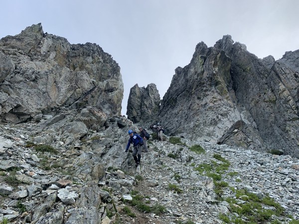
We were down at the lake at 9:00 and then we quickly traversed is on the left on two short snow sections first and then angle up towards the second snow patch (the first one was too thin and had water running under it). Once on snow we put crampons on again and ascended the left-facing snow ramp heading up and left. Found another section of talus rock for which we had to take crampons off again and then finally we step foot on the glacier. Here we roped up in two teams of 3 and proceeded up staying left and only traversing high on the glacier above the crevasses.
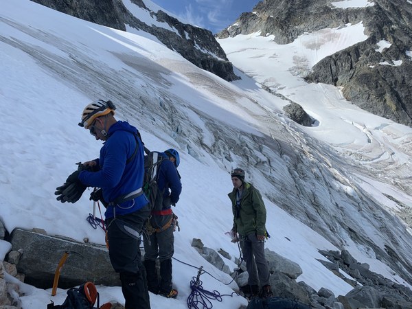
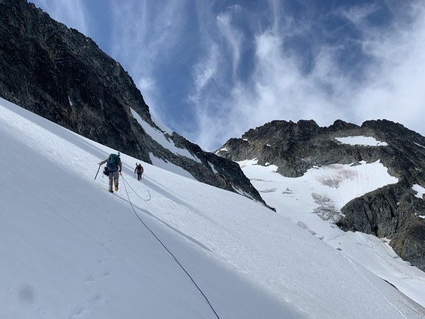
This was not a steep section and we did not use picket. Once at the top we found an interesting hogsback feature and safely traveled on the other side of it.
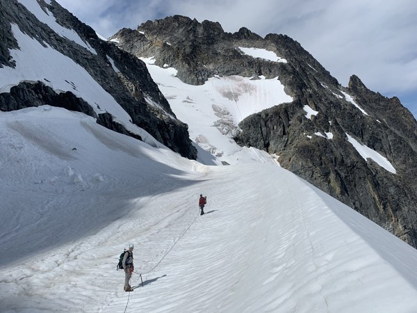
At the end of the hogsback we rounded a rock and then proceeded up a steeper section of the glacier with many large crevasses on climber's right. Here we set pickets and run two running belays.
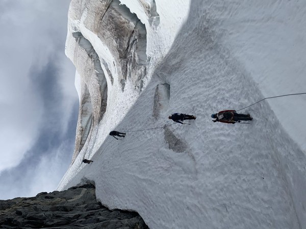
Once above this section we traversed climber's right to the Banded-Douglas Col and from there we continued right and up aiming at the NE ridge.
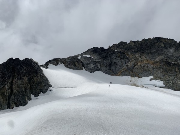
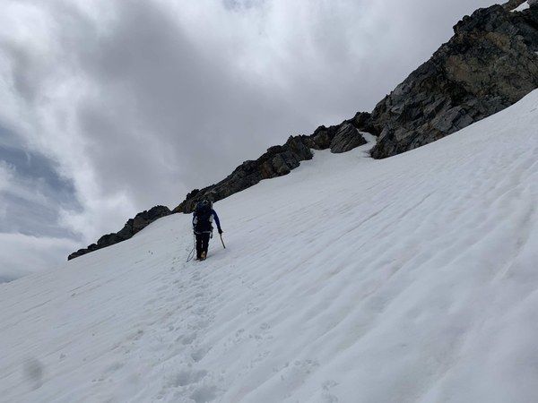
In this picture Brian is aiming at the correct spot to transition from snow to rock at about 8800 directly on the NE ridge. Once we got there though he found low snow and a deep moat which made him decide to descend 40 feet and try to get on the ridge from the left from a convenient saddle which had an inviting system of ledges. The good ledges though led us to a terrible chossy and very exposed section of rock. Getting up back on the ridge from there is un-necessarily dangerous. Had we realized this, we would have found a way to get on the rock from the deep moat spot.
Here is a picture of the moat and the spot where it would be best to transition that we used on the way back by setting a fixed line to descend back to the saddle and retrieve our gear.
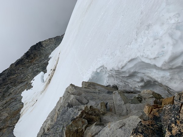
Once we safely regained the ridge, the scramble was pretty a pretty straightforward class 2-3 with a final class 4 move at the very summit.
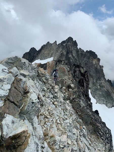
Before reaching the true summit one has to get almost on top of a false summit (traverse climber's left, then descend to a small saddle between the two and take the final class 4 move to reach the summit (cairn at the base).
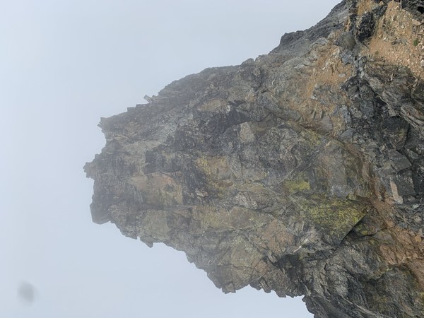
By the time we reached the summit, clouds had formed and enveloped us so we only got glimpses of the many amazing peaks surrounding us. We spent 45 minutes at the summit before heading down.
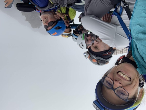
We set up a short rappel to facilitates the descent on the class 4 move and then retraced our steps down the ridge.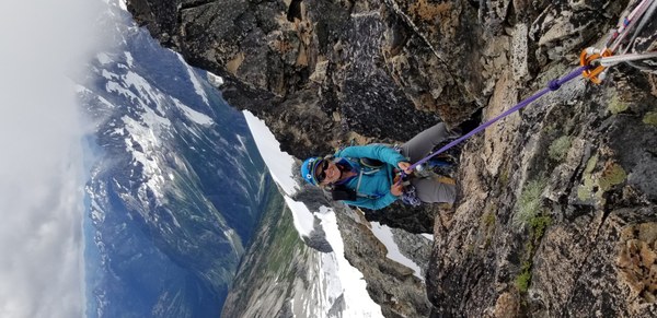
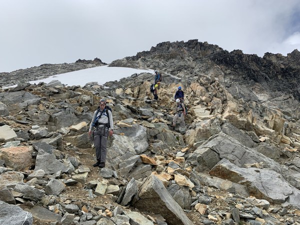
On the way down we stayed on the ridge the entire time and set-up a fixed line to descend from the ridge onto the snow and then safely reach our stashed gear (axes and crampons) at the saddle. We retraced our way back down the glacier and to the lake without any incidents.
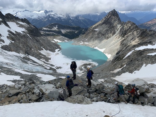
Then reluctantly made our way up the gully leading up to Christmas Col which we found almost as challenging going up as going down. Back at camp at 7:30 PM (15 hours day).
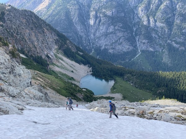
Day 3 stats: 12.5 miles, 3000 ft gain. 9 hours camp to car.
We left camp at 6:30 AM. After some fun with bog crossing (on the way back we stayed left near the lake shores as long as possible before wading the outlet stream), we were determined to find a better way down to the trail then the awful bush-wacking, cliff-band scrambling of the way up. At the end of our ascent, I had seen a boot path and marked it as a waypoint in Gaia. We decided we would take that and try to follow it as long as possible on the way down. Here is the start, very clear early on but later very faint and intermittent at best.
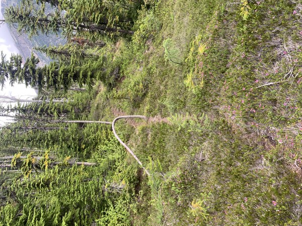
It was more like following tramped soil or animal tracks and possibly some human ones but every time I was in doubt and made a call, I would eventually found it again. It it was animal tracks, the animals are pretty smart at finding the path of least resistance all the way down. While this route was not perfect by any means (still plenty of bush-wacking, and veggie belaying) we avoided all cliff bands and traveled mostly on some muddy rooty gullies all the way down to more of less open forest until we popped right on the Fisher Creek trail.
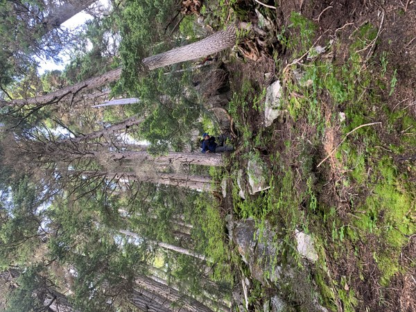
What a relief! Two hours down. Once on the trail it was first pretty (but not flat travel) to Fisher Camp, then a brutal climb up to Easy Pass and what felt like a never-ending descent back to the car.
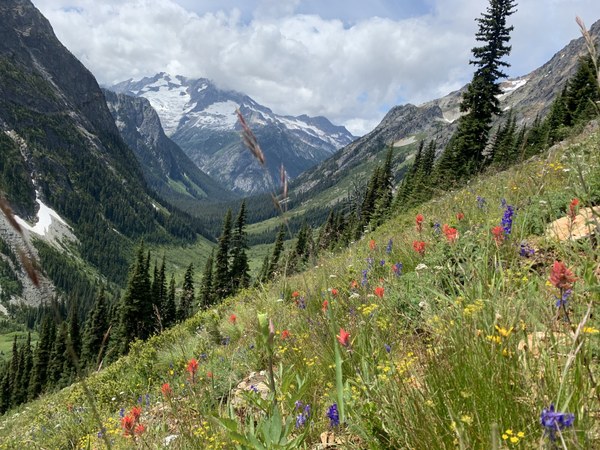
Emma's GPS track (RT, return track is the best route)
https://www.gaiagps.com/datasummary/track/1c155113aa233ea4d86656f5eb721bb1/?layer=CalTopo
Brian's GPS folder (camp to summit; summit to camp, camp to car)
 Emma Agosta