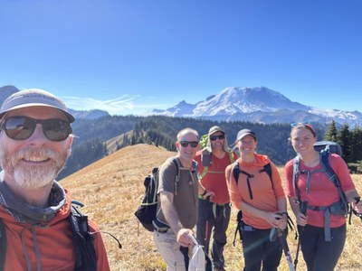
Trip Report
Alpine Scramble - Burnt Park Loop
Great day for a ridge ramble with awesome views and possibly the hardest way to visit the Huckleberry creek patrol cabin.
- Fri, Oct 14, 2022
- Alpine Scramble - Burnt Park Loop
- Huckleberry Creek
- Scrambling
- Successful
-

- Road suitable for all vehicles
-
The Huckleberry creek section of trail we did use was still usable. The bridges across the water crossings on the national park side were very deteriorated/rotten and are in need of replacement.
With a great forecast we decided it was time to attempt the Burnt park loop scramble again. After our early morning meeting time we headed for the trail. Our drive out to the trailhead was uneventful. State route 410 just outside of Enumclaw was still signed that is was one way traffic in a section but we did not encounter this on our drive out or return. Forest road 73 was in great shape with minimal potholes. We were the only vehicles parked at the trailhead which has parking for maybe 5 vehicles.
Upon arriving at the trailhead we did a quick briefing, distributed group gear and then headed down the Huckleberry creek trail. We only stayed on the trail for just under half a mile before we departed into the woods on a SSE bearing to gain the ridge leading to peak 5836 and Burnt park north peak. Our approach up the ridge went very nicely. We did encounter a couple blow downs but we easily went over or around them. It wasn't very long into our off trail journey that we found a game trail super highway that was heading in the exact direction we wanted to go. Seeing as how the animals always know the best way through an area we followed it. This trail saved us a bunch of time and helped us quickly gain the ridge.
At park boundary while gaining ridge.
Photo by Kurt Mallery

Just before gaining the actual ridge at around an elevation of 5,400 feet we changed bearings to nearly due south. This was done since we knew from past experience that being on top of the ridge for this section would be much harder then just going low and bypassing this section. As we headed south along the side of the ridge we once again found a game trail heading where we needed to go. Using this and the ridge top as a handrail led us right to a meadow full of large rock outcroppings below the nasty part of the ridge. We were able to quickly get through this section and then we decided it was time to gain the actual ridge directly north of Peak 5836. Once again we found a game trail heading up the slope to the saddle of Peak 5836 and the rocky section of ridge we avoided.
On North side of Peak 5836. Views are amazing.
Ridge section we bypassed visible.
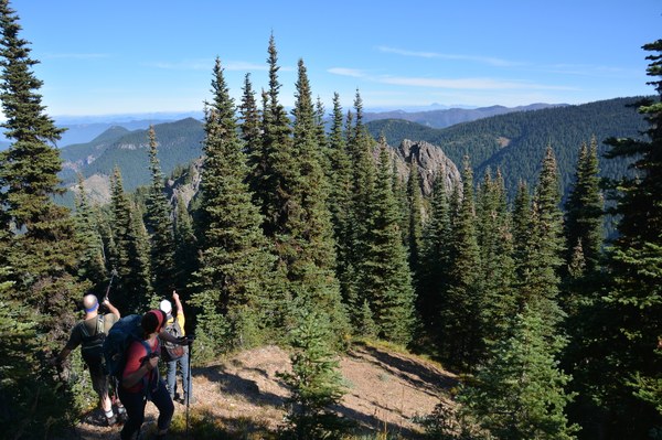
Once we gained the ridge the views opened up for us. We now had views of Slide mountain to the east of us and the Stewart range North of us. Once again there was a game trail running along the top of the ridge that led us through the best terrain along the ridge. From our first peak we continued down the ridge heading towards Burnt park north peak. Travel was very easy now and the views kept getting better. As we came out into the open just south of Burnt park north peak we caught our first views of Rainier. At this point we decided to stop for lunch and enjoy ourselves a bit.
Slide mountain
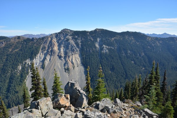
Now refueled we kept moving along the ridge to gain Burnt park north peak. The scramble up this peak was very easy with no complications. The views from it were simply amazing. We could now see the rest of the days route and the final goal Burnt park across the valley from us.
Ascent of Burnt park north.
Burnt park in background.
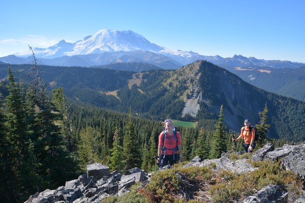
The descent and ridge walk from this point was in pretty much open country. The ridge had now widened out and was easy to follow. When in doubt there was a game trail to follow along. The only complication we had along this section of the route were two of our party members getting stung by wasps/hornets.
Following the ridge around.
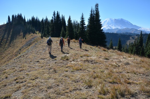
Upon following the ridge around we now faced our final goal of the day, summiting Burnt park itself. From a distance it looked much harder than it actually was. As we closed in on it we saw that it was pretty much going to be a walk up just like the others we had done today. As we ascended the peak we found the false summit offered a spot for some great photos.
False summit Burnt park.
Photo by Anora Ayer
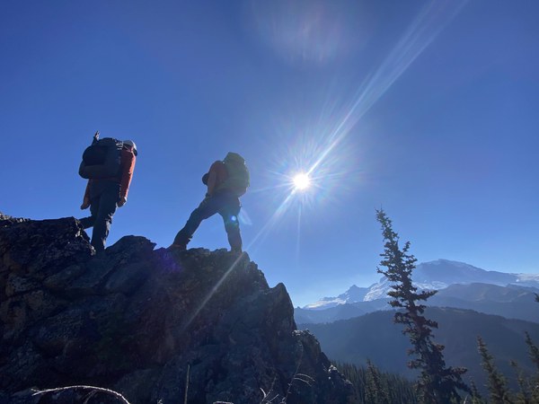
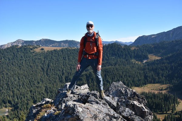
Photo by David Judish
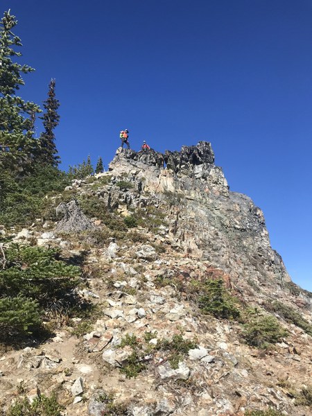
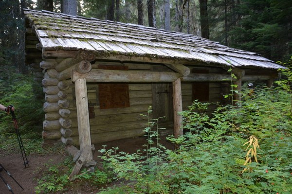
Once we summited Burnt Park itself we had a quick discussion on how to get down to the Huckleberry creek trail. After much map comparing and ideas we decided we would stay on the ridge running north till we reached an elevation of around 4,800 feet. From there we then went straight down the fall line. This worked out well initially until we hit an elevation of approximately 3,800 feet. In this area it got very steep and we had to choose our terrain carefully. Another complication in this area was that the maps loaded onto the various gps devices we were using did not match up on the trails actual location. Some of the maps showed that we should have hit the trail at an elevation of around 3,680 feet while other maps showed the location another 300 feet below us. The correct location was the lower one. Once we hit the trail we made good time out with a stop at the highlight of the day for some participants, the Huckleberry creek patrol cabin. This cabin is on the Rainier Patroller badge list and was a highly anticipated part of the day and goal as well. If you are going to visit this cabin you may want to do it soon. The cabin is not in great shape and it appears the roof is failing and may fall on one corner in the future. From the cabin we quickly left the park and returned to our vehicles around 15 minutes before sunset. It was a long day but everyone agreed the trip was great overall and offered an experience and views that few will ever get in Mt. Rainier.
Huckleberry creek patrol cabin.
Total trip time was right at 10 hours.
Distance 10 miles.
Elevation gain 4,000 feet.
 Jerrick Linde