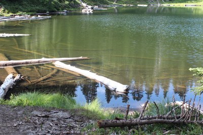
Huckleberry Creek
A moderate 9-mile one-way hike with 400 feet of elevation gain from a start at Sunrise or 3,800 feet of elevation gain from a start at Forest Road 73. Travel through old-growth forest and waterfalls, past Forest Lake, and along Huckleberry Creek with grand views of Mount Rainier and McNeeley Peak. It's also possible to loop through Sunrise and Grand Park to Lake Eleanor.
getting there
From SR-410 turn west onto Huckleberry Creek Road (Forest Road 73) and drive to the Huckleberry Creek Trailhead (2,900 ft). Leave a car here. Then drive to Sunrise in Mount Rainier National Park via the White River entrance.
on the trail
Huckleberry Creek
9 miles one-way,
Hike about 0.5 mile north and west out of Sunrise on the Sourdough Trail, gaining 400 feet of elevation. Turn right onto the Huckleberry Creek Trail at the junction at 6,800 ft. Continue 8.5 miles, descending 3,800 feet on the Huckleberry Creek Trail until its other end at Forest Road 73. This route can be done also be done as a key exchange day hike.
huckleberry creek TRailhead to forest lake camp
6.75 miles one-way, 3,200 elevation gain
From the Huckleberry Creek trailhead on Forest Road 73, hike on the Huckleberry Creek trail to Forest Lake camp, 6.75 miles with 3,200 feet of elevation gain. Overnight permits required to camp at Forest Lake, visit recreation.gov.
Huckleberry Creek–Sunrise Area–Lake Eleanor Loop
18-mile loop with a short 4.1-mile car shuttle, 4,700 feet of elevation gain
Suggested Itinerary
- Day 1: Drop a car off at the Lake Eleanor Trailhead. Drive 4.1 miles to the Huckleberry Creek Trailhead. Hike the Huckleberry Creek trail to and camp at night at Forest Lake. It's 6.8 miles, +2,785 ft/-49 feet of elevation gain/loss.
- Day 2: Hike to and camp at Berkeley Park. It's 4.9 miles and +1,293 ft/-1,347 feet of elevation gain/loss with a possible side trip to Fremont Lookout.
- Day 3: Hike to the Lake Eleanor Trailhead and drive to the Huckleberry Creek Trailhead to retrieve vehicles. It's 6.4 miles and +678 ft/-1,691 feet of elevation gain/loss.
scramble Route
Burnt Park Loop
10-mile loop, 4,000 feet of elevation gain, difficulty: Strenuous 3, Technical 1
Hike south on the Huckleberry Creek Trail from the Huckleberry Creek Trailhead. Head southeast shortly before Josephine Creek, ascending to the ridge that circles Burnt Park. Follow the ridge around Burnt Park and then north back to the trailhead.
Notes
- The National Park Entrance Fee is required for the trailhead at Sunrise.
- A Northwest Forest Pass needed for the trailhead on Forest Road 73.
- Learn more from our Secret Rainier | Huckleberry Creek Trail blog post.
- Suitable Activities: Backpacking, Day Hiking, Scrambling
- Seasons: July, August, September
- Weather: View weather forecast
- Difficulty: Moderate
- Length: 9.0 mi
- Elevation Gain: 400 ft
- 6,800 ft
-
Land Manager:
Mount Rainier National Park
Mount Rainier Wilderness
- Parking Permit Required: National Park Entrance Fee
- Recommended Party Size: 12
- Maximum Party Size: 12
- Maximum Route/Place Capacity: 12
- Green Trails Mount Rainier Wonderland No. 269SX
- Trails Illustrated Mount Rainier National Park
- Green Trails Mt Rainier East No. 270
This is a list of titles that represent the variations of trips you can take at this route/place. This includes side trips, extensions and peak combinations. Not seeing a title that fits your trip? Log in and send us updates, images, or resources.
- Huckleberry Creek
- Burnt Park Loop
- Huckleberry Creek–Sunrise Area–Lake Eleanor Loop
- Forest Lake Camp
There are no resources for this route/place. Log in and send us updates, images, or resources.
