Trip
Day Hike - Rattlesnake Ledge
This is a hike up to Rattlesnake Ledge *AND* around Rattlesnake Lake. The trail around the lake is well marked, but rocky; sturdy footwear is advised.
- Sat, Feb 24, 2024
- Seattle Hiking Committee
- Day Hiking
- Adults
- Moderate
- Moderate
- Mileage: 6.0 mi
- Elevation Gain: 1,200 ft
- High Point Elevation: 2,030 ft
- Pace: 2.0-2.5 mph
- 5 (7 capacity)
- FULL (2 capacity)
- Cancellation & Refund Policy
Let's meet in the Rattlesnake Ledge parking lot at 9:00 am with boots on and ready to go. To get to the trailhead, take exit 32 off I-90 and go three mile to the Rattlesnake recreation area. A Northwest Forest Pass is required for parking at the trailhead.
This is a hike up to Rattlesnake Ledge *AND* around Rattlesnake Lake.
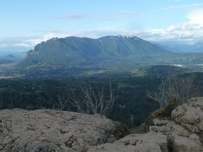
Our goal is to enjoy the wilderness, mountain views, lake scenery, and each other's company. Target pace: 2 - 2.5 mph. We will first hike up to Rattlesnake Ledge, ~2 miles and ~1200 ft elevation gain. We will have a short break at the top and enjoy the views. After hiking back down, we will hike around the lake (~2 miles with negligible elevation gain). The trail around the lake is rocky/sandy, so wear sturdy footwear. We will break for lunch halfway around the lake. There is a stream crossing, so there is a possibility of getting wet feet. It will be really special to see the giant tree stumps surrounding the lake up close and learn the history of how they and the lake were created.
Route Map: https://www.gaiagps.com/map/?loc=14.3/-121.7838/47.4331&pubLink=MnQfIFRWdnFGJImxyAGsWbAJ&trackId=dbaa1971-fb4e-436f-b197-d36b61333edf
Required Equipment
- Navigation
- Headlamp
- Sun protection
- First aid
- Knife
- Fire
- Shelter
- Extra food
- Extra water
- Extra clothes
