Trip
Backpack - Stein River Canyon & Stein Valley
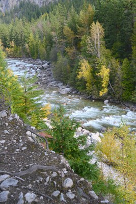
Scenic river canyon with spring wildflowers, pictograph sites, birds and more
- Sat, May 26, 2018 — Mon, May 28, 2018
- Seattle Backpacking Committee
- Exploring Nature, Backpacking
- Adults
- Moderate
- Mileage: 20.0 mi
- Elevation Gain: 1,400 ft
- FULL, 2 on waitlist (10 capacity)
- Cancellation & Refund Policy
7:15-7:30am Lillooet visitor center, and convoy to trailhead via detour route (Lytton ferry closure expected through end of May).
*Updated 5/18/18: Registration will close 5/21 with no new wait list requests after 5/8.
ATTENTION: Lytton ferry access across Fraser River is temporarily closed 24 hours/day due to high water and large debris in river. Due to expected ferry closure through at least end of May, leader has selected detour route to trailhead via Lillooet and Texas Crk Rd (adds ~3 hours drive time).
Registration open to members only, with backpacking experience. Leader approval required via email or phone.
Experience the natural beauty, rock art, captivating spirit and power of the Stein River canyon! You can usually count on a dry or mostly dry backpack here, as the lower and middle valleys are situated in the rain shadow (rarely rains, except in winter).
Pace leisurely to moderate, paced with stops for photo opportunities and for enjoyment of nature. If you're seeking a faster pace or prefer a different objective than photography/nature enjoyment, this is not the trip for you. Thank you.
Motel/camp accommodations recommended in Lillooet, near jct BC-12/99 (evening prior to backpack) on detour route, in Lieu of Lytton area.
Stein Valley Nlaka'pamux Heritage Park is a large provincial park (similar in size to Rainier), without requirements for backcountry camp reservations, fees, permits.
Lower Stein Valley Trail description: http://www.clubtread.com/Routes/Route.aspxRoute480.html?Route=480
Latest trail report:
http://www.env.gov.bc.ca/bcparks/explore/parkpgs/stein_val/trail_report.pdf
The suspension bridge crosses the Stein River at about 7 miles, allowing access again to the Middle Stein valley and extended backpacking into remote sub-alpine/alpine upper Stein from the eastern trailhead.
On day 1, we'll backpack 5-6 miles along/above the Stein River, between trailhead and basecamp in a Lower Stein Canyon camp (Teepee or Earl's Cabin camp). Camps have bearproof food storage, pit toilets and nearby water source. We'll do a day hike on Sunday from our basecamp, along more pictograph sites and the scenic Lower Stein into the Middle Stein valley.
Leader will have copies of topo map for participants.
Current passport or WA enhanced driver's license (or WA enhanced ID), required for border crossing.
Drive time from Everett, approx 3-3/4 hrs.
Background on Stein pictographs:
http://talonbooks.com/books/they-write-their-dreams-on-the-rock-forever (Leader will bring excerpts for those interested in pictograph interpretations). http://newagetravel.com/vision-quest-rock-paintings-stein-valley/
NOTE: Stein Valley was submitted into UNESCO World Heritage Site nomination process in April 2018. For more info: https://whc.unesco.org/en/tentativelists/6341/
Stein River Canyon & Stein Valley
-
CNTS Stein River 92I/5
Stein Valley: Heritage Guide and Map East - See full route/place details.
Required Equipment
The Ten Essentials plus overnight gear which may include:
- Tent with footprint/ground tarp
- Stove and fuel
- Sleeping bag
- Sleeping pad
- Water filter
- Cooking pot/pan with plate and utensils
- Toilet paper and shovel or blue bag to deal with waste
- NOTE: Bear-proof food storage provided at camps
