Trip Report
Basic Glacier Climb - Sahale Peak/Quien Sabe Glacier
A wonderful mixed terrain climb with great views going up Quien Sabe glacier, stunning 360 degree views from the summit, and spectacular views going down the Sahale glacier.
- Fri, Aug 4, 2023
- Basic Glacier Climb - Sahale Peak/Quien Sabe Glacier
- Sahale Peak/Quien Sabe Glacier
- Climbing
- Successful
-

- Road suitable for all vehicles
-
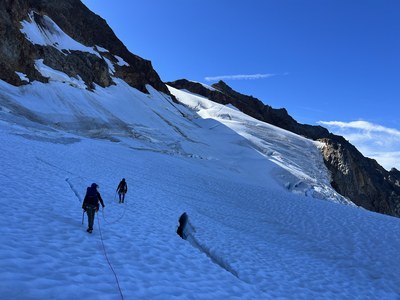
Our plan was to ascend Sahale Mountain via the Quien Sabe glacier, via the climbers route from the Cascade Pass trailhead, then descend via the Sahale glacier. The climbers route from the Cascade Pass trailhead (the smaller of the two parking lots) was a bit over-grown, but still passable. The Quien Sabe glacier has retreated up to about the 7,900' mark, on the upper north end of the basin. The upper part of the glacier had a few obvious crevasses that were easy to navigate around, without adding a lot of time, distance, or exposure.

From the Col, snow was absent and it was just an exposed rock scramble to the summit. Summit was clear of snow, ice, and moisture. We rappelled off the back side of Sahale Peak to the exposed rock below, then traversed a short exposed rock section to the Sahale Glacier. From that point, it was an easy descent to the Sahale Glacier camp. Sahale Arm Trail was clearly defined, moderate in slope and a crusier of a hike out.
Our team of six met at the Cascade Pass Trailhead at 3:00 AM, elevation approx. 3,323', temperature was a balmy 63 degrees. We departed at 3:28 AM up the slightly over-grown climbers route, making our way for Quien Sabe Basin. We attempted our first break at 4:36 AM, on an inviting fallen log adjacent to the trail. Unbeknownst to us, that same log was home to a nest of Yellow Jackets, and three of our team were bitten/stung over five times! Location of that log was at approximately 4,599' elevation. The climbers trail was quite over-grown. We all had ice axes strapped to our packs and these kept catching on the branches that were growing over the trail, so this slowed our progress a bit.
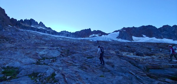
The Quien Sabe glacier has retreated up slope quite a bit, so the basin was mostly exposed slab-like rock with glacier-fed run-off streams. The streams were not very wide or deep, so picking points at which to cross didn't require significant route finding. There were ample places to choose from for water or bio-breaks.
We roped up at about 9:23 AM at an elevation of approx. 7,649'. It was 57 degrees, clear skies, and no wind. Shaping up to be a gorgeous day.
We traversed the upper portion of the Quien Sabe glacier with relative ease. Though, there was no recent boot path, the route towards the Col, separating Sahale Peak and Boston Peak was easy to follow. Crevasses were obvious and easy to navigate through. We had a moderate pace, slightly faster than a "rest-step" pace.
Our trip plan schedule had us arriving at the summit at 12:00 PM: we arrived at 11:47 AM. Upon arriving at the col, we shed our crampons and the rope. There was only dry exposed rock from that point to the summit. We had a fantastic Assistant Leader, and she led the route to the summit, installing a single #3 cam and handline. We didn't need the handline, but since the summit block is rather exposed, the handline added a level of comfort for our students. There was a team of two already at the summit taking in the views. There was room at the summit for all six of us, so we enjoyed the panoramic views while snacking, then began our rappel at 12:30 PM.
The existing anchor had 4 slings that were in great shape, so we joined our two x 60 meter ropes and fed them through the rap rings. The two-man team before us only had a single 60 meter rope, so once they reached the end of their two strand rappel, they still had to down climb a portion of the rock, that seemed to take 25 or so minutes. With our ropes joined, we also performed a 2 strand rappel, but were able to descend much further down the peak. All told, all six of us were down by 1:40 PM, with no issues and no rush.
Sahale Glacier was super tame. The snow was quite compacted with only a 2-3" layer of slush. We donned our crampons, roped up and descended down to the rocks just above Sahale Glacier camp with no issues. Glacier melt streams were on the surface of the snow/slush. In the rock section, just above camp, there were numerous locations where to easily gather water.
From Sahale Glacier Camp, down the Sahale arm trail, and all the way down to the upper parking lot, the trail was obvious, easy to moderate in slope, and mostly clear of water or mud. The weather was spectacular and the tourist traffic wasn't too bad. We saw a few mountain goats, Marmots, and squirrels.
We arrived at the upper trailhead parking lot at about 7 PM. Our descent was slowed a bit because one of our party was in a bit of pain from a previous injury, but otherwise, the descent was great. We were able to keep pace, chat with one-another as well as other people heading either up or down the trail.
Over-all: a fantastic trip. We had a great team, the weather was spectacular, and the climb a awesome. Though a long day that started off waaaaay too early and with some unpleasantness from some Yellow Jackets, we all had a blast. A highly recommended climb.
 Will Tooker