Trip
Day Hike - Dosewallips River Road Trail
*** Trip Initially open to Spring Hiking Students. Trip will open to registration to all Mountaineers 7 to 10 days prior to the hike date ***
- Wed, Jun 19, 2024
- Tacoma Hiking & Backpacking Committee
- Day Hiking
- Adults
- Moderate
- Moderate
- Mileage: 13.0 mi
- Elevation Gain: 1,200 ft
- High Point Elevation: 1,550 ft
- Pace: 2.0
- 3 (6 capacity)
- FULL (2 capacity)
- Cancellation & Refund Policy
We will meet at 8:45am at the Dosewallips Road entrance Trailhead (as listed on Google Maps and Waze) and begin hiking at 9am. No restrooms available at the trailhead. No pass required for this location.
This trip is initially open only to Olympic River Rambler students.
More information will be provided in the Hello Hiker email.
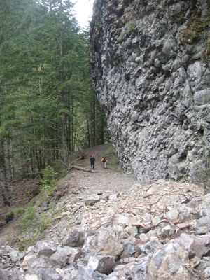
Dosewallips River/Abandoned National Park Road
-
Green Trails Olympic Mountains East No. 168S
Green Trails Tyler Peak No. 136
Green Trails The Brothers No. 168
Green Trails Mt Steel No. 167
Custom Correct Gray Wolf - Dosewallips
Custom Correct Buckhorn Wilderness - See full route/place details.
Required Equipment
10 Essentials
