Clinic
Review of Advanced Off-Trail Navigation Field Trip - Heybrook Lookout & Ridge
A field trip for Wilderness Navigation badge holders only, designed to hone off-trail navigation skills and comprehension.
- Sun, Jun 2, 2024
- Seattle Navigation Committee
- Navigation
- Adults
- Moderate
- Moderate
- Mileage: 5.0 mi
- Elevation Gain: 1,200 ft
- High Point Elevation: 1,900 ft
- FULL, 1 on waitlist (0 capacity)
- 1 (9 capacity)
- Sun, May 5, 2024 at 6:00 AM
- Wed, May 8, 2024 at 5:00 AM
- Cancellation & Refund Policy
- iCal Google
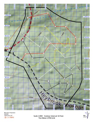
This field trip is currently in beta. It is designed to offer graduates of the Wilderness Navigation course an opportunity to hone their off-trail navigation skills in a real-world environment
Meet time: 7:30am
Meet Location: Meet at the giant saw blade in Doolittle Pioneer Park, Index WA.
WGS84 UTM Zone 10T 608198E 5297323N
47.82017, -121.55457
Heybrook Lookout & Ridge
-
USGS Baring
USGS Index
Green Trails Index No. 142
Green Trails Alpine Lakes West (Stevens Pass) No. 176S - See full route/place details.
Required Equipment
Bring your compass, altimeter, and gps. Caltopo maps and scenario notes will be provided at the field trip. Be prepared for bushwhacking.
