Trip Report
Winter Scramble - Tumtum Peak (winter)
A great trip to a less visited peak at Mt. Rainier.
- Sat, Mar 14, 2020
- Winter Scramble - Tumtum Peak (winter)
- Tumtum Peak (winter)
- Scrambling
- Successful
-

- Road suitable for all vehicles
-
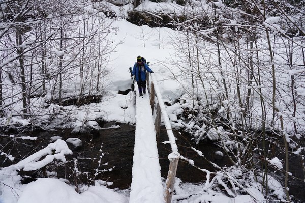
The Kautz creek trail is entirely snow covered at this time from the parking lot. There were trees down over the trail but they were easily bypassed due to the amount of snow. We brought snowshoes figuring the snow may soften up as we got off the beaten path but they were not needed. We were able to do the entire trip with just microspikes. Most importantly the bridges and path across Kautz creek are intact.
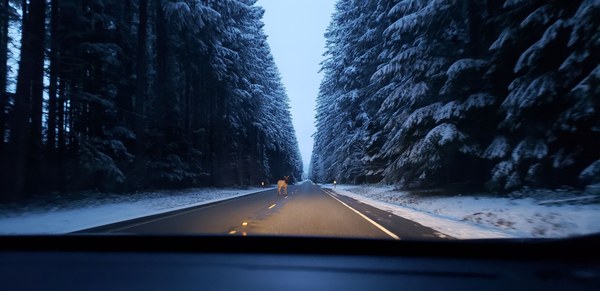
The drive to the Kautz creek trailhead was uneventful except for the fresh snow that started falling heavily as we proceeded through Graham. The snow kept getting heavier as we traveled through Eatonville and then much to our relief disappeared. Once we cleared Ashford we ran into a few herds of Elk. One young elk decided to stand directly in the center of the dark road and wait for us to approach and then watched us for a bit before finally deciding to step aside and let us pass. The road section that washed out in February has been repaired very nicely. At this time there was no line to get into the park and there was no one parked at the Kautz creek trailhead when we arrived.
Photo of the curious elk, photo by Dani Repp

After parking and getting geared up we headed up the Kautz creek trail just before 8am. There were a few trees down across the initial sections of the trail on the way to the Kautz creek crossing. They were easily stepped around or over. There was probably 2 to 3 inches of new snow on top of the hard packed snow that already covered the trail. Once we got to the creek crossings the going got a little rougher. For the most part we were able to easily walk the valley but there was the occasional fall through the snow to the ground. We very carefully did this section till we arrived at the bridges that actually crossed Kautz creek. I was very happy that the route through this section and the bridges was still intact. My fear was that the strong rains, flooding, and slides in February may have knocked this area out. When I inquired with the park to see if they knew about the current trail conditions they were unsure but said to expect lots of downed trees.
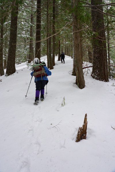
 Once across the valley we started to gain elevation. At this point we put on our microspikes to make going up the slick hard packed trail easier. There were trees down across the trail and they were much larger. They were fairly easy to get over or go around due to the snow now getting deep enough to make walking over them not a problem. We stayed on the trail till we reached an elevation of around 3,040 feet. At this elevation we headed off trail into the woods. Due to the avalanche danger being raised to moderate from low we decided to choose a more conservative approach to the saddle before Tumtum then listed in the Guide to 100 peaks book. Our goal was to minimize our travel on slopes of 30 degrees or greater and make observations on the way up looking for any signs of the forecast avy danger.

Much to our surprise the snow was very firm and thick even off trail. We were able to make good time without the aid of our snowshoes and travel through an area that has been reported to have many blowdowns without problems. We easily reached the saddle just before the final steep summit push for Tumtum. After a short break and conversation about our observations up to this point we decided to head up the final section to Tumtum . The snow at this point was very hard and consolidated and made kicking steps up to the summit easy going but tiring with our small group. We finally reached the summit just past 11 am. At the summit we quickly refueled took a photo or two and then proceeded down. Our return path followed our path in. We thought about plotting a quicker path out going down the steeper terrain back to the trail but decided it was most likely quicker and safer to just follow our path we made in. The snow conditions were very nice for plunge stepping down to the saddle and back to the trail.
We arrived back at the car just after 1 pm. Total time on the trail five hours nine minutes.
Elevation gain according to the phone 2,477 feet.
Trip distance 5.29 miles.
The most helpful gear used today was Caltopo maps, a smartphone, and a compass. I used Caltopo to make a map of the area with slope angle shading so we would be able to plan a route that would help us avoid the steeper slopes on the way up as much as possible.
Here is the peakbagger listing with a gpx track showing our route up Tumtum today.
 Jerrick Linde