Trip Report
Winter Scramble - Mount Kent (winter)
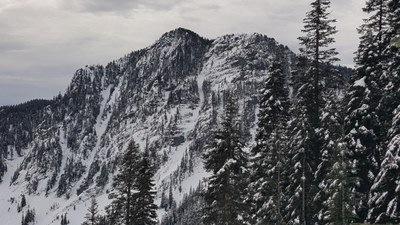
Mt Kent is a challenging scramble that requires ideal conditions to summit it in the winter
- Sat, Jan 28, 2017
- Winter Scramble - Mount Kent
- Mount Kent
- Scrambling
- Successful
-

- Road suitable for all vehicles
Mt Kent is a challenging scramble that requires ideal conditions to summit it in the winter. This is not a trip for beginners.
The day we went there, we had moderate avy conditions. 11 days earlier, heavy freezing rain fell at all elevations and resulted in a thick layer of ice. A subsequent storm left fresh snow at the higher elevations, but just below the summit, wind had blown the snow around resulting in 12" drifts in some places and an icy crust in other places.
But overall, I would describe the our conditions as nearly ideal.
In "Low" avy conditions the steep slopes would much too icy to regard the route as a "scramble"
In "Considerable" or "High" avy conditions, it would be just too much work to get there, plus crossing the huge avalanche chutes off McClellan Butte would be way too dangerous.
Park 150 yards south of the I-90 Exit 42 interchange, just past the DOT facility. From there, walk the road 200-yards south and then up a side road west to the summer McClellan Butte trailhead. From there head straight uphill to the big power lines and follow them west to where they join the summer trail, (which will likely be packed enough to follow).
We did not actually go this way. Instead we went WSW straight uphill from the cars. This route was tough due to lots of downed trees we had to cross over, (which really means fall over). We came back via the summer trailhead, which was much easier. Note that in early season, you might be able to drive to the summer trailhead. A few years ago we did this in December.
On our January day, the snow/ice covered summer trail was easy to follow until it reached the first of the big avy chutes near 3800' From there on, we traversed cross-country gently up in a generally SW direction until we reach about 4500' where we maintained a level traverse. Our goal was the road system that runs along the south side of the mountains. At about 4600' we crossed a large clearing (visible on USGS map), with a hard windblown curst, but still suitable for MSR snowshoes.
I had considered getting around point 4684 by traversing on its NE side. However, I decided it would be easier for the group to follow the well defined road system on the SW side of Pt 4684. We had to drop 200' and travel an extra half mile each way, but it was definitely the right decision. The easy terrain, made for fast travel. We left the road about 100 yards before then end just below North Alice Lake, which we reached by ascending through moderate timber.
From North Lake Alice, we ascended toward the gap north of the summit and then traversed to the right and on to the summit. The going was fine until about 300' below the summit where much of the snow had sluffed off leaving us with an intermittent icy crust. At this point a couple party members stopped and retreated back down the lake. The remaining 6 of us made it to the summit.
Descending the same route was challenging. We swapped our snowshoes for MicroSpikes, which did not really have enough traction. 2 party members had crampons and had minimal problems.
If I were to ever do this trip again, everybody would have crampons. Also on the ascent, we would ascend to a point WNW of the summit at 4800' then traverse without gaining elevation to the right (above and below steeper slopes) then ascend the south ridge to the top. The topo map looks slightly less steep there. I considered descending that way, but did not want to risk cliffing out. Note: I have no direct experience with this alternative.
During the descent of the steep upper slopes, I slipped and slid feet-first about 40'. Arresting on the hard crust was challenging and resulted in my arms be drawn above my head. The pull strained my right arm and felt like it was dislocated. With help from other party members, I descended to the lake, but not without falling once and landing on my hurt arm - no doubt a result of fear caused by first arrest. Later in the afternoon, I grabbed a tree branch for balance as we hiked down the trail. This unexpectedly caused significant pain as I felt my shoulder dislocating again. At that point, the handed out most of my gear and hiked out with a nearly empty pack. Then to make matters worse, what I thought was a bad blister on my heal was actually a strained Achilles Tendon.
(UPDATE AFTER 6 weeks: Several doctor visits and lots of PT have helped, but I still can't do overhead stuff with my right arm, nor put much pressure on my heal, (such as hiking up a hill).
Overall, the trip was 10.5 hours. We used headlamps for the last 20-30 minutes.
Required gear for future winter attempts: MicroSpikes for lower sections of trail. Snowshoes for the middle sections. Crampons near the summit if there has been rain above 4000' within the last 6 weeks. Excellent GPS navigation skills are essential.
 John Gilbert