Trip Report
Wahpenayo Peak
Smoky!
- Sun, Aug 20, 2023
- Chutla, Eagle & Wahpenayo Peaks
- Scrambling
- Successful
-

- Road suitable for all vehicles
-
The boot path is clear, but the talus and scree very loose. I was on high alert for sliding .
A very smokey arrival at Ashford, the ranger at the gate said the North Cascade fires’ smoke had enveloped MRNP.
Parked at Longmire, heading out just before 8 AM for a solo scramble. On Eagle Pk trail was passes two times by young men in trail runners and water bladders. They weren't talkative, but I did not meet them again. Crossed the rock boundary indicating "don't take this boot path" onto the saddle at 1.5 hrs., continued to the talus field for a snack. Appreciate the rock cairns at either side. The marmot sitting smack in the middle on the great big boulder kept an eye on me for a while.
Up the saddle, turned southeast, still a very visible boot path with prints this time of year. Attaining the ridge, met a young man heading to the saddle, in the process of a traverse from Denman to Wahpenayo, onto the Wonderland back to Reflection Lake. He counseled me to be careful on my scramble bid for the peak. Nice guy. I learned later he wasn't just saying that but meant it.
Picking my way along from the second rock through the tree filled gully to the true Wahpenayo, the tree snagged one of my trekking poles from my pack and I had that unique experience of watching my pole bounce down the gully to land at the base of the rock, just where it meets the talus field below. If I were a climber with the correct equipment, I could have easily lowered down and retrieved it!
Honestly, this was the moment that gave me great pause, and the young man's "Be Careful" rang in my thoughts. I sat for several minutes, contemplating the options with the peak seemingly within sight and the boot path visible.
I opted to carry on, picking from a spiderweb of boot paths to the true peak summit.
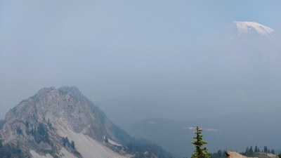
There, swarming with flying ants, I quickly snapped photos of the Geological Survey marker, the Mountain shrouded in smoke and then retreated 20 feet away to eat my lunch. Supervised by a non-begging chipmunk, I continued to survey the possibilities for retrieving my trekking pole, and then started my journey back to the ridge. I did lose the route one time up on the rocks, going back tracked uphill and then re-found it on the east side. Going down this was very slow- there is only loose scree and talus this time of year. Any misstep seemed to carry serious consequences of a long fall down the slopes.
Finally, back on solid ground, I considered crossing the scree field to retrieve my pole, but I felt that I had already used all my adrenaline and allowance of grace for the day. I simply paused time and time again to make notes of possible routes for a return trip to the base of the rock on a later date. (With the Mission Impossible theme playing in my thoughts, I also ruminated on which of my companions I could interest in accompanying me.)
No one on Eagle Pk trail as I descended, back to a subdued (for summer Sunday) at Longmire, I had a nice conversation with Ranger Laura Conrad in the History Museum regarding the provenance of the name Wahpenayo.
Car to car, 7 hours, not too bad considering all the pauses for a trekking pole.
 Michelle Peterson