Trip Report
Sea Kayak - Columbia River: Tenasillahe & Welch Islands
A beautiful paddle through the Lewis and Clark National Wildlife Refuge with a following wind and favorable currents.
- Tue, Jan 30, 2024
- Sea Kayak - Columbia River: Tenasillahe & Welch Islands
- Columbia River: Puget Island & Cathlemet Area
- Sea Kayaking
- Successful
-

- Road suitable for all vehicles
-
River and tidal currents of up to 3kt in the morning.
River level was fairly high, enabling exploration of many sloughs along the way.
Winds were light and from the east or northeast during the day.
No rain and several sunbreaks during the day.
Almost no competition for using the ramps at either end of the trip.
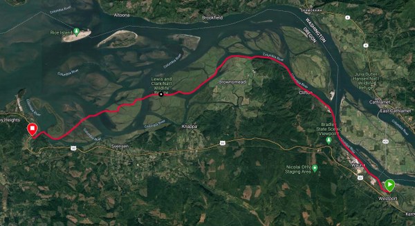
Total distance: 20.61 nm.
Average moving speed: 3.6 kt (lots of current assist!)
Launched at 8:45am and arrived at the take out at 3:15pm
All participants arrived on time and we efficiently completed the shuttle so that we were on the water by 8:45am. While there had been some light rain during the drive to the launch, the rain had stopped by the time we were on the water.
We paddled past the Wauna paper mill, avoiding a tug positioning barges for the mill. The combination of tidal current and high river levels gave us a great boost - we were going up to 7kt at times along the way. We rounded the bend and stopped at the nice little beach at Aldrich Point for a snack/bio break.
After break, we continued into the low islands and sloughs of the Lewis and Clark National Wildlife Refuge. The current continued to push us along, although less vigorously than earlier. All the shoreline in this area is mostly marsh, with no good places to get out of the boats. We continued along looking for a likely spot for a lunch break, finally settling for a standing lunch in the march along the north side of Karlson Island. Before and during lunch we were treated with the site of many swans across the channel along the shore of Marsh Island.
After lunch we made our way west through a maze of sloughs in Russian Island, discovering a line of floating fishing/hunting shacks along the way. Exiting from the west side of Russian Island, we then paddled west crossing to the red channel marker and then to the south end of Lois Island. Rounding Lois Island we paddled into the mouth of the John Day River and up to our take out.
 Will Greenough