Trip Report
Sea Kayak - Cape Scott
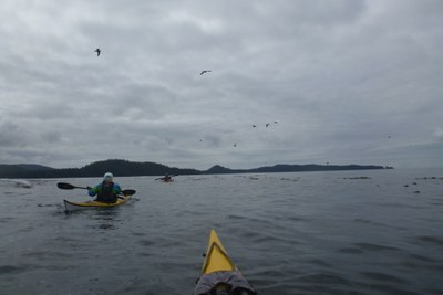
Kayaked from Port Hard to Coal Harbor rounding Cape Scott (aka "North Vancouver Island Circular Route Trail"). Camped on wilderness beaches. Saw whales, sea lions, and sea otters.
- Sat, Jul 22, 2017 — Sun, Aug 6, 2017
- Sea Kayak - Cape Scott
- Cape Scott
- Sea Kayaking
- Successful
-

- Road suitable for all vehicles
Planning Resources: The guide books by John Kimantas (Wild Coast series and BC Explorer series) provide good general information about paddling this route. The best resources is the BC Marine Trails web site with information on camp sites (www.bcmarinetrails.org). If you are paddling in BC I recommend joining this organization: these are the people making your future trips possible.
Timing: I planned this trip so that we would round Cape Scott and go to the Scott Islands on the moderate tides of the half moon. It meant starting and ending the trip with the higher tides and currents of new and full moons.
This window happened to match a two-week week-end to week-end period. Disadvantage of returning on a weekend is increased traffic and competition for lodging.
Weather Forecasts: Marine forecasts from Environment Canada commonly predict more wind than you will experience. We had several days of winds predicted to be up to 35 or 40 knots and what we experienced was light to 10 knots of wind. It does get wind and we also saw winds up to 25 knots. You can’t disregard the forecast but you must learn how to interpret it.
Port Hardy Resources: We stayed at the North Coast Trail Backpackers Hostel (www.northcoasttrailhostel.com). We parked one car there during our trip at no charge. They recommended the marina parking lot as another place to leave a car in Port Hardy.
Coal Harbor Resources: We parked two cars in Coal Harbor with D H Timber Towing and Salvage (250) 949-6358 for $5/night each.
Water: There are many streams with fresh water. The large streams are often tidal for some ways up stream. You must go upstream to a point that never floods with sea water to get pure fresh water. Smaller streams are at forest level and fresh water can be found at the forest edge or a short ways in. At the cape there is no water in Explorer bight and the flow in Guise is slow. 9 minutes to fill 10 liters. A hiker said that it was uncommonly slow.
Route:
Day 1: Shuttle cars to Coal Harbor. Launch from the Port Hardy waterfront around noon. Paddle to Nolan Point
Day 2: Early launch to catch current. Paddle to Vansatart Island.
Day 3: Early launch to catch current. Paddle to Shuttleworth bight via Goletas Channel.
A common weather pattern in Queen Charlotte Straight is for winds to rise mid day and blow strong from the NW in the afternoon. To catch tides and avoid winds we planned early mornings.
We planned to go around the north side of Hope island but decided not to and instead went south through Bate Passage and Goletas channel. Current ebbs north and east through Bate passage so we had to work eddies along shoreline. Most of Goletas channel ebb current escapes up Bate passage. Current is slow from Bates to the Tatnal reefs and Nawhitti bar.
Reefs and bar can be dangerous when ebbing current meets entering swell. Avoid those conditions and it is reasonable. We saw mostly flat water. Paddled over the Tatnal reefs in flat water until strong flooding current thwarted our progress. We then moved close to shore for less current. Once past the reef current abated.
Day 4: Rest day. Paddle 1.25 nm up Stranby River for fresh water.
Day 5: Paddle to Experiment Bight
Day 6: Round cape and paddle to Lowrie bay. Day 6 would have been the day to cross to Scott Islands and we had good conditions for it however forecast called for a front to come in the following day with sustained high winds in the days after that. Despite the forecast I thought there would be windows of opportunity to return from the island. It was a marginal forecast – not clear go or no-go. We chose to be cautious and not cross.
Day 7: Layover in Lowrie bay. Rain in the morning, good weather in the afternoon.
Day 8: Paddle to Raft Cove in 4 to 9 ft swell. Large surf on main beach. Camp on gravel beach S side of cove where surf was significantly smaller.
Day 9: Layover and explore Raft Cove.
Day 10: Paddle to Grant Bay
Day 11: Paddle to Spencer Cove
Day 12: Paddle to Ildstad Island. This is marked as camp by Kimantas but since learned it is First Nations sensitive. BC Marine trails has a preferred site nearby on Drake island. Said to be nice.
Day 13: Paddle to Coal Harbor. Transit Quatsino narrows at max flood (3.6 knots). No difficulties with current and no dangers observed.
 Tom Unger