
Trip Report
Mount Fernow/Southwest Slope
Successful early June climb via Leroy Creek basin.
- Fri, Jun 7, 2019 — Sat, Jun 8, 2019
- Mount Fernow/Southwest Slope
- Climbing
- Successful
-

- Road rough but passable
-
Ascent. Left camp at 4:25am. We climbed the gully with a major stream that was mostly snow-filled, keeping left. Kept left to climb a rock section then more snow to the head of the basin and a saddle. The correct gap in the saddle is to climber’s left of the head of the basin and is marked by a large cairn (7740ft). We scrambled down a short, steep snow slope, then on rocks skier’s right to remain on the ridgeline. We encountered some water ice so moved further right onto snow down to the saddle on the ridge above the tarn to skier’s left (7560ft).
We then made a descending traverse heading for a snow-filled gully beyond the glacier remnant (6640ft).
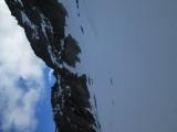 We climbed the gully to a relatively flat area (sometimes referenced as an alternate bivy site), at 7000ft.
Next, we climbed a short snow slope to reach a rock band, making an ascending traverse to climber’s left. We climbed rock islands to reach a final steepish snow slope to the ridgeline with good cramponing.
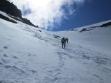 We followed a faint climber’s path along the ridgeline to the chockstone gully.
 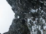 From that gully we followed a climber’s path and scrambled rock and scree to the summit. Did not find a summit register.
Descent. From the summit we basically retraced our ascent route. The snow had softened significantly descending from the ridgeline, making plunge-stepping fairly easy. Ascending the snow slope from 6640 to 7740ft was the most challenging section of the descent.
Time: 7h45m camp to summit. 4h50m summit to camp.
Approach conditions:
Phelps Creek Trail is mostly pleasant but has not had any work done on it this year. There was a lot of water running down the trail near many of the stream crossings. 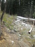 We elected to remove boots and wade Box Creek, since the water was deep and there didn’t seem to be a convenient way to cross on logs or rocks. Last third of the trail still had snow but it was relatively easy to find the trail. Leroy Creek crossing was made uneventfully by going upstream from the main trail crossing.
Leroy Creek Trail has many down trees, but all were fairly easy to cross. Upper third of the trail was still covered with snow. We lost the trail after a creek crossing but later found it by just following the streambed up.
Leroy Creek basin was still under about 12-18 inches of snow. Probably another 2-3 weeks before it melts out. We moved a little higher than the usual campsites near the creek, in hopes of camping on some rock islands. We found those to be fairly swampy so elected to camp on snow, at around 6170ft.
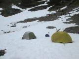
Time: 4h15m from TH to Leroy Creek basin camp
Departure: 3h camp to trailhead.
Permits required?
NW Forest Pass.
Driving / parking notes:
There was a tree across Phelps Creek Road. We parked at a stock pull-out about 15 minutes from the trailhead. Upon our return the tree had been dragged off the road and access was available all the way to the trailhead.
Equipment notes:
Carried and used poles, ice axe, crampons.
Required Skills:
Snow & rock scrambling skills.
Weather Notes:
Day 1: Mostly high overcast with some low clouds. Occasional snow showers.
Day 2. Mostly sunny with some high clouds.
Flora and Fauna: Observed a black bear crossing Chiwawa River Road on the drive in.
 Curtis Stock