Trip Report
Maude, Fernow, 7FJ
Great trip to warmup to canadian choss.
- Sat, Aug 29, 2020 — Mon, Aug 31, 2020
- Mount Fernow/Southwest Slope
- Scrambling
- Successful
-

- Road recommended for high clearance only
-
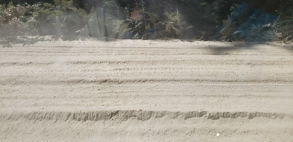
- Last 2 miles, aka the turn off to Phelps Creek Trail is very very sandy almost half a feet deep and also very rocky.
- Parking Lot is very crowded even on a Friday morning
By this time of year, you do not need crampons and ice axe and can skirt the snow.
The correct route is never more than class 3, which is an understatement for all the loose scree and talus.
There's a bootpath every where and double check for 7FJ as it can take you up the wrong gully.
Lots of blue berries are appearing
Lots of water for Fernow. Never needed to carry more than a liter.
These mountains are perfect to practice travelling over scree, talus and choss. Both ascending and descending. Since there's already a lot of beta for 7FJ and Maude I will be sparse and focus on Fernow which I consider was the highlight of this trip.
Trip Statistics were: ~23 mi, ~14000 ft of gain.
- 2.5 Hrs from the TH to Leeroy Basin where we sent up camp
- 6:00 am start for Fernow
- 7:30 am, hit the saddle overlooking Gloomy Basin
- 8:50 am, bottom of the basin
- 10:00am, up by the waterfall
- 12:30 pm, summit
- 1:05 pm, descent
- 6:00 pm, back to camp
From camp head towards the saddle left of 7FJ. There is another bootpath above the trees on the left but we took a more direct line.
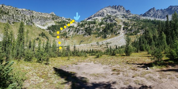
Sadly that is the false saddle, the bowl expands to look like below. Aim slightly left of the middle and cairns will mark the way. There's couple of bivy spots at the saddle as well.
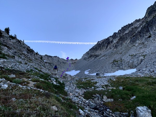
From there you can see gloomy basin. The initial 400 ft or so is very steep and loose to the point where you want your group size to be very small and space out. Poles were a must for additional stability.
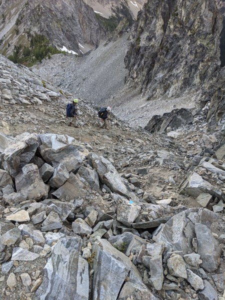
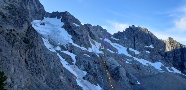
All these routes go. Just notice that we went skiers right, right below the ridge. This was the most sketchy portion as the snow is hard in the morning and the scree is on downward sloping slab and everything is loose. Apparently, one can traverse down to the lake on the other side of the ridge and go around as well if this looks too sketchy.
Now for the uphill, there's a bootpath going climbers right of the reddish waterfall to get up to the first basin (another bivy spot) and the another to the path of trees and heather.
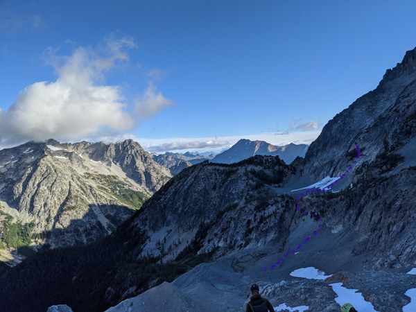
From here, it's mostly a choose your own adventure scrambling and cross the waterfall if you find a good place.
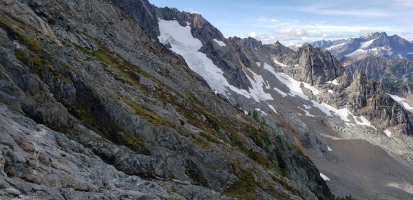
Once you reach the snowfield(~ 7400 ft), you have two options to ascend the final choss field.
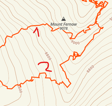
We took the #2 path on the way up is towards the ridge and go up the gully with the chockstone. Another option is the cut immediately left up the larger gully (#1). Both lead to the final summit block.
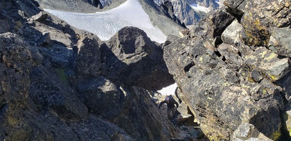
Follow the gully up to the summit block. Don't go all the way up the scree field as it pops you toward the north face. You want to get on the rock on the south side facing Maude.
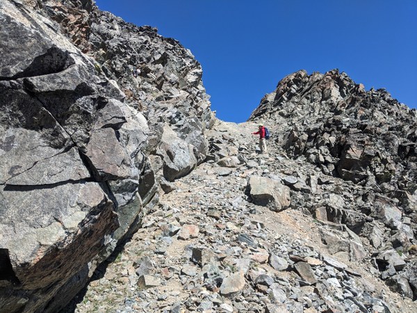
Right where I'm standing is where we transitioned on to rock. If you were to keep going up the scree you will find yourself in some fun class 5.
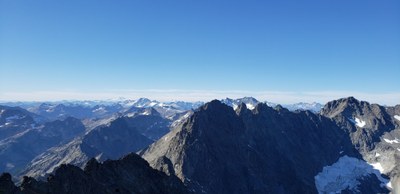
From here it's pretty straightforward to the summit. Awesome views of Bonanza, Dome, Glacier, Frostbite Ridge, Clark, Buck, Luahna, Chiwawa, Fortress, Dumbell, Greenwood, North Spectable Butte, Maude, 7FJ, Copper, Tower, Martin, Copper, Stuart, Shuksan, Baker, Rainier, Adams, Sloan, Golden Horn, Tower and lots of other north cascades peaks I didn't recognize from this angle.
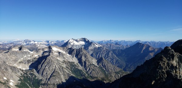
Above picture is actually from 7FJ as that was early morning and air was more clear.
If you're fast enough, you can probably ascend 7FJ by traversing from the ridge overlooking Gloomy and Leroy Basin. We just went to camp and climbed it the next day which I liked as it was less cloudy than the day before.
Thanks to Tom Girard, Jon Larson for the pictures and Ananth for organizing the trip
 Rio Hoshi